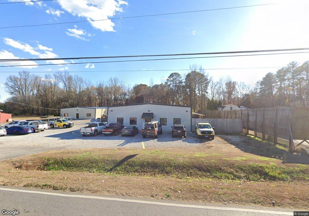
202 Nick Davis Rd Madison, AL 35757
Monrovia NeighborhoodEstimated Value: $469,684
Studio
--
Bath
5,500
Sq Ft
$85/Sq Ft
Est. Value
About This Home
This home is located at 202 Nick Davis Rd, Madison, AL 35757 and is currently estimated at $469,684, approximately $85 per square foot. 202 Nick Davis Rd is a home located in Madison County with nearby schools including Legacy Elementary School, Monrovia Middle School, and Sparkman High School.
Ownership History
Date
Name
Owned For
Owner Type
Purchase Details
Closed on
Jan 26, 2026
Sold by
Thompson Dustin and Thompson Rachel
Bought by
Millennium Properties Llc
Current Estimated Value
Purchase Details
Closed on
May 12, 2020
Sold by
Gayman Ronald Dean
Bought by
Thompson Dustin
Home Financials for this Owner
Home Financials are based on the most recent Mortgage that was taken out on this home.
Original Mortgage
$254,400
Interest Rate
3.3%
Mortgage Type
Commercial
Create a Home Valuation Report for This Property
The Home Valuation Report is an in-depth analysis detailing your home's value as well as a comparison with similar homes in the area
Home Values in the Area
Average Home Value in this Area
Purchase History
| Date | Buyer | Sale Price | Title Company |
|---|---|---|---|
| Millennium Properties Llc | -- | None Listed On Document | |
| Thompson Dustin | $318,000 | None Available | |
| Gayman Ronald Dean | -- | None Available |
Source: Public Records
Mortgage History
| Date | Status | Borrower | Loan Amount |
|---|---|---|---|
| Previous Owner | Thompson Dustin | $254,400 |
Source: Public Records
Tax History
| Year | Tax Paid | Tax Assessment Tax Assessment Total Assessment is a certain percentage of the fair market value that is determined by local assessors to be the total taxable value of land and additions on the property. | Land | Improvement |
|---|---|---|---|---|
| 2025 | $3,788 | $104,180 | $5,000 | $99,180 |
| 2024 | $3,788 | $100,740 | $5,000 | $95,740 |
| 2023 | $3,662 | $81,460 | $5,000 | $76,460 |
| 2022 | $1,618 | $44,740 | $5,000 | $39,740 |
| 2021 | $1,516 | $41,940 | $5,000 | $36,940 |
| 2020 | $1,204 | $33,400 | $5,000 | $28,400 |
| 2019 | $1,157 | $32,120 | $5,000 | $27,120 |
| 2018 | $1,098 | $30,500 | $0 | $0 |
| 2017 | $1,098 | $30,500 | $0 | $0 |
| 2016 | $1,098 | $30,500 | $0 | $0 |
| 2015 | $1,098 | $30,500 | $0 | $0 |
| 2014 | $1,206 | $33,460 | $0 | $0 |
Source: Public Records
Map
Nearby Homes
- 1861 Jeff Rd NW
- 1980 Jeff Rd NW
- 103 Kinsman Cir
- 423 Jasmine Dr
- 110 Danika Dr NW
- 442 Jasmine Dr
- 195 Sarah Jane Dr
- 118 Wedgewood Terrace Rd
- 104 Huntington Ridge Rd
- 112 Waterweep Dr
- 123 Forest Ridge Dr
- 146 Forest Ridge Dr
- 224 Cheswick Dr
- 126 Hawks Nest Dr
- 118 Creekmound Dr
- 354 Jasmine Dr
- 228 Wainscott Dr
- 223 Wainscott Dr
- 102 Rathdoon Ct
- 212 Wilson Hall Dr
- 174 Nick Davis Rd
- 216 Nick Davis Rd
- 211 Nick Davis Rd
- 223 Nick Davis Rd
- 168 Nick Davis Rd
- 103 Mystic Way
- 1.22 acres Nick Davis Rd
- 0 Nick Davis Rd Unit 1819884
- 0 Nick Davis Rd Unit 1803872
- 100 Mystic Way
- 160 Nick Davis Rd
- 105 Mystic Way
- 145 Nick Davis Rd
- 102 Bay Harbor
- 101 Bay Harbor
- 240 Nick Davis Rd
- 107 Mystic Way
- 104 Bay Harbor
- 106 Mystic Way
- 103 Bay Harbor
Your Personal Tour Guide
Ask me questions while you tour the home.