Estimated Value: $275,000 - $318,000
4
Beds
2
Baths
1,850
Sq Ft
$158/Sq Ft
Est. Value
About This Home
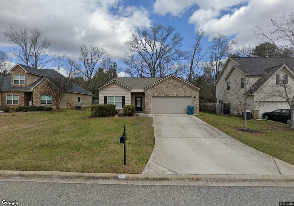
This home is located at 202 Ousley Way Unit 11-Cannon, Perry, GA 31069 and is currently estimated at $292,606, approximately $158 per square foot. 202 Ousley Way Unit 11-Cannon is a home located in Houston County with nearby schools including Morningside Elementary School, Perry Middle School, and Perry High School.
Ownership History
Date
Name
Owned For
Owner Type
Purchase Details
Closed on
Mar 29, 2019
Sold by
Builders Professional Group Llc
Bought by
Williams Lataura P
Current Estimated Value
Home Financials for this Owner
Home Financials are based on the most recent Mortgage that was taken out on this home.
Original Mortgage
$179,097
Outstanding Balance
$157,458
Interest Rate
4.3%
Mortgage Type
VA
Estimated Equity
$135,148
Create a Home Valuation Report for This Property
The Home Valuation Report is an in-depth analysis detailing your home's value as well as a comparison with similar homes in the area
Home Values in the Area
Average Home Value in this Area
Purchase History
| Date | Buyer | Sale Price | Title Company |
|---|---|---|---|
| Williams Lataura P | $174,900 | None Available |
Source: Public Records
Mortgage History
| Date | Status | Borrower | Loan Amount |
|---|---|---|---|
| Open | Williams Lataura P | $179,097 |
Source: Public Records
Tax History Compared to Growth
Tax History
| Year | Tax Paid | Tax Assessment Tax Assessment Total Assessment is a certain percentage of the fair market value that is determined by local assessors to be the total taxable value of land and additions on the property. | Land | Improvement |
|---|---|---|---|---|
| 2024 | $3,520 | $95,800 | $8,000 | $87,800 |
| 2023 | $2,995 | $80,960 | $8,000 | $72,960 |
| 2022 | $1,673 | $72,760 | $8,000 | $64,760 |
| 2021 | $1,563 | $67,600 | $8,000 | $59,600 |
| 2020 | $1,518 | $65,360 | $8,000 | $57,360 |
| 2019 | $1,220 | $52,520 | $8,000 | $44,520 |
| 2018 | $93 | $5,440 | $5,440 | $0 |
| 2017 | $95 | $4,080 | $4,080 | $0 |
| 2016 | $95 | $4,080 | $4,080 | $0 |
| 2015 | $95 | $4,080 | $4,080 | $0 |
| 2014 | -- | $4,080 | $4,080 | $0 |
| 2013 | -- | $6,000 | $6,000 | $0 |
Source: Public Records
Map
Nearby Homes
- 118 Farmers Way
- 107 Lighterknot Trail
- 106 Raspberry Trail
- 311 Rusty Plow Ln Unit 16
- 307 Rusty Plow Ln
- 104 Red Barn Ct
- 102 Kanza Trail
- 307 Rusty Plow Ln Unit 14
- 108 Christine Cir
- 110 Gwendolyn Ave
- 204 Susanne's Retreat
- 500 Legacy Park Dr
- 2111 N Us Hwy 41
- 412 Legacy Park Dr
- 1008 Ridge Cir S
- 314 Waxmyrtle Way
- 149 MacK Thompson Road Common
- 1015 Cherokee Rd
- 0 Langston Rd Unit 16828609
- 0 MacK Thompson Rd Unit 253661
- 200 Ousley Way
- 204 Ousley Way
- 206 Ousley Way Unit lt13-Westin
- 206 Ousley Way Unit lot13-Westin
- 206 Ousley Way
- 206 Ousley Way Unit 13-Westin
- 110 Ousley Way
- 112 Ousley Way
- 205 Ousley Way
- 208 Ousley Way Unit l4-Patriot
- 208 Ousley Way Unit lt14-Patriot
- 208 Ousley Way Unit 14-Patriot
- 201 Ousley Way
- 207 Ousley Way Unit 89-Everest
- 207 Ousley Way Unit lt89-Everest
- 207 Ousley Way
- 108 Ousley Way
- 106 Ousley Way
- 210 Ousley Way Unit 15- Westin