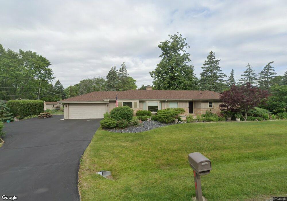
202 Owen Place Prospect Heights, IL 60070
Estimated Value: $439,000 - $507,000
4
Beds
2
Baths
1,643
Sq Ft
$279/Sq Ft
Est. Value
About This Home
This home is located at 202 Owen Place, Prospect Heights, IL 60070 and is currently estimated at $459,066, approximately $279 per square foot. 202 Owen Place is a home located in Cook County with nearby schools including Dwight D Eisenhower Elementary School, Anne Sullivan Elementary School, and Betsy Ross Elementary School.
Ownership History
Date
Name
Owned For
Owner Type
Purchase Details
Closed on
Oct 28, 1997
Sold by
First Colonial Trust Company
Bought by
Lee Margaret E
Current Estimated Value
Home Financials for this Owner
Home Financials are based on the most recent Mortgage that was taken out on this home.
Original Mortgage
$115,000
Outstanding Balance
$17,995
Interest Rate
6.75%
Estimated Equity
$441,071
Create a Home Valuation Report for This Property
The Home Valuation Report is an in-depth analysis detailing your home's value as well as a comparison with similar homes in the area
Home Values in the Area
Average Home Value in this Area
Purchase History
| Date | Buyer | Sale Price | Title Company |
|---|---|---|---|
| Lee Margaret E | -- | -- |
Source: Public Records
Mortgage History
| Date | Status | Borrower | Loan Amount |
|---|---|---|---|
| Open | Lee Margaret E | $115,000 |
Source: Public Records
Tax History Compared to Growth
Tax History
| Year | Tax Paid | Tax Assessment Tax Assessment Total Assessment is a certain percentage of the fair market value that is determined by local assessors to be the total taxable value of land and additions on the property. | Land | Improvement |
|---|---|---|---|---|
| 2024 | $8,124 | $33,000 | $8,054 | $24,946 |
| 2023 | $7,564 | $33,000 | $8,054 | $24,946 |
| 2022 | $7,564 | $33,000 | $8,054 | $24,946 |
| 2021 | $5,123 | $24,465 | $7,047 | $17,418 |
| 2020 | $4,622 | $24,465 | $7,047 | $17,418 |
| 2019 | $4,560 | $27,366 | $7,047 | $20,319 |
| 2018 | $6,325 | $27,332 | $6,040 | $21,292 |
| 2017 | $4,841 | $27,332 | $6,040 | $21,292 |
| 2016 | $5,371 | $27,332 | $6,040 | $21,292 |
| 2015 | $6,231 | $24,386 | $5,033 | $19,353 |
| 2014 | $6,036 | $24,386 | $5,033 | $19,353 |
| 2013 | $6,028 | $24,386 | $5,033 | $19,353 |
Source: Public Records
Map
Nearby Homes
- 302 Lonsdale Rd
- 481 Green Bridge Ln Unit B
- 109 Rob Roy Ln Unit C
- 354 Country Club Dr
- 603 Thistle Ln Unit 16185
- 206 E Camp Mcdonald Rd
- 1142 N Boxwood Dr Unit B
- 1400 N Elmhurst Rd Unit 106
- 212 Country Club Dr Unit 198
- 1121 N Greenfield Ln
- 107 W Brighton Place Unit T12
- 1400 N Yarmouth Place Unit 314
- 108 N Meadow Ln
- 1116 N Westgate Rd
- 211 W Hanover Place Unit T85
- 300 E Marion Ave
- 1428 N Bridgeport Dr Unit T37
- 1400-1500 E Kensington Rd
- 710 Creekside Dr Unit 506A
- 720 Creekside Dr Unit 305B
- 209 Lonsdale Rd
- 204 Owen Place
- 111 Owen Place
- 207 Lonsdale Rd
- 206 Owen Place
- 210 Lonsdale Rd
- 208 Lonsdale Rd
- 303 Lonsdale Rd
- 201 Owen Place
- 206 Tully Place
- 205 Lonsdale Rd
- 206 Lonsdale Rd
- 208 Tully Place
- 300 Lonsdale Rd
- 203 Owen Place
- 204 Tully Place
- 204 Lonsdale Rd
- 203 Lonsdale Rd
- 305 Lonsdale Rd
- 205 Owen Place