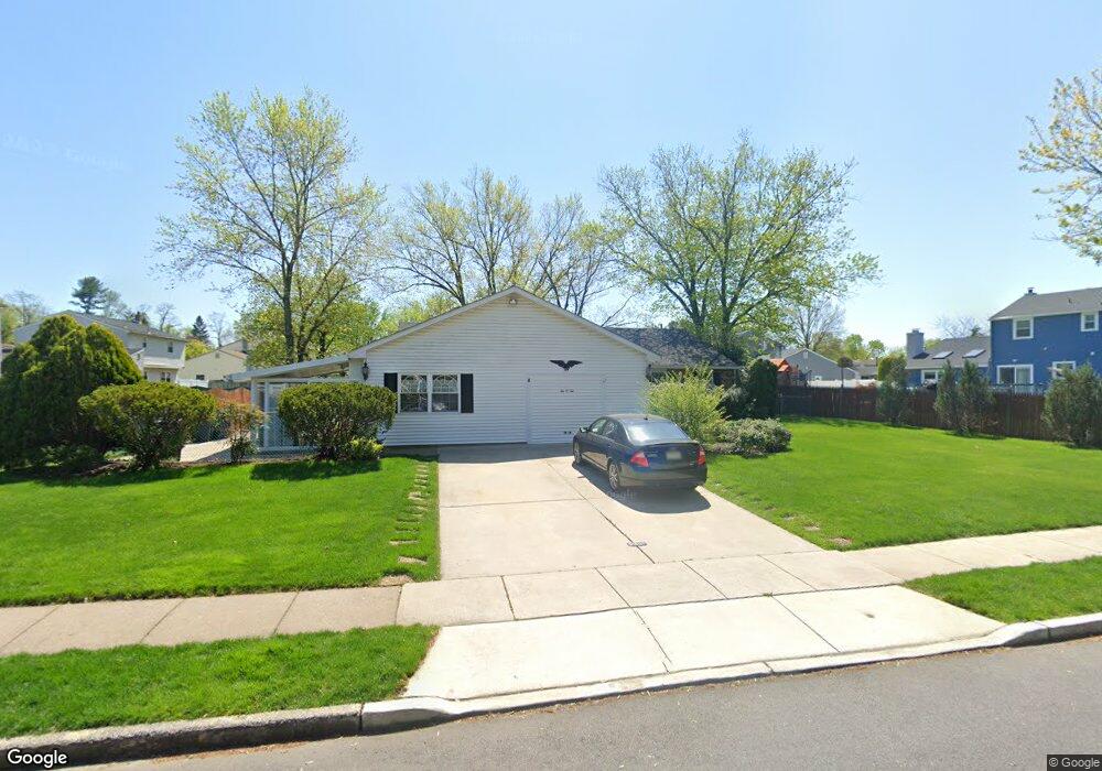
202 Patricia Ave Delran, NJ 08075
Swedes Run NeighborhoodEstimated Value: $504,981 - $688,000
--
Bed
--
Bath
3,146
Sq Ft
$180/Sq Ft
Est. Value
About This Home
This home is located at 202 Patricia Ave, Delran, NJ 08075 and is currently estimated at $567,495, approximately $180 per square foot. 202 Patricia Ave is a home located in Burlington County with nearby schools including Millbridge Elementary School, Delran Intermediate School, and Delran Middle School.
Ownership History
Date
Name
Owned For
Owner Type
Purchase Details
Closed on
Jan 15, 1999
Sold by
Wenzke Edward R and Wenzke Anita M
Bought by
Hindman Stewart C and Hindman Diane
Current Estimated Value
Home Financials for this Owner
Home Financials are based on the most recent Mortgage that was taken out on this home.
Original Mortgage
$87,750
Outstanding Balance
$20,195
Interest Rate
6.67%
Mortgage Type
Purchase Money Mortgage
Estimated Equity
$547,300
Create a Home Valuation Report for This Property
The Home Valuation Report is an in-depth analysis detailing your home's value as well as a comparison with similar homes in the area
Home Values in the Area
Average Home Value in this Area
Purchase History
| Date | Buyer | Sale Price | Title Company |
|---|---|---|---|
| Hindman Stewart C | $167,750 | Weichert Title Agency |
Source: Public Records
Mortgage History
| Date | Status | Borrower | Loan Amount |
|---|---|---|---|
| Open | Hindman Stewart C | $87,750 |
Source: Public Records
Tax History Compared to Growth
Tax History
| Year | Tax Paid | Tax Assessment Tax Assessment Total Assessment is a certain percentage of the fair market value that is determined by local assessors to be the total taxable value of land and additions on the property. | Land | Improvement |
|---|---|---|---|---|
| 2025 | $10,711 | $269,400 | $57,000 | $212,400 |
| 2024 | $10,614 | $269,400 | $57,000 | $212,400 |
| 2023 | $10,614 | $269,400 | $57,000 | $212,400 |
| 2022 | $10,477 | $269,400 | $57,000 | $212,400 |
| 2021 | $10,482 | $269,400 | $57,000 | $212,400 |
| 2020 | $10,461 | $269,400 | $57,000 | $212,400 |
| 2019 | $10,364 | $269,400 | $57,000 | $212,400 |
| 2018 | $10,191 | $269,400 | $57,000 | $212,400 |
| 2017 | $10,030 | $269,400 | $57,000 | $212,400 |
| 2016 | $9,882 | $269,400 | $57,000 | $212,400 |
| 2015 | $9,717 | $269,400 | $57,000 | $212,400 |
| 2014 | $9,294 | $269,400 | $57,000 | $212,400 |
Source: Public Records
Map
Nearby Homes
- 139 Patricia Ave
- 4327 Bridgeboro Rd
- 110 Kathleen Ave
- 103 Congressional Ct
- 415 Bridgeboro Rd
- 31 Cornell Dr
- 0 0 Swarthmore Dr
- 693 Garwood Rd
- 128 Dorado Dr
- 60 Notre Dame Dr
- 751 Garwood Rd
- 164 Fox Chase Dr
- 142 Fox Chase Dr
- 53 Princeton Dr
- 740 Garwood Rd
- 342 Huntington Dr Unit 342
- 29 Haines Mill Rd
- 347 Tom Brown Rd
- 628 Windsock Way
- 53 Hartford Rd
- 149 Jacqueline Ave
- 142 Swedes Run Dr
- 147 Jacqueline Ave
- 140 Swedes Run Dr
- 145 Jacqueline Ave
- 138 Swedes Run Dr
- 203 Patricia Ave
- 205 Patricia Ave
- 207 Patricia Ave
- 143 Jacqueline Ave
- 201 Patricia Ave
- 209 Patricia Ave
- 136 Swedes Run Dr
- 138 Patricia Ave
- 152 Jacqueline Ave
- 141 Jacqueline Ave
- 148 Jacqueline Ave
- 150 Jacqueline Ave
- 137 Swedes Run Dr
- 143 Patricia Ave