Estimated Value: $835,000 - $908,000
4
Beds
3
Baths
2,296
Sq Ft
$383/Sq Ft
Est. Value
About This Home
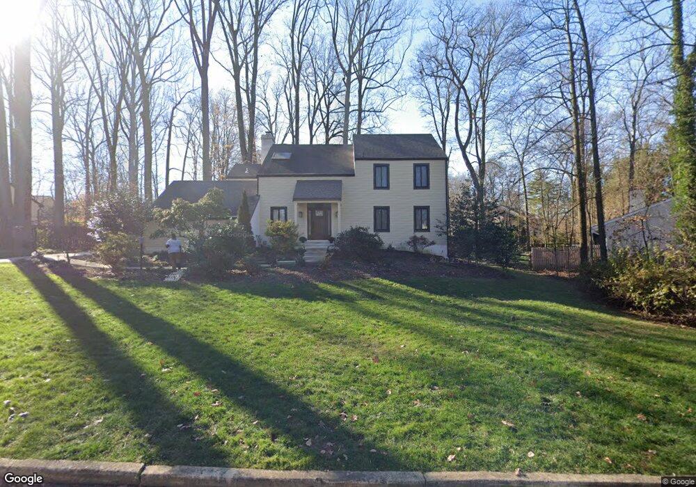
This home is located at 202 Pheasant Run Dr, Paoli, PA 19301 and is currently estimated at $880,356, approximately $383 per square foot. 202 Pheasant Run Dr is a home located in Chester County with nearby schools including Beaumont Elementary School, Tredyffrin-Easttown Middle School, and Conestoga Senior High School.
Ownership History
Date
Name
Owned For
Owner Type
Purchase Details
Closed on
Aug 29, 2007
Sold by
Hardgrove David H and Hardgrove Pamela S
Bought by
Davis G Preston and Davis Patricia G
Current Estimated Value
Home Financials for this Owner
Home Financials are based on the most recent Mortgage that was taken out on this home.
Original Mortgage
$363,000
Outstanding Balance
$231,821
Interest Rate
6.74%
Mortgage Type
Purchase Money Mortgage
Estimated Equity
$648,535
Purchase Details
Closed on
Oct 24, 2003
Sold by
Myers James L and Myers Kathleen C
Bought by
Hardgrove David H and Hardgrove Pamela S
Home Financials for this Owner
Home Financials are based on the most recent Mortgage that was taken out on this home.
Original Mortgage
$200,000
Interest Rate
6.05%
Mortgage Type
Purchase Money Mortgage
Create a Home Valuation Report for This Property
The Home Valuation Report is an in-depth analysis detailing your home's value as well as a comparison with similar homes in the area
Home Values in the Area
Average Home Value in this Area
Purchase History
| Date | Buyer | Sale Price | Title Company |
|---|---|---|---|
| Davis G Preston | $510,000 | None Available | |
| Hardgrove David H | $400,000 | -- |
Source: Public Records
Mortgage History
| Date | Status | Borrower | Loan Amount |
|---|---|---|---|
| Open | Davis G Preston | $363,000 | |
| Previous Owner | Hardgrove David H | $200,000 |
Source: Public Records
Tax History Compared to Growth
Tax History
| Year | Tax Paid | Tax Assessment Tax Assessment Total Assessment is a certain percentage of the fair market value that is determined by local assessors to be the total taxable value of land and additions on the property. | Land | Improvement |
|---|---|---|---|---|
| 2025 | $10,991 | $294,670 | $62,140 | $232,530 |
| 2024 | $10,991 | $294,670 | $62,140 | $232,530 |
| 2023 | $10,277 | $294,670 | $62,140 | $232,530 |
| 2022 | $9,843 | $290,160 | $62,140 | $228,020 |
| 2021 | $9,629 | $290,160 | $62,140 | $228,020 |
| 2020 | $9,361 | $290,160 | $62,140 | $228,020 |
| 2019 | $9,101 | $290,160 | $62,140 | $228,020 |
| 2018 | $8,943 | $290,160 | $62,140 | $228,020 |
| 2017 | $8,741 | $290,160 | $62,140 | $228,020 |
| 2016 | -- | $290,160 | $62,140 | $228,020 |
| 2015 | -- | $290,160 | $62,140 | $228,020 |
| 2014 | -- | $290,160 | $62,140 | $228,020 |
Source: Public Records
Map
Nearby Homes
- 131 Devon Rd
- 337 Paoli Woods
- 332 Paoli Woods
- 1201 Weatherstone Dr Unit 1201
- 2104 Weatherstone Dr Unit 2104
- 38 E Circular Ave
- 106 S Valley Rd
- 19 E Golf Club Ln
- 216 Paoli Pointe Dr Unit 216
- 227 Paoli Pointe Dr Unit 227
- 41 Greenlawn Rd
- 1500 Sugartown Rd
- 113 Manor Rd
- 114 Manor Rd
- 109 Vincent Rd
- 1441 Berwyn Paoli Rd Unit D
- 1441 Berwyn Paoli Rd
- 5 Kent Ln
- 72 W Central Ave
- 29 Manor Rd
- 204 Pheasant Run Dr
- 200 Pheasant Run Dr
- 701 Weatherstone Dr
- 702 Weatherstone Dr
- 703 Weatherstone Dr
- 704 Weatherstone Dr
- 705 Weatherstone Dr Unit 705
- 604 Weatherstone Dr Unit 604
- 706 Weatherstone Dr
- 603 Weatherstone Dr Unit 603
- 206 Pheasant Run Dr
- 602 Weatherstone Dr Unit 602
- 601 Weatherstone Dr
- 203 Pheasant Run Dr
- 201 Pheasant Run Dr
- 1001 Weatherstone Dr Unit 1001
- 801 Weatherstone Dr
- 802 Weatherstone Dr Unit 802
- 1002 Weatherstone Dr Unit 1002
- 906 Weatherstone Dr Unit 906