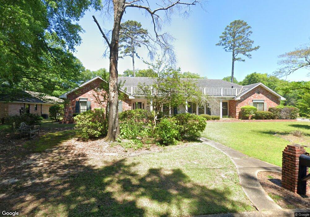
202 Pine Ridge Rd Prattville, AL 36067
Estimated Value: $348,264 - $429,000
Studio
--
Bath
3,248
Sq Ft
$120/Sq Ft
Est. Value
About This Home
This home is located at 202 Pine Ridge Rd, Prattville, AL 36067 and is currently estimated at $389,816, approximately $120 per square foot. 202 Pine Ridge Rd is a home located in Autauga County with nearby schools including Prattville Primary School, Prattville Elementary School, and Prattville Intermediate School.
Ownership History
Date
Name
Owned For
Owner Type
Purchase Details
Closed on
Aug 1, 2025
Sold by
Smith Amanda P and Peterson Elizabeth P
Bought by
Burlingame Allen Todd and Smith Amanda P
Current Estimated Value
Home Financials for this Owner
Home Financials are based on the most recent Mortgage that was taken out on this home.
Original Mortgage
$403,750
Outstanding Balance
$401,304
Interest Rate
6.81%
Mortgage Type
New Conventional
Estimated Equity
-$11,488
Purchase Details
Closed on
Aug 26, 2024
Sold by
Pope Eddie E
Bought by
Peterson Elizabeth P
Create a Home Valuation Report for This Property
The Home Valuation Report is an in-depth analysis detailing your home's value as well as a comparison with similar homes in the area
Purchase History
| Date | Buyer | Sale Price | Title Company |
|---|---|---|---|
| Burlingame Allen Todd | $425,000 | None Listed On Document | |
| Peterson Elizabeth P | $370,200 | None Listed On Document |
Source: Public Records
Mortgage History
| Date | Status | Borrower | Loan Amount |
|---|---|---|---|
| Open | Burlingame Allen Todd | $403,750 |
Source: Public Records
Tax History
| Year | Tax Paid | Tax Assessment Tax Assessment Total Assessment is a certain percentage of the fair market value that is determined by local assessors to be the total taxable value of land and additions on the property. | Land | Improvement |
|---|---|---|---|---|
| 2025 | -- | $33,320 | $0 | $0 |
| 2024 | -- | $34,640 | $0 | $0 |
| 2023 | $0 | $31,660 | $0 | $0 |
| 2022 | $0 | $30,540 | $0 | $0 |
| 2021 | $860 | $28,640 | $0 | $0 |
| 2020 | $860 | $27,600 | $0 | $0 |
| 2019 | $860 | $27,620 | $0 | $0 |
| 2018 | $851 | $27,440 | $0 | $0 |
| 2017 | $0 | $27,740 | $0 | $0 |
| 2015 | -- | $0 | $0 | $0 |
| 2014 | -- | $26,300 | $3,000 | $23,300 |
| 2013 | -- | $27,240 | $4,000 | $23,240 |
Source: Public Records
Map
Nearby Homes
- 203 Evergreen St
- 112 Chimney Ridge
- 112 Oak Creek Cir
- Lot 2 Oak Creek Cir
- 119 Burning Embers
- 701 Emerald Dr Unit LOT 10
- 811 Mountain Lake Ct
- 813 Carter Rd
- 216 1st St
- 925 Fireside Dr
- 529 Weatherby Trail
- 0 Doster St
- 315 S Northington St
- 180 W 6th St
- 228 Moncrief St
- 217 Wetumpka St
- 103 W Bonanza Dr
- 624 Lower Kingston Rd Unit Lot 1
- 349 Wetumpka St
- 825 Fairwood Dr
- 204 Pine Ridge Rd
- 207 Deerwood Dr
- 201 Pine Ridge Rd
- 201 Deer Run Dr
- 206 Pine Ridge Rd
- 203 Deer Run Dr
- 203 Pine Ridge Rd
- 202 Deerwood Dr
- 205 Deer Run Dr
- 205 Pine Ridge Rd
- 208 Pine Ridge Rd
- 104 Thomas Ln
- 206 Deerwood Dr
- 208 Deerwood Dr
- 142 Quail Run
- 211 Deerwood Dr
- 204 Deerwood Dr
- 106 Thomas Ln
- 205 Spruce St
- 207 Deer Run Dr
Your Personal Tour Guide
Ask me questions while you tour the home.