Estimated Value: $84,000 - $163,000
--
Bed
1
Bath
1,470
Sq Ft
$86/Sq Ft
Est. Value
About This Home
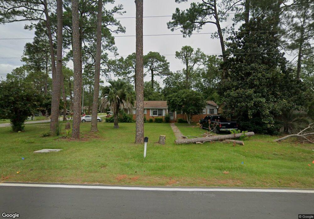
This home is located at 202 Radio Station Rd, Alma, GA 31510 and is currently estimated at $127,061, approximately $86 per square foot. 202 Radio Station Rd is a home located in Bacon County with nearby schools including Bacon County Primary School, Bacon County Elementary School, and Bacon County Middle School.
Ownership History
Date
Name
Owned For
Owner Type
Purchase Details
Closed on
Apr 5, 2024
Sold by
Smart Larry
Bought by
Prevaclint Llc
Current Estimated Value
Purchase Details
Closed on
Oct 21, 2014
Sold by
Deen Jimmy
Bought by
Smart Larry
Purchase Details
Closed on
Jul 25, 2014
Sold by
Johnson John Roger
Bought by
Deen Jimmy C
Purchase Details
Closed on
May 7, 2013
Sold by
Bacon County Tax Commissio
Bought by
Johnson John Roger
Purchase Details
Closed on
Jun 16, 1998
Sold by
Deen Felder E
Bought by
Deen Jimmy C and Deen Bill
Purchase Details
Closed on
Jun 12, 1997
Sold by
Deen Felder
Bought by
Deen Felder E
Create a Home Valuation Report for This Property
The Home Valuation Report is an in-depth analysis detailing your home's value as well as a comparison with similar homes in the area
Home Values in the Area
Average Home Value in this Area
Purchase History
| Date | Buyer | Sale Price | Title Company |
|---|---|---|---|
| Prevaclint Llc | $3,510,000 | -- | |
| Smart Larry | $20,000 | -- | |
| Deen Jimmy C | -- | -- | |
| Johnson John Roger | -- | -- | |
| Deen Jimmy C | -- | -- | |
| Deen Felder E | -- | -- |
Source: Public Records
Tax History Compared to Growth
Tax History
| Year | Tax Paid | Tax Assessment Tax Assessment Total Assessment is a certain percentage of the fair market value that is determined by local assessors to be the total taxable value of land and additions on the property. | Land | Improvement |
|---|---|---|---|---|
| 2024 | $923 | $25,412 | $3,600 | $21,812 |
| 2023 | $872 | $22,612 | $2,640 | $19,972 |
| 2022 | $682 | $17,692 | $2,640 | $15,052 |
| 2021 | $668 | $17,332 | $2,640 | $14,692 |
| 2020 | $627 | $15,551 | $2,400 | $13,151 |
| 2019 | $627 | $15,551 | $2,400 | $13,151 |
| 2018 | $605 | $15,026 | $2,400 | $12,626 |
| 2017 | $605 | $15,026 | $2,400 | $12,626 |
| 2016 | $605 | $15,026 | $2,400 | $12,626 |
| 2015 | $612 | $15,175 | $2,634 | $12,541 |
| 2014 | $849 | $21,154 | $2,634 | $18,520 |
| 2013 | $849 | $20,800 | $2,634 | $18,166 |
Source: Public Records
Map
Nearby Homes
- 403 S Ware St
- 117 Grace Loop Unit 1
- 118 Grace Loop Unit 1
- 122 Grace Loop Unit 1
- 611 S Bead St
- 314 W 16th St
- 9TH E 417
- 113 Brite Blue Dr
- 166 Grace Loop Unit 1
- 198 Meadow Rd
- 907 N Pierce St
- 401 Lee St
- 0 Oriole Rd Unit 1654653
- 0 Oriole Rd Unit 10543585
- 0 Oriole Rd Unit 25773381
- 0 Oriole Rd Unit 160930
- 224 Meadow Rd
- 118 Morris Dr
- 1109 W 4th Street Extension
- 1348 U S 1
- 204 Radio Station Rd
- 826 S Ware St
- 829 S Ware St
- 106 Radio Station Rd
- 0 Radio Station Rd Unit 7519477
- 0 Radio Station Rd Unit 121854
- 0 Radio Station Rd Unit 123126
- 827 S Ware St
- 206 Radio Station Rd
- 825 S Ware St
- 824 S Ware St
- 905 S Wayne St
- 822 S Ware St
- 823 S Ware St
- 910 S Wayne St
- 102 Crosby Rd
- 303 Radio Station Rd
- 1006 S Pierce St
- 904 S Wayne St
- 819 S Ware St