Estimated Value: $394,747 - $472,000
3
Beds
2
Baths
1,597
Sq Ft
$272/Sq Ft
Est. Value
About This Home
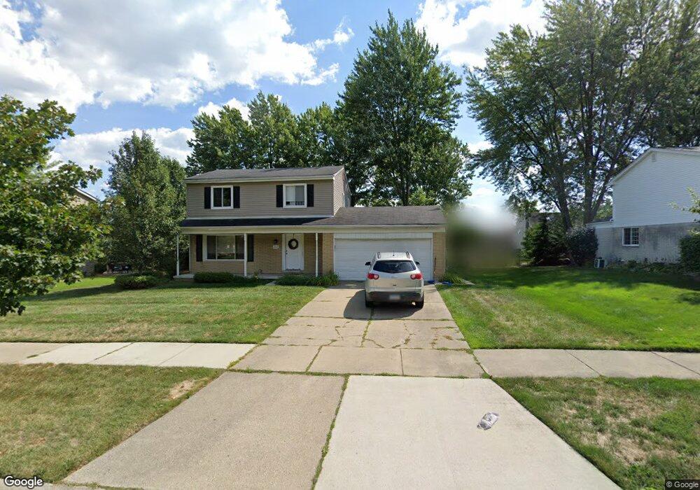
This home is located at 202 Randall Dr, Troy, MI 48085 and is currently estimated at $434,187, approximately $271 per square foot. 202 Randall Dr is a home located in Oakland County with nearby schools including Leonard Elementary School, Smith Middle School, and Troy High School.
Ownership History
Date
Name
Owned For
Owner Type
Purchase Details
Closed on
Dec 15, 2011
Sold by
Lamb Michael J
Bought by
Goodrich Stephanie
Current Estimated Value
Purchase Details
Closed on
Apr 19, 2011
Sold by
Neyou Maurice
Bought by
Citimortgage Inc
Purchase Details
Closed on
Jul 11, 2008
Sold by
Chuang Ying C and Chuang Mei H
Bought by
Neyou Maurice
Purchase Details
Closed on
Jun 20, 2008
Sold by
Morris Cappuso Investment Llc
Bought by
Chuang Ying C and Chuang Mei H
Purchase Details
Closed on
Apr 11, 2008
Sold by
Chuang Ying C and Chuang Mei H
Bought by
Morris Cappuso Investment Llc
Home Financials for this Owner
Home Financials are based on the most recent Mortgage that was taken out on this home.
Original Mortgage
$135,000
Interest Rate
9%
Mortgage Type
Seller Take Back
Purchase Details
Closed on
Jul 19, 1998
Sold by
Chuang Ying C
Bought by
Ying Cheh Chuang Tr
Create a Home Valuation Report for This Property
The Home Valuation Report is an in-depth analysis detailing your home's value as well as a comparison with similar homes in the area
Home Values in the Area
Average Home Value in this Area
Purchase History
| Date | Buyer | Sale Price | Title Company |
|---|---|---|---|
| Goodrich Stephanie | $160,000 | Title Source | |
| Citimortgage Inc | $261,652 | None Available | |
| Neyou Maurice | $225,000 | Clearly Title | |
| Chuang Ying C | -- | Manzo Title Company | |
| Morris Cappuso Investment Llc | $140,000 | First American Title Ins Co | |
| Ying Cheh Chuang Tr | -- | -- |
Source: Public Records
Mortgage History
| Date | Status | Borrower | Loan Amount |
|---|---|---|---|
| Previous Owner | Morris Cappuso Investment Llc | $135,000 |
Source: Public Records
Tax History
| Year | Tax Paid | Tax Assessment Tax Assessment Total Assessment is a certain percentage of the fair market value that is determined by local assessors to be the total taxable value of land and additions on the property. | Land | Improvement |
|---|---|---|---|---|
| 2022 | $3,540 | $144,890 | $0 | $0 |
| 2015 | $3,773 | $103,410 | $0 | $0 |
| 2014 | -- | $94,850 | $0 | $0 |
| 2011 | -- | $82,290 | $0 | $0 |
Source: Public Records
Map
Nearby Homes
- 89 MacLynn Dr
- 417 Carter Dr
- 194 E Long Lake Rd
- 4931 Treeside Ln
- 4953 Treeside Ln
- 4849 Parkside Ln
- 4840 Parkside Ln
- 793 Canterbury Ln
- 821 Canterbury Ln
- 207 Harrington Dr Unit 34
- 735 Canterbury Ln
- 797 Canterbury Ln
- 1066 Lorenzo Ct Unit 5
- 1030 Lorenzo Ct
- 556 Trombley Dr
- 4313 Bennett Park Cir
- 4876 Parkside Ln
- 4837 Ludlow Ln
- 3443 Ellenboro Dr
- 769 Canterbury Ln
Your Personal Tour Guide
Ask me questions while you tour the home.