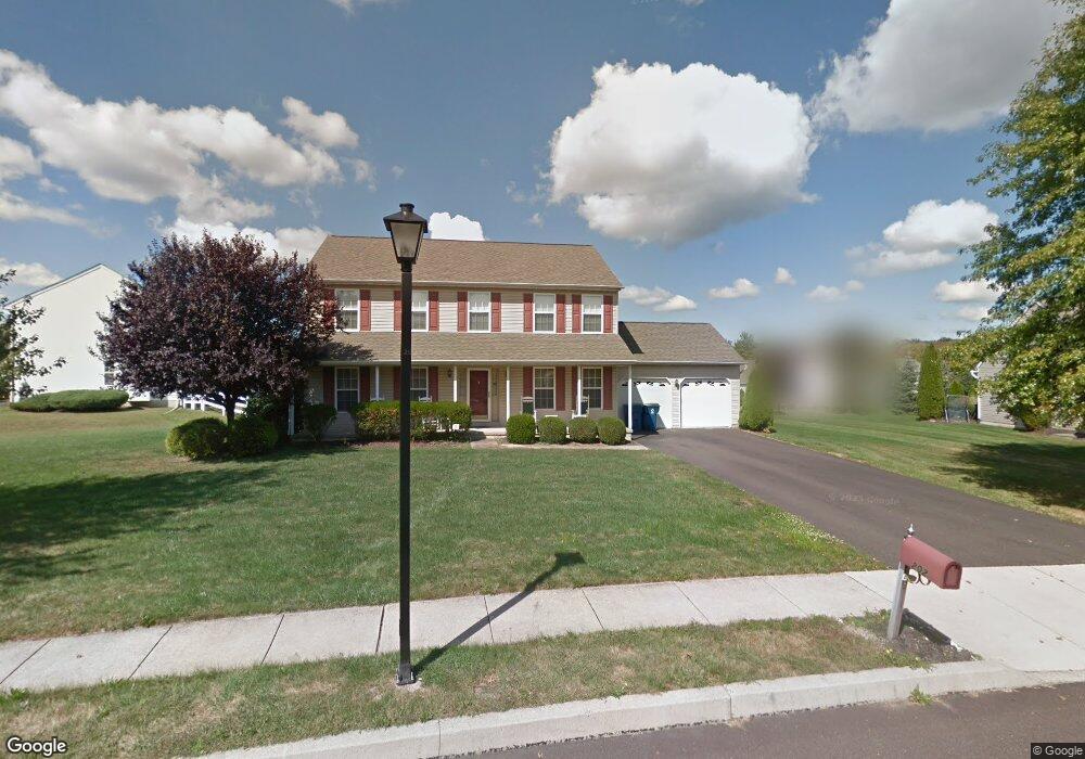
202 Rayburn Ln Chalfont, PA 18914
Estimated Value: $728,000 - $736,000
4
Beds
3
Baths
2,240
Sq Ft
$327/Sq Ft
Est. Value
About This Home
This home is located at 202 Rayburn Ln, Chalfont, PA 18914 and is currently estimated at $731,953, approximately $326 per square foot. 202 Rayburn Ln is a home located in Bucks County with nearby schools including Mill Creek Elementary School, Unami Middle School, and Central Bucks High School - South.
Ownership History
Date
Name
Owned For
Owner Type
Purchase Details
Closed on
Aug 31, 1998
Sold by
Th Properties
Bought by
Somma Anthony E and Somma Karen A
Current Estimated Value
Home Financials for this Owner
Home Financials are based on the most recent Mortgage that was taken out on this home.
Original Mortgage
$193,185
Outstanding Balance
$41,339
Interest Rate
6.92%
Estimated Equity
$690,614
Create a Home Valuation Report for This Property
The Home Valuation Report is an in-depth analysis detailing your home's value as well as a comparison with similar homes in the area
Home Values in the Area
Average Home Value in this Area
Purchase History
| Date | Buyer | Sale Price | Title Company |
|---|---|---|---|
| Somma Anthony E | $215,848 | First American Title Ins Co |
Source: Public Records
Mortgage History
| Date | Status | Borrower | Loan Amount |
|---|---|---|---|
| Open | Somma Anthony E | $193,185 |
Source: Public Records
Tax History Compared to Growth
Tax History
| Year | Tax Paid | Tax Assessment Tax Assessment Total Assessment is a certain percentage of the fair market value that is determined by local assessors to be the total taxable value of land and additions on the property. | Land | Improvement |
|---|---|---|---|---|
| 2025 | $7,620 | $41,280 | $9,560 | $31,720 |
| 2024 | $7,620 | $41,280 | $9,560 | $31,720 |
| 2023 | $7,055 | $41,280 | $9,560 | $31,720 |
| 2022 | $6,916 | $41,280 | $9,560 | $31,720 |
| 2021 | $6,839 | $41,280 | $9,560 | $31,720 |
| 2020 | $6,839 | $41,280 | $9,560 | $31,720 |
| 2019 | $6,798 | $41,280 | $9,560 | $31,720 |
| 2018 | $6,722 | $41,280 | $9,560 | $31,720 |
| 2017 | $6,631 | $41,280 | $9,560 | $31,720 |
| 2016 | $6,611 | $41,280 | $9,560 | $31,720 |
| 2015 | -- | $41,280 | $9,560 | $31,720 |
| 2014 | -- | $41,280 | $9,560 | $31,720 |
Source: Public Records
Map
Nearby Homes
- 202 Shepard Ln
- 722 Upper State Rd
- 14 Woodside Ave
- 0 S Limekiln Pike
- 957 Hickory Ridge Dr
- 134 Kings Ct
- Lots 123 Pickertown Rd
- 129 Cambridge Place
- 3474 Pond View Dr
- 208 Grove Valley Ct
- 214 Prince William Way
- 200 Cornwall Dr
- 103 Bonnie Lark Ct
- 428 Reagans Ln
- 434 Reagans Ln
- 431 Reagans Ln
- 435 Reagans Ln
- 332 Foxtail Ln
- 437 Reagans Ln
- 442 Reagans Ln
- 117 Billingsley Dr
- 204 Rayburn Ln
- 203 Rayburn Ln
- 133 Billingsley Dr
- 135 Billingsley Dr
- 119 Billingsley Dr
- 129 Billingsley Dr
- 139 Billingsley Dr
- 206 Rayburn Ln
- 116 Billingsley Dr
- 205 Rayburn Ln
- 114 Billingsley Dr
- 118 Billingsley Dr
- 109 Billingsley Dr
- 112 Billingsley Dr
- 120 Billingsley Dr
- 303 Metsger Way
- 110 Billingsley Dr
- 309 Metsger Way
- 138 Billingsley Dr