
Seller's Agent in 2025
John Jam
KW Greater West Chester
(610) 316-9623
3 in this area
102 Total Sales
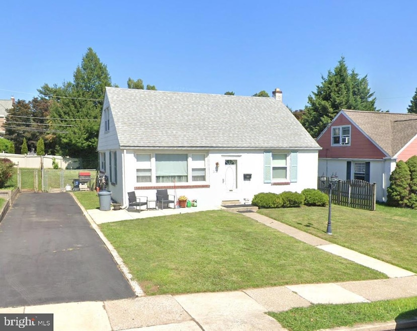
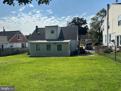
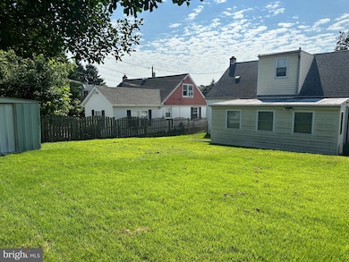
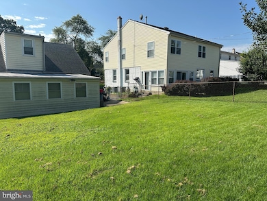
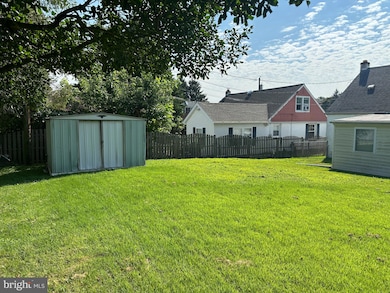
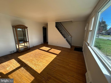
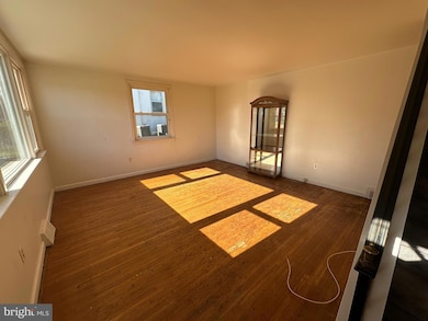
Charming 3-Bedroom, 2-Bath Home with Endless Potential! Welcome to this solidly built home featuring stucco-over-block construction, offering durability and timeless character. Step inside to a bright and cheery living room, adjoining dining room (or could be used as a 4th bedroom; a closet would be needed), kitchen, and a first-floor addition perfect for a family room overlooking the fenced-in rear yard. The main level also includes one bedroom and a full bath, ideal for flexible living arrangements. Upstairs, you’ll find two comfortable bedrooms and a second full bath. The full basement, finished some time ago, provides abundant storage and extra living space possibilities. This property is being sold in its present condition, giving you the opportunity to update and add your own personal touches. Located in a desirable neighborhood, this home offers unbeatable convenience with quick access to I-476 (Blue Route), I-95, and Route 1. Just 15–20 minutes to Philadelphia International Airport and the city’s major sporting venues, and less than 2 hours to your favorite Jersey Shore town!
Last Agent to Sell the Property
(610) 436-6500 johnpatrick@kw.com KW Greater West Chester Listed on: 10/03/2025
Last Buyer's Agent
(610) 353-6200 susannedurso@gmail.com BHHS Fox&Roach-Newtown Square License #RS302617
| Date | Type | Sale Price | Title Company |
|---|---|---|---|
| Deed | $385,000 | Trident Land Transfer | |
| Deed | $130,000 | -- |
| Date | Status | Loan Amount | Loan Type |
|---|---|---|---|
| Open | $365,750 | New Conventional | |
| Previous Owner | $50,000 | No Value Available |
| Date | Event | Price | List to Sale | Price per Sq Ft |
|---|---|---|---|---|
| 12/10/2025 12/10/25 | Sold | $385,000 | -4.9% | $276 / Sq Ft |
| 11/05/2025 11/05/25 | Pending | -- | -- | -- |
| 10/22/2025 10/22/25 | Price Changed | $405,000 | -4.7% | $291 / Sq Ft |
| 10/03/2025 10/03/25 | For Sale | $425,000 | -- | $305 / Sq Ft |
| Year | Tax Paid | Tax Assessment Tax Assessment Total Assessment is a certain percentage of the fair market value that is determined by local assessors to be the total taxable value of land and additions on the property. | Land | Improvement |
|---|---|---|---|---|
| 2025 | $4,357 | $252,100 | $80,500 | $171,600 |
| 2024 | $4,357 | $252,100 | $80,500 | $171,600 |
| 2023 | $4,218 | $252,100 | $80,500 | $171,600 |
| 2022 | $4,138 | $252,100 | $80,500 | $171,600 |
| 2021 | $6,246 | $252,100 | $80,500 | $171,600 |
| 2020 | $3,311 | $115,060 | $38,170 | $76,890 |
| 2019 | $3,271 | $115,060 | $38,170 | $76,890 |
| 2018 | $3,237 | $115,060 | $0 | $0 |
| 2017 | $3,239 | $115,060 | $0 | $0 |
| 2016 | $631 | $115,060 | $0 | $0 |
| 2015 | $631 | $115,060 | $0 | $0 |
| 2014 | $631 | $115,060 | $0 | $0 |
Seller's Agent in 2025
John Jam
KW Greater West Chester
(610) 316-9623
3 in this area
102 Total Sales
Buyer's Agent in 2025
Susanne Durso
BHHS Fox & Roach
(484) 321-1003
4 in this area
17 Total Sales
Source: Bright MLS
MLS Number: PADE2101246
APN: 25-00-04028-00
Disclaimer: Certain information contained herein is derived from information provided by parties other than Homes.com. All information provided is deemed reliable, but is not guaranteed to be accurate and should be independently verified.
![]() The data relating to real estate for sale on this website appears in part through the BRIGHT Internet Data Exchange program, a voluntary cooperative exchange of property listing data between licensed real estate brokerage firms, and is provided by BRIGHT through a licensing agreement.
The data relating to real estate for sale on this website appears in part through the BRIGHT Internet Data Exchange program, a voluntary cooperative exchange of property listing data between licensed real estate brokerage firms, and is provided by BRIGHT through a licensing agreement.
Listing information is from various brokers who participate in the Bright MLS IDX program and not all listings may be visible on the site.
The property information being provided on or through the website is for the personal, non-commercial use of consumers and such information may not be used for any purpose other than to identify prospective properties consumers may be interested in purchasing.
Some properties which appear for sale on the website may no longer be available because they are for instance, under contract, sold or are no longer being offered for sale.
Property information displayed is deemed reliable but is not guaranteed.
Copyright 2026 Bright MLS, Inc.
Ask me questions while you tour the home.