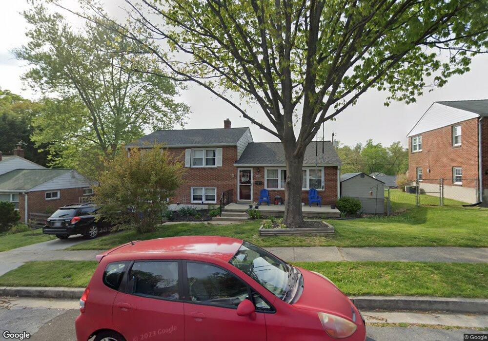
202 Rollingbrook Way Catonsville, MD 21228
Estimated Value: $519,341 - $593,000
--
Bed
2
Baths
2,465
Sq Ft
$229/Sq Ft
Est. Value
About This Home
This home is located at 202 Rollingbrook Way, Catonsville, MD 21228 and is currently estimated at $564,085, approximately $228 per square foot. 202 Rollingbrook Way is a home located in Baltimore County with nearby schools including Westchester Elementary School, Catonsville Middle School, and Catonsville High School.
Ownership History
Date
Name
Owned For
Owner Type
Purchase Details
Closed on
Feb 1, 2002
Sold by
Batchellor Iris T
Bought by
Mcgirr Ryan T and Mcgirr Marcelina L
Current Estimated Value
Purchase Details
Closed on
Jan 29, 1997
Sold by
Batchellor Iris T
Bought by
Batchellor Iris T
Purchase Details
Closed on
Apr 26, 1994
Sold by
Gmurek Michael F
Bought by
Batchellor Iris T
Home Financials for this Owner
Home Financials are based on the most recent Mortgage that was taken out on this home.
Original Mortgage
$126,000
Interest Rate
7.6%
Create a Home Valuation Report for This Property
The Home Valuation Report is an in-depth analysis detailing your home's value as well as a comparison with similar homes in the area
Home Values in the Area
Average Home Value in this Area
Purchase History
| Date | Buyer | Sale Price | Title Company |
|---|---|---|---|
| Mcgirr Ryan T | $182,000 | -- | |
| Batchellor Iris T | -- | -- | |
| Batchellor Iris T | $140,000 | -- |
Source: Public Records
Mortgage History
| Date | Status | Borrower | Loan Amount |
|---|---|---|---|
| Previous Owner | Batchellor Iris T | $126,000 |
Source: Public Records
Tax History Compared to Growth
Tax History
| Year | Tax Paid | Tax Assessment Tax Assessment Total Assessment is a certain percentage of the fair market value that is determined by local assessors to be the total taxable value of land and additions on the property. | Land | Improvement |
|---|---|---|---|---|
| 2025 | $5,250 | $393,133 | -- | -- |
| 2024 | $5,250 | $369,600 | $127,000 | $242,600 |
| 2023 | $2,488 | $359,633 | $0 | $0 |
| 2022 | $4,798 | $349,667 | $0 | $0 |
| 2021 | $4,487 | $339,700 | $127,000 | $212,700 |
| 2020 | $4,487 | $328,967 | $0 | $0 |
| 2019 | $4,519 | $318,233 | $0 | $0 |
| 2018 | $4,191 | $307,500 | $91,000 | $216,500 |
| 2017 | $3,839 | $289,800 | $0 | $0 |
| 2016 | $3,307 | $274,000 | $0 | $0 |
| 2015 | $3,307 | $254,400 | $0 | $0 |
| 2014 | $3,307 | $254,400 | $0 | $0 |
Source: Public Records
Map
Nearby Homes
- 231 Gralan Rd
- 11 Clay Lodge Ln Unit 204
- 19 Clay Lodge Ln Unit 104
- 2110 Edmondson Ave
- 8 Seminole Ave
- 302 Wessling Cir
- 311 Radstock Rd
- 627 Meyers Dr
- 627 Meyers Dr Unit PARCEL 108
- 2305 Rockwell Ave
- 1300 Rice Ave
- 230 N Beaumont Ave
- 343 N Beaumont Ave
- 2 Park Dr
- 201 Suter Rd
- 353 N Beaumont Ave
- 0 Melvin Ave
- 332 Suter Rd
- 346 Suter Rd
- 6042 Old Frederick Rd
- 204 Rollingbrook Way
- 200 Rollingbrook Way
- 203 Brookside Dr
- 201 Brookside Dr
- 205 Brookside Dr
- 206 Rollingbrook Way
- 203 Rollingbrook Way
- 205 Rollingbrook Way
- 201 Rollingbrook Way
- 207 Brookside Dr
- 207 Rollingbrook Way
- 208 Rollingbrook Way
- 209 Rollingbrook Way
- 202 Brookside Dr
- 200 Brookside Dr
- 209 Brookside Dr
- 2001 Devere Ln
- 202 Rollingfield Rd
- 2005 Devere Ln
- 204 Rollingfield Rd