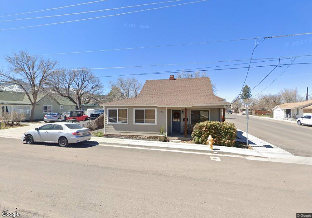
202 S 5th St Williams, AZ 86046
Estimated Value: $310,261 - $385,000
2
Beds
1
Bath
84
Sq Ft
$4,007/Sq Ft
Est. Value
About This Home
This home is located at 202 S 5th St, Williams, AZ 86046 and is currently estimated at $336,565, approximately $4,006 per square foot. 202 S 5th St is a home located in Coconino County with nearby schools including Williams Elementary/Middle School, Williams High School, and Heritage Elementary - Williams.
Ownership History
Date
Name
Owned For
Owner Type
Purchase Details
Closed on
Dec 2, 2015
Sold by
Rushton Fran
Bought by
Rushton Ii John L
Current Estimated Value
Purchase Details
Closed on
Feb 18, 2009
Sold by
Wells Fargo Financial Arizona Inc
Bought by
Rushton Fran
Purchase Details
Closed on
Oct 7, 2008
Sold by
Garlock David and Garlock Jo Anne
Bought by
Wells Fargo Financial Arizona Inc
Purchase Details
Closed on
Mar 16, 2000
Sold by
Gibbons Alan K and Jean Gibbons M
Bought by
Garlock David and Garlock Jo Anne
Home Financials for this Owner
Home Financials are based on the most recent Mortgage that was taken out on this home.
Original Mortgage
$75,000
Interest Rate
8.34%
Mortgage Type
Seller Take Back
Create a Home Valuation Report for This Property
The Home Valuation Report is an in-depth analysis detailing your home's value as well as a comparison with similar homes in the area
Home Values in the Area
Average Home Value in this Area
Purchase History
| Date | Buyer | Sale Price | Title Company |
|---|---|---|---|
| Rushton Ii John L | -- | Accommodation | |
| Rushton Fran | $74,000 | First American Title Ins Co | |
| Wells Fargo Financial Arizona Inc | $105,000 | None Available | |
| Garlock David | $80,000 | Transnation Title Ins Co |
Source: Public Records
Mortgage History
| Date | Status | Borrower | Loan Amount |
|---|---|---|---|
| Previous Owner | Garlock David | $75,000 |
Source: Public Records
Tax History Compared to Growth
Tax History
| Year | Tax Paid | Tax Assessment Tax Assessment Total Assessment is a certain percentage of the fair market value that is determined by local assessors to be the total taxable value of land and additions on the property. | Land | Improvement |
|---|---|---|---|---|
| 2025 | $490 | $16,963 | -- | -- |
| 2024 | $490 | $16,074 | -- | -- |
| 2023 | $476 | $12,108 | $0 | $0 |
| 2022 | $453 | $10,055 | $0 | $0 |
| 2021 | $437 | $9,042 | $0 | $0 |
| 2020 | $428 | $7,563 | $0 | $0 |
| 2019 | $415 | $6,191 | $0 | $0 |
| 2018 | $402 | $5,091 | $0 | $0 |
| 2017 | $394 | $4,076 | $0 | $0 |
| 2016 | $390 | $4,057 | $0 | $0 |
| 2015 | $384 | $3,949 | $0 | $0 |
Source: Public Records
Map
Nearby Homes
- 304 S 4th St
- 411 S 6th St
- 407 S 7th St
- 215 W Hancock Ave
- 106 W Sherman Ave
- 500 W Meade Ave
- 412 S 1st St
- 530 W Mcpherson Ave
- 1011 W Sheridan Ave
- 911 W Oak St
- 1021 W Sheridan Ave
- 733 S 3rd St
- 00 W Fulton Ave
- 1030 W Hancock Ave
- 500 Grand Canyon Ave
- 201 S Slagel St
- 1111 W Sheridan Ave
- 1012 Foothill Rd
- 509 S 11th St
- 344 E Route 66