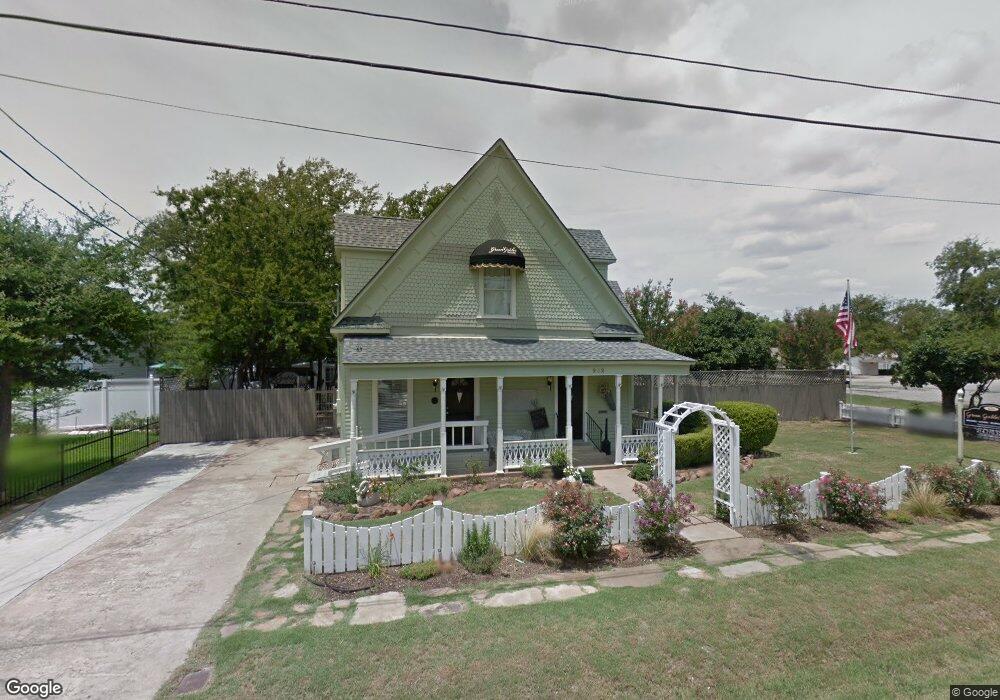
202 S Pearl St Trenton, TX 75490
Estimated Value: $355,000 - $428,000
--
Bed
--
Bath
2,116
Sq Ft
$187/Sq Ft
Est. Value
About This Home
This home is located at 202 S Pearl St, Trenton, TX 75490 and is currently estimated at $395,989, approximately $187 per square foot. 202 S Pearl St is a home located in Fannin County with nearby schools including Trenton Elementary School, Trenton Middle School, and Trenton High School.
Ownership History
Date
Name
Owned For
Owner Type
Purchase Details
Closed on
May 24, 2021
Sold by
Mt Equities Llc
Bought by
Larose Jennifer and Lessner Julie May
Current Estimated Value
Home Financials for this Owner
Home Financials are based on the most recent Mortgage that was taken out on this home.
Original Mortgage
$288,000
Outstanding Balance
$259,610
Interest Rate
2.9%
Mortgage Type
New Conventional
Estimated Equity
$136,379
Create a Home Valuation Report for This Property
The Home Valuation Report is an in-depth analysis detailing your home's value as well as a comparison with similar homes in the area
Home Values in the Area
Average Home Value in this Area
Purchase History
| Date | Buyer | Sale Price | Title Company |
|---|---|---|---|
| Larose Jennifer | -- | Chicago Title |
Source: Public Records
Mortgage History
| Date | Status | Borrower | Loan Amount |
|---|---|---|---|
| Open | Larose Jennifer | $288,000 |
Source: Public Records
Tax History Compared to Growth
Tax History
| Year | Tax Paid | Tax Assessment Tax Assessment Total Assessment is a certain percentage of the fair market value that is determined by local assessors to be the total taxable value of land and additions on the property. | Land | Improvement |
|---|---|---|---|---|
| 2025 | $4,024 | $226,240 | $65,970 | $160,270 |
| 2024 | $4,024 | $229,890 | $63,630 | $166,260 |
| 2023 | $5,483 | $245,470 | $77,760 | $167,710 |
| 2022 | $4,705 | $208,780 | $52,270 | $156,510 |
| 2021 | $4,449 | $174,300 | $13,190 | $161,110 |
| 2020 | $4,082 | $151,640 | $12,860 | $138,780 |
| 2019 | $4,118 | $145,920 | $8,520 | $137,400 |
| 2018 | $4,015 | $140,100 | $8,350 | $131,750 |
| 2017 | $3,730 | $130,660 | $8,020 | $122,640 |
| 2016 | $3,434 | $120,290 | $8,020 | $112,270 |
| 2015 | -- | $120,120 | $7,680 | $112,440 |
| 2014 | -- | $82,270 | $7,520 | $74,750 |
Source: Public Records
Map
Nearby Homes
- TBD Cr 4435
- 210 Carrie Mabrie St
- 104 N 4th St
- 503 S Pearl St
- 118 Indian Creek
- 211 Church St
- 513 Augustus St
- 549 Augustus St
- 1284 Emily Dr
- 1286 Emily Dr
- 1104 Alexander St
- 1290 Emily Dr
- 1205 Anderson Dr
- 1265 Emily Dr
- Violet Plan at Anderson Crossing
- Dewberry II Plan at Anderson Crossing
- Magnolia III Plan at Anderson Crossing
- Spring Cress Plan at Anderson Crossing
- Carolina IV Plan at Anderson Crossing
- Bellflower Plan at Anderson Crossing
- 204 S Pearl St
- 201 Ballentine St
- 201 S Pearl St
- 105 S Pearl St
- 205 Ballentine St
- 103 S Pearl St
- 107 W Neale St
- 302 S Pearl St
- 114 Katy St
- 103 Ballentine St
- 301 S Pearl St
- 301 Ballentine St
- 6700 W State Highway Loop 220 Hwy W
- 304 S Pearl St
- 203 S Pearl St
- 303 S Pearl St
- 303 Ballentine St
- 204 Ballentine St
- 102 Ballentine St
- 202 Ballentine St