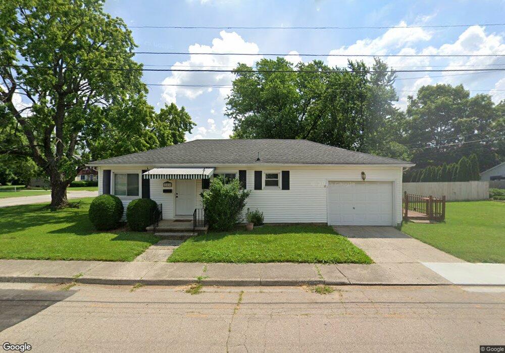
202 S Perry St Vandalia, OH 45377
Estimated Value: $126,000 - $146,000
2
Beds
1
Bath
768
Sq Ft
$180/Sq Ft
Est. Value
About This Home
This home is located at 202 S Perry St, Vandalia, OH 45377 and is currently estimated at $138,534, approximately $180 per square foot. 202 S Perry St is a home located in Montgomery County with nearby schools including Demmitt Elementary School, Smith Middle School, and Butler High School.
Ownership History
Date
Name
Owned For
Owner Type
Purchase Details
Closed on
Oct 10, 2014
Sold by
The Secretary Of Hud
Bought by
Snyder Scott and Snyder Alicia
Current Estimated Value
Purchase Details
Closed on
Feb 5, 2014
Sold by
Wells Fargo Bank Na
Bought by
Secretary Of Hud
Purchase Details
Closed on
Jan 8, 2014
Sold by
Davis Ollie M
Bought by
Wells Fargo Bank Na
Purchase Details
Closed on
Aug 30, 1996
Sold by
Schott Annie L
Bought by
Burkett Lynne K
Create a Home Valuation Report for This Property
The Home Valuation Report is an in-depth analysis detailing your home's value as well as a comparison with similar homes in the area
Home Values in the Area
Average Home Value in this Area
Purchase History
| Date | Buyer | Sale Price | Title Company |
|---|---|---|---|
| Snyder Scott | $55,000 | Sterling Land Title North | |
| Secretary Of Hud | -- | None Available | |
| Wells Fargo Bank Na | $36,000 | None Available | |
| Burkett Lynne K | $71,900 | -- |
Source: Public Records
Tax History Compared to Growth
Tax History
| Year | Tax Paid | Tax Assessment Tax Assessment Total Assessment is a certain percentage of the fair market value that is determined by local assessors to be the total taxable value of land and additions on the property. | Land | Improvement |
|---|---|---|---|---|
| 2024 | $1,751 | $32,550 | $14,120 | $18,430 |
| 2023 | $1,751 | $32,550 | $14,120 | $18,430 |
| 2022 | $1,539 | $23,110 | $9,670 | $13,440 |
| 2021 | $1,540 | $23,110 | $9,670 | $13,440 |
| 2020 | $1,536 | $23,110 | $9,670 | $13,440 |
| 2019 | $1,566 | $21,610 | $9,670 | $11,940 |
| 2018 | $1,569 | $21,610 | $9,670 | $11,940 |
| 2017 | $1,559 | $21,610 | $9,670 | $11,940 |
| 2016 | $1,593 | $21,710 | $9,670 | $12,040 |
| 2015 | $1,698 | $24,030 | $9,670 | $14,360 |
| 2014 | $1,698 | $24,030 | $9,670 | $14,360 |
| 2012 | -- | $26,190 | $9,830 | $16,360 |
Source: Public Records
Map
Nearby Homes
- 552 Tionda Dr N
- 416 Attica St
- 106 Grosbeck St
- 314 N American Blvd
- 214 Marview Ave
- 545 Koch Ave
- 465 Pilot Point Unit 1-302
- 626 W National Rd
- 365 Inverness Ave
- 475 Pilot Point Unit 1-300
- 461 Poplar Grove Dr
- 485 Pilot Point Unit 1-301
- 92 Waller Ave
- 1182 Park Forest Dr
- 0 Northwoods Blvd
- 416 Bent Twig Dr
- 696 W Alkaline Springs Rd
- 775 Cassel Creek Dr
- 469 Farrell Rd
- 76 Farrell Rd