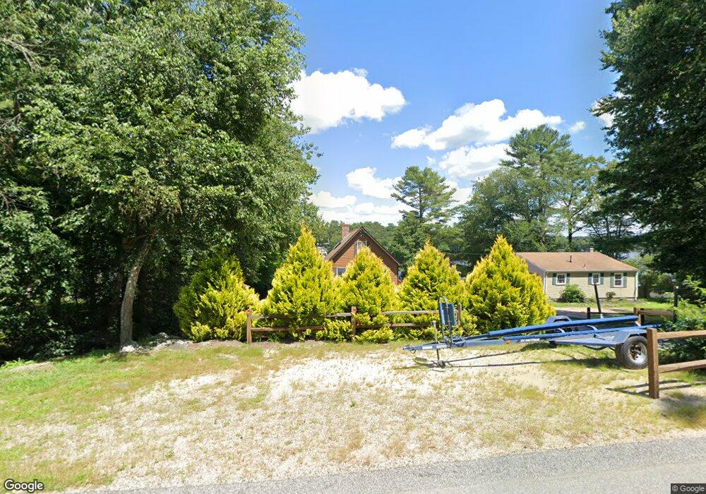
202 Saunders Brook Rd Chepachet, RI 02814
Estimated Value: $480,385 - $585,000
2
Beds
1
Bath
1,496
Sq Ft
$359/Sq Ft
Est. Value
About This Home
This home is located at 202 Saunders Brook Rd, Chepachet, RI 02814 and is currently estimated at $537,096, approximately $359 per square foot. 202 Saunders Brook Rd is a home located in Providence County with nearby schools including West Glocester Elementary School, Ponaganset Middle School, and Ponaganset High School.
Ownership History
Date
Name
Owned For
Owner Type
Purchase Details
Closed on
Jun 18, 1999
Sold by
Aubin Arthur G and Aubin Alice A
Bought by
Trinque Timothy J and Trinque Patricia A
Current Estimated Value
Purchase Details
Closed on
Jun 15, 1995
Sold by
Bentley Andrew J and Bentley Renee
Bought by
Aubin Arthur A and Aubin Alice
Create a Home Valuation Report for This Property
The Home Valuation Report is an in-depth analysis detailing your home's value as well as a comparison with similar homes in the area
Home Values in the Area
Average Home Value in this Area
Purchase History
| Date | Buyer | Sale Price | Title Company |
|---|---|---|---|
| Trinque Timothy J | $162,000 | -- | |
| Aubin Arthur A | $157,000 | -- |
Source: Public Records
Mortgage History
| Date | Status | Borrower | Loan Amount |
|---|---|---|---|
| Open | Aubin Arthur A | $186,000 | |
| Closed | Aubin Arthur A | $22,000 | |
| Closed | Aubin Arthur A | $150,000 |
Source: Public Records
Tax History
| Year | Tax Paid | Tax Assessment Tax Assessment Total Assessment is a certain percentage of the fair market value that is determined by local assessors to be the total taxable value of land and additions on the property. | Land | Improvement |
|---|---|---|---|---|
| 2025 | $6,788 | $476,000 | $317,600 | $158,400 |
| 2024 | $6,597 | $476,000 | $317,600 | $158,400 |
| 2023 | $6,783 | $476,000 | $317,600 | $158,400 |
| 2022 | $5,372 | $291,300 | $168,500 | $122,800 |
| 2021 | $5,372 | $291,300 | $168,500 | $122,800 |
| 2020 | $5,307 | $291,300 | $168,500 | $122,800 |
| 2018 | $5,508 | $275,400 | $165,300 | $110,100 |
| 2017 | $5,513 | $279,400 | $165,300 | $114,100 |
| 2016 | $4,896 | $218,100 | $114,200 | $103,900 |
| 2015 | $4,824 | $218,100 | $114,200 | $103,900 |
| 2014 | $4,748 | $218,100 | $114,200 | $103,900 |
| 2013 | $5,223 | $245,900 | $140,000 | $105,900 |
Source: Public Records
Map
Nearby Homes
- 109 Saunders Brook Rd
- 35 Wintergreen Way
- 17 Wintergreen Way
- 143 Lake View Dr
- 37 Anan Wade Rd
- 0 Stone Dam Rd
- 14 Hemlock Rd
- 61 Diamond Hill Rd
- 53 Diamond Hill Rd
- 51 Diamond Hill Rd
- 77 Chestnut Hill Rd
- 35 Diamond Hill Rd
- 0 Chopmist Hill Rd Unit 1402653
- 0 Putnam Pike Unit 1361114
- 0 Putnam Pike Unit 1361504
- 0 Adelaide Rd Unit 1397706
- 1261 Putnam Pike
- 0 Beach Rd
- 175 Huntinghouse Rd
- 112 Cranberry Ridge Rd
- 206 Saunders Brook Rd
- 182 Saunders Brook Rd
- 216 Saunders Brook Rd
- 185 Saunders Brook Rd
- 201 Saunders Brook Rd
- 205 Saunders Brook Rd
- 228 Saunders Brook Rd
- 219 Saunders Brook Rd
- 219 Saunders Brook Rd Unit 219
- 238 Saunders Brook Rd
- 229 Saunders Brook Rd
- 140 Saunders Brook Rd
- 237 Saunders Brook Rd
- 256 Saunders Brook Rd
- 137 Saunders Brook Rd
- 259 Saunders Brook Rd
- 127 Saunders Brook Rd
- 1 Keach Pond Dr
- 15 Keach Pond Dr
- 236 Saunders Brook Rd
Your Personal Tour Guide
Ask me questions while you tour the home.