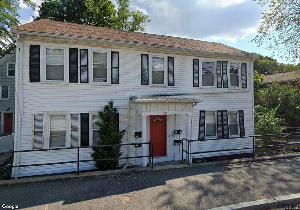
202 School St Quincy, MA 02169
South Quincy NeighborhoodEstimated Value: $841,000 - $1,189,000
9
Beds
4
Baths
3,400
Sq Ft
$296/Sq Ft
Est. Value
About This Home
This home is located at 202 School St, Quincy, MA 02169 and is currently estimated at $1,007,667, approximately $296 per square foot. 202 School St is a home located in Norfolk County with nearby schools including Lincoln-Hancock Community School, South West Middle School, and Quincy High School.
Ownership History
Date
Name
Owned For
Owner Type
Purchase Details
Closed on
Apr 15, 2014
Sold by
Dunne Stephen D
Bought by
Hegarty Richard B and Hegarty Gerard T
Current Estimated Value
Home Financials for this Owner
Home Financials are based on the most recent Mortgage that was taken out on this home.
Original Mortgage
$373,000
Outstanding Balance
$283,042
Interest Rate
4.37%
Mortgage Type
New Conventional
Estimated Equity
$724,625
Create a Home Valuation Report for This Property
The Home Valuation Report is an in-depth analysis detailing your home's value as well as a comparison with similar homes in the area
Home Values in the Area
Average Home Value in this Area
Purchase History
| Date | Buyer | Sale Price | Title Company |
|---|---|---|---|
| Hegarty Richard B | -- | -- |
Source: Public Records
Mortgage History
| Date | Status | Borrower | Loan Amount |
|---|---|---|---|
| Open | Hegarty Richard B | $373,000 |
Source: Public Records
Tax History Compared to Growth
Tax History
| Year | Tax Paid | Tax Assessment Tax Assessment Total Assessment is a certain percentage of the fair market value that is determined by local assessors to be the total taxable value of land and additions on the property. | Land | Improvement |
|---|---|---|---|---|
| 2025 | $10,314 | $894,500 | $309,500 | $585,000 |
| 2024 | $9,797 | $869,300 | $294,900 | $574,400 |
| 2023 | $8,933 | $802,600 | $268,300 | $534,300 |
| 2022 | $8,895 | $742,500 | $244,100 | $498,400 |
| 2021 | $8,877 | $731,200 | $244,100 | $487,100 |
| 2020 | $8,434 | $678,500 | $232,500 | $446,000 |
| 2019 | $8,352 | $665,500 | $219,500 | $446,000 |
| 2018 | $7,417 | $556,000 | $219,500 | $336,500 |
| 2017 | $7,531 | $531,500 | $209,200 | $322,300 |
| 2016 | $6,979 | $486,000 | $199,300 | $286,700 |
| 2015 | $6,977 | $477,900 | $199,300 | $278,600 |
| 2014 | $6,387 | $429,800 | $189,900 | $239,900 |
Source: Public Records
Map
Nearby Homes
- 51 Brook Rd
- 76 Scotch Pond Place Unit 76
- 73 Scotch Pond Place
- 94 Brook Rd Unit 3
- 8 Jackson St Unit B2
- 64 Garfield St Unit B
- 118 Brook Rd Unit 2
- 91 Garfield St
- 81-85 Water St
- 21 Arthur St
- 50 N Payne St Unit 1
- 50 N Payne St Unit 3
- 18 Cliveden St Unit 406W
- 18 Cliveden St Unit 201W
- 12 Arthur Ave
- 14 Arthur Ave
- 2 Cliveden St Unit 601E
- 2 Cliveden St Unit 405E
- 56 Penn St Unit 4
- 72 Federal Ave
- 202 School St Unit 2
- 202 School St Unit 3
- 202 School St Unit 1L
- 200 School St
- 198 School St
- 198 School St Unit 198
- 198 School St Unit B
- 198 School St Unit A
- 198 School St Unit 1
- 198 School St Unit 2
- 208 School St Unit 4
- 208 School St Unit 2
- 194 School St
- 192 School St
- 218 Granite St
- 190 School St
- 207-209 Granite St
- 207 Granite St
- 222 Granite St
- 222 Granite St Unit 1