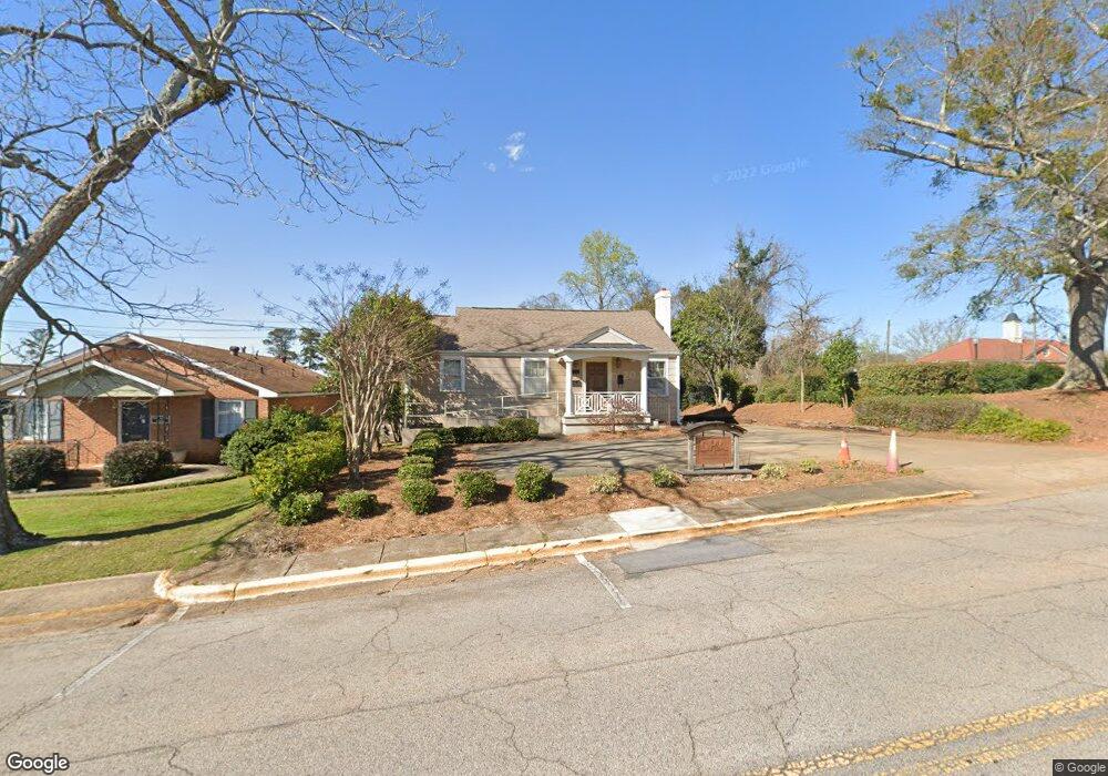
202 Smith St Lagrange, GA 30240
Estimated Value: $151,000
Studio
3
Baths
1,336
Sq Ft
$113/Sq Ft
Est. Value
About This Home
This home is located at 202 Smith St, Lagrange, GA 30240 and is currently priced at $151,000, approximately $113 per square foot. 202 Smith St is a home located in Troup County with nearby schools including Franklin Forest Elementary School, Hollis Hand Elementary School, and Ethel W. Kight Elementary School.
Ownership History
Date
Name
Owned For
Owner Type
Purchase Details
Closed on
Jun 10, 2002
Sold by
Macw Dorris
Bought by
Dh & A Properties
Current Estimated Value
Purchase Details
Closed on
Aug 21, 1998
Sold by
Mrs R Rice
Bought by
Macw Dorris
Purchase Details
Closed on
May 1, 1947
Sold by
Sara L R Lane
Bought by
Mrs R Rice
Create a Home Valuation Report for This Property
The Home Valuation Report is an in-depth analysis detailing your home's value as well as a comparison with similar homes in the area
Purchase History
| Date | Buyer | Sale Price | Title Company |
|---|---|---|---|
| Dh & A Properties | $95,400 | -- | |
| Macw Dorris | $75,000 | -- | |
| Mrs R Rice | -- | -- |
Source: Public Records
Tax History Compared to Growth
Tax History
| Year | Tax Paid | Tax Assessment Tax Assessment Total Assessment is a certain percentage of the fair market value that is determined by local assessors to be the total taxable value of land and additions on the property. | Land | Improvement |
|---|---|---|---|---|
| 2025 | $2,319 | $97,120 | $26,800 | $70,320 |
| 2024 | $2,319 | $85,040 | $26,800 | $58,240 |
| 2023 | $2,161 | $79,240 | $26,800 | $52,440 |
| 2022 | $2,116 | $75,800 | $26,800 | $49,000 |
| 2021 | $2,082 | $69,040 | $33,480 | $35,560 |
| 2020 | $2,082 | $69,040 | $33,480 | $35,560 |
| 2019 | $1,594 | $52,840 | $30,000 | $22,840 |
| 2018 | $1,594 | $52,840 | $30,000 | $22,840 |
| 2017 | $1,594 | $52,840 | $30,000 | $22,840 |
| 2016 | $1,571 | $52,093 | $30,000 | $22,093 |
| 2015 | $1,477 | $48,890 | $32,700 | $16,190 |
| 2014 | $1,479 | $48,890 | $32,700 | $16,190 |
| 2013 | -- | $48,890 | $32,700 | $16,190 |
Source: Public Records
Map
Nearby Homes
- 609 Ridley Ave
- 707 Ridley Ave
- 611 Ridley Ave
- 615 Ridley Ave
- 709 Ridley Ave
- 0 Ridley Ave Unit 10550104
- 206 Broad St
- 408 Gordon St
- 301 E Bacon St
- 105 Saynor Cir
- 219 Banks St
- 101 McGee St
- 600,606,608,616 S Harlem
- 109 Thomas St
- 598 Edmondson Ave
- 203 Waverly Way
- 208 Boulevard
- 110 Waverly Way
- 505 S Lewis St
- 509 S Lewis St
- 208 Smith St
- 316 N Lewis St
- 303 N Lewis St
- 1113 N Greenwood St
- 406 Ridley Ave
- 410 N Greenwood St
- 102 W Bacon St
- 101 New Franklin Rd
- 101 New Franklin Rd Unit OFFICE SPACE C
- 101 New Franklin Rd Unit D
- 101 New Franklin Rd Unit Office Space C & D
- 209 Church St
- 207 N Lewis St Unit B
- 207 N Lewis St Unit K
- 207 N Lewis St
- 306 Ridley Ave
- W Bacon St
- 205 N Lewis St Unit SUITE 1
- 205 N Lewis St Unit SUITE3
- 408 Ridley Ave