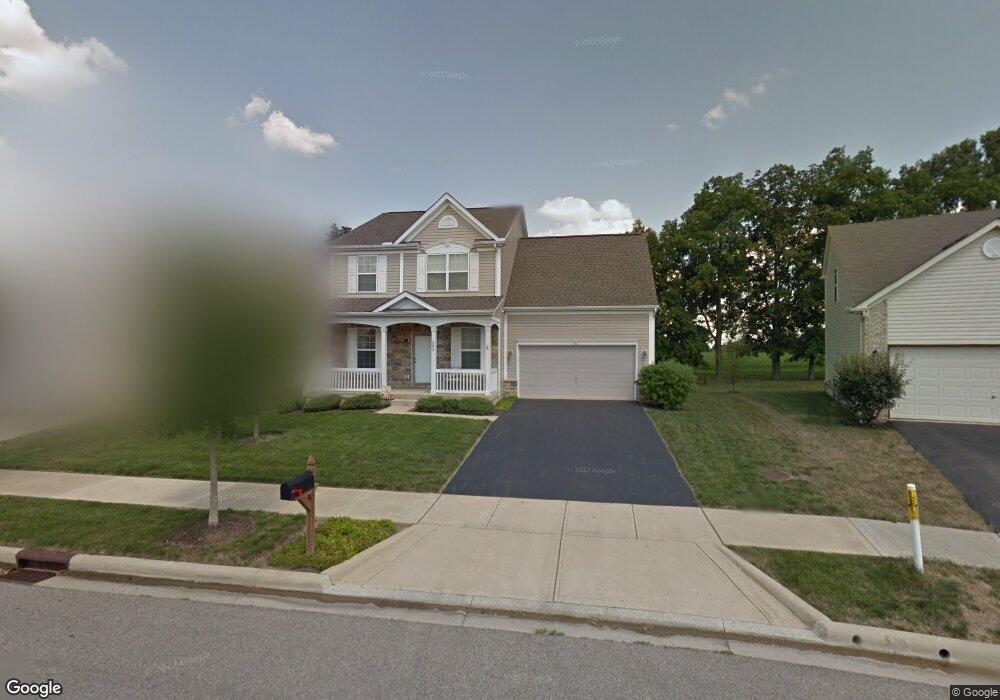
202 Stockard Loop Delaware, OH 43015
Estimated Value: $373,519 - $405,000
4
Beds
3
Baths
2,040
Sq Ft
$193/Sq Ft
Est. Value
About This Home
This home is located at 202 Stockard Loop, Delaware, OH 43015 and is currently estimated at $394,630, approximately $193 per square foot. 202 Stockard Loop is a home located in Delaware County with nearby schools including James Conger Elementary School, John C. Dempsey Middle School, and Rutherford B. Hayes High School.
Ownership History
Date
Name
Owned For
Owner Type
Purchase Details
Closed on
Sep 22, 2005
Sold by
Beazer Homes Investments Llc
Bought by
Tuck Randall S and Tuck Cynthia J
Current Estimated Value
Home Financials for this Owner
Home Financials are based on the most recent Mortgage that was taken out on this home.
Original Mortgage
$184,900
Outstanding Balance
$89,565
Interest Rate
4.37%
Mortgage Type
Fannie Mae Freddie Mac
Estimated Equity
$305,065
Create a Home Valuation Report for This Property
The Home Valuation Report is an in-depth analysis detailing your home's value as well as a comparison with similar homes in the area
Home Values in the Area
Average Home Value in this Area
Purchase History
| Date | Buyer | Sale Price | Title Company |
|---|---|---|---|
| Tuck Randall S | $204,900 | Preferred Title |
Source: Public Records
Mortgage History
| Date | Status | Borrower | Loan Amount |
|---|---|---|---|
| Open | Tuck Randall S | $184,900 |
Source: Public Records
Tax History
| Year | Tax Paid | Tax Assessment Tax Assessment Total Assessment is a certain percentage of the fair market value that is determined by local assessors to be the total taxable value of land and additions on the property. | Land | Improvement |
|---|---|---|---|---|
| 2024 | $5,614 | $118,900 | $19,780 | $99,120 |
| 2023 | $5,624 | $118,900 | $19,780 | $99,120 |
| 2022 | $4,592 | $84,250 | $14,700 | $69,550 |
| 2021 | $4,694 | $84,250 | $14,700 | $69,550 |
| 2020 | $4,747 | $84,250 | $14,700 | $69,550 |
| 2019 | $4,365 | $70,210 | $12,250 | $57,960 |
| 2018 | $4,426 | $70,210 | $12,250 | $57,960 |
| 2017 | $4,383 | $61,530 | $10,290 | $51,240 |
| 2016 | $3,539 | $61,530 | $10,290 | $51,240 |
| 2015 | $3,559 | $61,530 | $10,290 | $51,240 |
| 2014 | $3,616 | $61,530 | $10,290 | $51,240 |
| 2013 | $3,635 | $61,530 | $10,290 | $51,240 |
Source: Public Records
Map
Nearby Homes
- 1767 Ashburn Dr
- 723 Wallace Dr
- 27 Barrhill Dr
- 173 Old Colony Dr
- 1998 State Route 37 E
- 126 Wilder St
- 98 Wilder St
- 0 Fair Ave
- 381 Rochdale Run
- 60 Oak St
- 35 Chamberlain St
- 447 Rochdale Run
- 102 Potter St
- 210 E Central Ave
- 323 Via Condotti Viaduct
- 0 Dildine Rd Unit 225015764
- 523 Rochdale Run
- 529 Rochdale Run
- 34 Prospect St
- 278 Rochdale Run
- 208 Stockard Loop
- 196 Stockard Loop
- 214 Stockard Loop
- 190 Stockard Loop
- 220 Stockard Loop
- 207 Stockard Loop
- 207 Stockard Loop Unit K8439
- 189 Stockard Loop
- 189 Stockard Loop Unit K8440
- 215 Stockard Loop
- 215 Stockard Loop Unit KP8438
- 184 Stockard Loop
- 226 Stockard Loop
- 219 Stockard Loop
- 219 Stockard Loop Unit KP8437
- 219 Stockard Loop Unit K8437
- 159 Stockard Loop
- 232 Stockard Loop
- 225 Stockard Loop
- 135 Stockard Loop
Your Personal Tour Guide
Ask me questions while you tour the home.