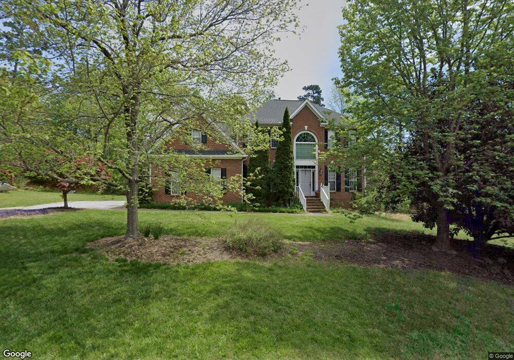
202 Sturdivant Rd Durham, NC 27705
West Durham NeighborhoodEstimated Value: $795,000 - $843,000
5
Beds
4
Baths
3,437
Sq Ft
$241/Sq Ft
Est. Value
About This Home
This home is located at 202 Sturdivant Rd, Durham, NC 27705 and is currently estimated at $828,752, approximately $241 per square foot. 202 Sturdivant Rd is a home located in Durham County with nearby schools including Morehead Montessori, Forest View Elementary, and Brogden Middle.
Ownership History
Date
Name
Owned For
Owner Type
Purchase Details
Closed on
Dec 2, 2005
Sold by
Stevens Linda F and Stevens Martie F
Bought by
Fogle Michael W and Fogle Laura B
Current Estimated Value
Home Financials for this Owner
Home Financials are based on the most recent Mortgage that was taken out on this home.
Original Mortgage
$191,000
Outstanding Balance
$105,272
Interest Rate
6.04%
Mortgage Type
Fannie Mae Freddie Mac
Estimated Equity
$723,480
Purchase Details
Closed on
Apr 7, 2000
Sold by
The New Fortis Corp
Bought by
Rogers Linda F
Home Financials for this Owner
Home Financials are based on the most recent Mortgage that was taken out on this home.
Original Mortgage
$247,900
Interest Rate
8.34%
Create a Home Valuation Report for This Property
The Home Valuation Report is an in-depth analysis detailing your home's value as well as a comparison with similar homes in the area
Home Values in the Area
Average Home Value in this Area
Purchase History
| Date | Buyer | Sale Price | Title Company |
|---|---|---|---|
| Fogle Michael W | $340,000 | -- | |
| Rogers Linda F | $310,000 | -- |
Source: Public Records
Mortgage History
| Date | Status | Borrower | Loan Amount |
|---|---|---|---|
| Open | Fogle Michael W | $191,000 | |
| Previous Owner | Rogers Linda F | $247,900 | |
| Closed | Rogers Linda F | $46,485 |
Source: Public Records
Tax History
| Year | Tax Paid | Tax Assessment Tax Assessment Total Assessment is a certain percentage of the fair market value that is determined by local assessors to be the total taxable value of land and additions on the property. | Land | Improvement |
|---|---|---|---|---|
| 2025 | $7,941 | $801,046 | $148,920 | $652,126 |
| 2024 | $6,523 | $467,597 | $65,835 | $401,762 |
| 2023 | $6,125 | $467,597 | $65,835 | $401,762 |
| 2022 | $5,985 | $467,597 | $65,835 | $401,762 |
| 2021 | $5,957 | $467,597 | $65,835 | $401,762 |
| 2020 | $5,816 | $467,597 | $65,835 | $401,762 |
| 2019 | $5,816 | $467,597 | $65,835 | $401,762 |
| 2018 | $5,899 | $434,869 | $65,835 | $369,034 |
| 2017 | $5,856 | $434,869 | $65,835 | $369,034 |
| 2016 | $5,658 | $434,869 | $65,835 | $369,034 |
| 2015 | $5,426 | $392,001 | $72,630 | $319,371 |
| 2014 | $5,426 | $392,001 | $72,630 | $319,371 |
Source: Public Records
Map
Nearby Homes
- 19 Providence Ct
- 22 Durbin Place
- 74 Forest Oaks Dr
- 128 Galway Glenn Ln
- 13 Providence Ct
- 50 Galway Glenn Ln
- 10 Forest Oaks Dr
- 4 Astor Ct
- 6 Intuition Cir
- 4111 Talcott Dr
- 409 Morreene Rd
- 112 Mt Evans Dr
- 10 Sunrise Place
- 300 Vincent Ave
- 4403 Valley Forge Rd
- 512 Soapstone Dr
- 516 Soapstone Dr
- 504 Soapstone Dr
- 508 Soapstone Dr
- 710 Constitution Dr Unit 206
- 204 Sturdivant Rd
- 110 Sturdivant Rd
- 24 Georgetown Ct
- 23 Georgetown Ct
- 22 Georgetown Ct
- 21 Georgetown Ct
- 407 Lionel St
- 20 Georgetown Ct
- 206 Sturdivant Rd
- 405 Lionel St
- 203 Sturdivant Rd
- 403 Lionel St
- 19 Georgetown Ct
- 401 Lionel St
- 25 Georgetown Ct
- 411 Lionel St
- 18 Georgetown Ct
- 26 Georgetown Ct
- 313 Lionel St
- 108 Sturdivant Rd
Your Personal Tour Guide
Ask me questions while you tour the home.