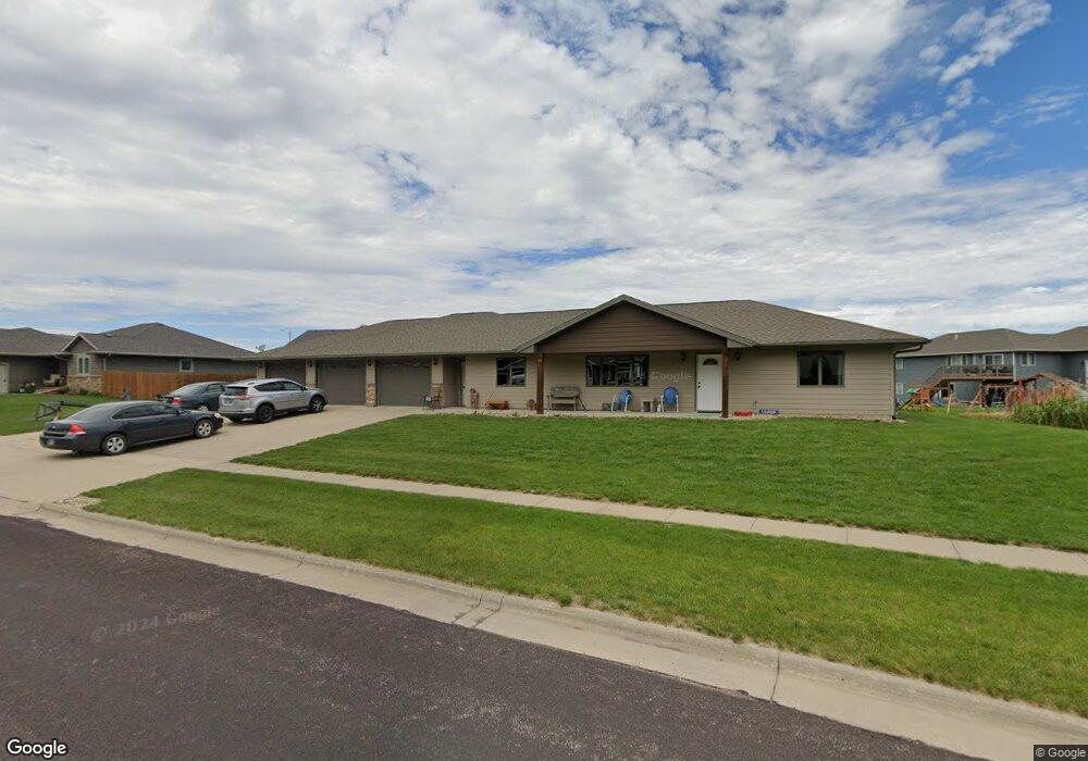
202 W 12th St Dell Rapids, SD 57022
Estimated Value: $412,000 - $474,000
3
Beds
2
Baths
1,608
Sq Ft
$274/Sq Ft
Est. Value
About This Home
This home is located at 202 W 12th St, Dell Rapids, SD 57022 and is currently estimated at $441,094, approximately $274 per square foot. 202 W 12th St is a home located in Minnehaha County with nearby schools including Dell Rapids Elementary School, Dell Rapids Middle School, and Dell Rapids High School.
Ownership History
Date
Name
Owned For
Owner Type
Purchase Details
Closed on
May 10, 2024
Sold by
Rhonda J Priola Living Trust
Bought by
Eulberg Richard J and Eulberg Paula A
Current Estimated Value
Purchase Details
Closed on
Jul 16, 2021
Sold by
Plooster Roger and Marlene Plooster Revocable Tru
Bought by
Priola Rhonda Joy
Purchase Details
Closed on
Jul 24, 2019
Sold by
Plooster L Dean and Plooster Marlene
Bought by
L Dean Plooster Revocable Trust
Purchase Details
Closed on
May 29, 2014
Sold by
Mark J Mark J
Bought by
Plooster Lyle Dean and Plooster Marlene
Create a Home Valuation Report for This Property
The Home Valuation Report is an in-depth analysis detailing your home's value as well as a comparison with similar homes in the area
Home Values in the Area
Average Home Value in this Area
Purchase History
| Date | Buyer | Sale Price | Title Company |
|---|---|---|---|
| Eulberg Richard J | $415,000 | -- | |
| Priola Rhonda Joy | -- | None Available | |
| L Dean Plooster Revocable Trust | -- | None Available | |
| Plooster Lyle Dean | $39,900 | Getty Abstract & Title Comp |
Source: Public Records
Tax History Compared to Growth
Tax History
| Year | Tax Paid | Tax Assessment Tax Assessment Total Assessment is a certain percentage of the fair market value that is determined by local assessors to be the total taxable value of land and additions on the property. | Land | Improvement |
|---|---|---|---|---|
| 2024 | $5,119 | $378,700 | $116,900 | $261,800 |
| 2023 | $5,088 | $356,900 | $89,600 | $267,300 |
| 2022 | $4,555 | $302,000 | $71,200 | $230,800 |
| 2021 | $4,999 | $258,200 | $0 | $0 |
| 2020 | $4,999 | $256,600 | $0 | $0 |
| 2019 | $4,744 | $249,654 | $0 | $0 |
| 2018 | $4,121 | $218,644 | $0 | $0 |
| 2017 | $4,160 | $206,998 | $39,792 | $167,206 |
| 2016 | $4,160 | $202,822 | $39,792 | $163,030 |
| 2015 | $2,776 | $126,914 | $39,792 | $87,122 |
| 2014 | $702 | $121,846 | $39,792 | $82,054 |
Source: Public Records
Map
Nearby Homes
- 1504 Julie Cir Unit L17B2
- 1502 Julie Cir Unit L16B2
- 1506 Julie Cir Unit L18B2
- 1600 Julie Cir Unit L19B2
- 1502 Neil Ave Unit L2B2
- 1500 Neil Ave Unit L1B2
- 1601 Julie Cir Unit L12B2
- 1607 Julie Cir Unit L9B2
- 1504 Neil Ave Unit L3B2
- 1605 Julie Cir Unit L10B2
- 1503 Julie Cir Unit L15B2
- 1603 Julie Cir Unit L11B2
- 1604 Julie Cir Unit L21B2
- 1606 Julie Ave Unit L22B2
- 408 W 14th St
- 1602 Neil Ave Unit L6B2
- 1503 Neil Ave Unit L2B1
- 1501 Neil Ave Unit L1B1
- 1604 Neil Ave Unit L7B2
- 1609 Neil Ave Unit L9B1
- 209 W 12th St
- 204 W 12th St
- 1305 Oak Creek Rd
- 1307 Oak Creek Rd
- 205 W 12th St
- 211 W 12th St
- 1303 Oak Creek Rd
- 1403 Oak Ridge Rd
- 1401 Oak Creek Rd
- 203 E 12th St
- 1400 Ripple Creek Rd
- 1301 Oak Creek Rd
- 1403 Oak Creek Rd
- 207 W 12th St
- 1303 Ripple Creek Rd
- 1405 Oak Creek Rd
- 0 Oak Creek Rd
- 102 E 14th St
- 0 E 14th St
- 1402 Ripple Creek Rd