Estimated Value: $81,000 - $100,000
--
Bed
1
Bath
1,288
Sq Ft
$69/Sq Ft
Est. Value
About This Home
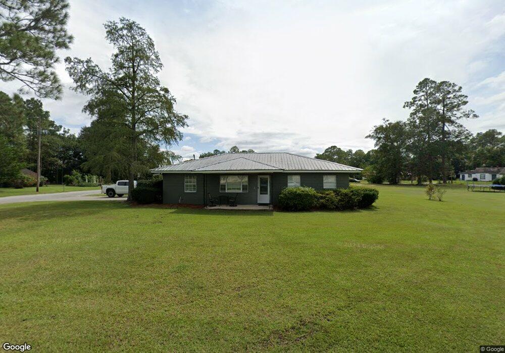
This home is located at 202 W 21st St, Alma, GA 31510 and is currently estimated at $89,085, approximately $69 per square foot. 202 W 21st St is a home located in Bacon County with nearby schools including Bacon County Primary School, Bacon County Elementary School, and Bacon County Middle School.
Ownership History
Date
Name
Owned For
Owner Type
Purchase Details
Closed on
Sep 30, 2020
Sold by
Carter Douglas M
Bought by
Bruner Monty Carter
Current Estimated Value
Home Financials for this Owner
Home Financials are based on the most recent Mortgage that was taken out on this home.
Original Mortgage
$10,000,000
Outstanding Balance
$8,894,467
Interest Rate
2.9%
Estimated Equity
-$8,805,382
Purchase Details
Closed on
Apr 13, 2006
Sold by
Carter Douglas M
Bought by
Carter Douglas M and Carter Winnie O
Purchase Details
Closed on
Jul 31, 1979
Sold by
Carter Vera
Bought by
Carter Douglas M
Create a Home Valuation Report for This Property
The Home Valuation Report is an in-depth analysis detailing your home's value as well as a comparison with similar homes in the area
Home Values in the Area
Average Home Value in this Area
Purchase History
| Date | Buyer | Sale Price | Title Company |
|---|---|---|---|
| Bruner Monty Carter | $46,000 | -- | |
| Carter Douglas M | -- | -- | |
| Carter Douglas M | -- | -- |
Source: Public Records
Mortgage History
| Date | Status | Borrower | Loan Amount |
|---|---|---|---|
| Open | Bruner Monty Carter | $10,000,000 |
Source: Public Records
Tax History Compared to Growth
Tax History
| Year | Tax Paid | Tax Assessment Tax Assessment Total Assessment is a certain percentage of the fair market value that is determined by local assessors to be the total taxable value of land and additions on the property. | Land | Improvement |
|---|---|---|---|---|
| 2024 | $1,045 | $28,760 | $1,600 | $27,160 |
| 2023 | $1,015 | $26,320 | $1,600 | $24,720 |
| 2022 | $677 | $17,560 | $1,600 | $15,960 |
| 2021 | $671 | $17,400 | $1,600 | $15,800 |
| 2020 | $643 | $15,947 | $1,600 | $14,347 |
| 2019 | $643 | $15,947 | $1,600 | $14,347 |
| 2018 | $612 | $15,212 | $1,600 | $13,612 |
| 2017 | $613 | $15,212 | $1,600 | $13,612 |
| 2016 | $613 | $15,212 | $1,600 | $13,612 |
| 2015 | $596 | $14,781 | $1,333 | $13,448 |
| 2014 | $456 | $14,781 | $1,333 | $13,448 |
| 2013 | $456 | $11,180 | $1,333 | $9,847 |
Source: Public Records
Map
Nearby Homes
- 314 W 16th St
- 117 Grace Loop Unit 1
- 118 Grace Loop Unit 1
- 122 Grace Loop Unit 1
- 403 S Ware St
- 611 S Bead St
- 9TH E 417
- 113 Brite Blue Dr
- 166 Grace Loop Unit 1
- 401 Lee St
- 198 Meadow Rd
- 118 Morris Dr
- 907 N Pierce St
- 0 Oriole Rd Unit 1654653
- 0 Oriole Rd Unit 10543585
- 0 Oriole Rd Unit 25773381
- 0 Oriole Rd Unit 160930
- 224 Meadow Rd
- 1109 W 4th Street Extension
- 0 W 4th Street Extension Unit 10650393