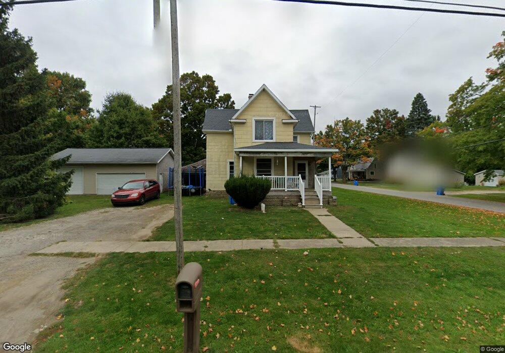
202 W Elm St Reading, MI 49274
Estimated Value: $154,000 - $160,000
3
Beds
1
Bath
828
Sq Ft
$190/Sq Ft
Est. Value
About This Home
This home is located at 202 W Elm St, Reading, MI 49274 and is currently estimated at $157,134, approximately $189 per square foot. 202 W Elm St is a home located in Hillsdale County with nearby schools including Reynolds Elementary School, Reading High School, and Cooper Amish School.
Ownership History
Date
Name
Owned For
Owner Type
Purchase Details
Closed on
Jul 12, 2023
Sold by
Denison Mitchell C and Denison Chrystal
Bought by
Denison Mitchell C and Denison Chrystal D
Current Estimated Value
Purchase Details
Closed on
Oct 22, 2015
Sold by
Denison Mitchell C and Denison Jerry L
Bought by
Denison Mitchell C and Denison Chrystal
Home Financials for this Owner
Home Financials are based on the most recent Mortgage that was taken out on this home.
Original Mortgage
$52,000
Interest Rate
4.5%
Mortgage Type
Adjustable Rate Mortgage/ARM
Purchase Details
Closed on
May 9, 1995
Sold by
Ricketts Cynthia J
Bought by
Denison Jerry L and Denison Susan C
Create a Home Valuation Report for This Property
The Home Valuation Report is an in-depth analysis detailing your home's value as well as a comparison with similar homes in the area
Home Values in the Area
Average Home Value in this Area
Purchase History
| Date | Buyer | Sale Price | Title Company |
|---|---|---|---|
| Denison Mitchell C | -- | -- | |
| Denison Mitchell C | -- | None Available | |
| Denison Jerry L | $44,000 | -- |
Source: Public Records
Mortgage History
| Date | Status | Borrower | Loan Amount |
|---|---|---|---|
| Previous Owner | Denison Mitchell C | $52,000 |
Source: Public Records
Tax History Compared to Growth
Tax History
| Year | Tax Paid | Tax Assessment Tax Assessment Total Assessment is a certain percentage of the fair market value that is determined by local assessors to be the total taxable value of land and additions on the property. | Land | Improvement |
|---|---|---|---|---|
| 2025 | $1,910 | $69,100 | $0 | $0 |
| 2024 | $812 | $67,000 | $0 | $0 |
| 2023 | $777 | $50,800 | $0 | $0 |
| 2022 | $1,741 | $42,100 | $0 | $0 |
| 2021 | $1,153 | $40,200 | $0 | $0 |
| 2020 | $1,143 | $35,000 | $0 | $0 |
| 2019 | $1,106 | $33,700 | $0 | $0 |
| 2018 | $1,063 | $33,000 | $0 | $0 |
| 2017 | $1,031 | $31,900 | $0 | $0 |
| 2016 | $1,528 | $34,500 | $0 | $0 |
| 2015 | $655 | $34,500 | $0 | $0 |
| 2013 | $634 | $27,000 | $0 | $0 |
| 2012 | $645 | $27,460 | $0 | $0 |
Source: Public Records
Map
Nearby Homes
- 309 S Main St
- 0 W Silver St Unit 25044322
- 203 E Michigan St
- 108 Lynn St
- 5411 Lilac Rd
- 5211 Long Lake Rd
- 5160 Quackenbush Rd
- 7944 Gilmore Rd
- 4421 Carpenter Rd
- 3870 Rus Dic Dr
- 4427 Carpenter Rd
- 9949 Indian Trail
- 7841 Topinabee Dr
- 4111 Blair Rd
- 6524 W Montgomery Rd
- 0 Dimmers Rd
- 490 Kelley Rd
- 2520 S Sand Lake Rd
- 4164 S Pleasant Dr
- 7410 Cambria Rd