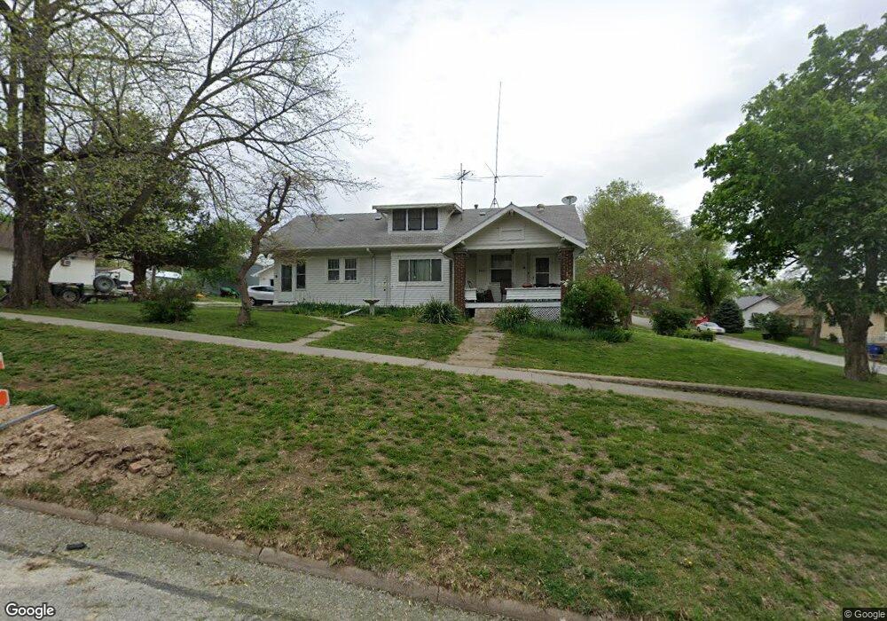
202 W Nebraska St Dunbar, NE 68346
Estimated Value: $109,000 - $210,000
2
Beds
1
Bath
1,134
Sq Ft
$138/Sq Ft
Est. Value
About This Home
This home is located at 202 W Nebraska St, Dunbar, NE 68346 and is currently estimated at $156,110, approximately $137 per square foot. 202 W Nebraska St is a home located in Otoe County with nearby schools including Elementary School at Syracuse and High School at Syracuse.
Ownership History
Date
Name
Owned For
Owner Type
Purchase Details
Closed on
May 15, 2024
Sold by
Jensen Carla S
Bought by
Jensen Carla S and Jensen Megan
Current Estimated Value
Purchase Details
Closed on
Feb 20, 2009
Sold by
Fenske Bertha
Bought by
Jensen Roland L and Jensen Carla S
Home Financials for this Owner
Home Financials are based on the most recent Mortgage that was taken out on this home.
Original Mortgage
$59,930
Interest Rate
4.92%
Mortgage Type
FHA
Create a Home Valuation Report for This Property
The Home Valuation Report is an in-depth analysis detailing your home's value as well as a comparison with similar homes in the area
Home Values in the Area
Average Home Value in this Area
Purchase History
| Date | Buyer | Sale Price | Title Company |
|---|---|---|---|
| Jensen Carla S | -- | Otoe County Title | |
| Jensen Roland L | $62,000 | None Available |
Source: Public Records
Mortgage History
| Date | Status | Borrower | Loan Amount |
|---|---|---|---|
| Previous Owner | Jensen Roland L | $59,930 |
Source: Public Records
Tax History Compared to Growth
Tax History
| Year | Tax Paid | Tax Assessment Tax Assessment Total Assessment is a certain percentage of the fair market value that is determined by local assessors to be the total taxable value of land and additions on the property. | Land | Improvement |
|---|---|---|---|---|
| 2024 | $1,032 | $71,188 | $2,440 | $68,748 |
| 2023 | $1,212 | $71,188 | $2,440 | $68,748 |
| 2022 | $1,010 | $59,730 | $2,440 | $57,290 |
| 2021 | $985 | $59,730 | $2,440 | $57,290 |
| 2020 | $1,028 | $59,730 | $2,440 | $57,290 |
| 2019 | $1,044 | $59,730 | $2,440 | $57,290 |
| 2018 | $990 | $59,730 | $2,440 | $57,290 |
| 2017 | $981 | $59,330 | $2,040 | $57,290 |
| 2016 | $980 | $59,330 | $2,040 | $57,290 |
| 2015 | $988 | $59,330 | $2,040 | $57,290 |
| 2014 | $1,067 | $59,330 | $2,040 | $57,290 |
| 2012 | $1,089 | $59,330 | $2,040 | $57,290 |
Source: Public Records
Map
Nearby Homes
- 101 S Mcginley St
- 105 S Mcginley St
- 206 W Nebraska St
- 107 N Mcginley St
- 106 N Mcginley St
- 205 W Nebraska St
- 205 W Indiana St
- 108 N Mcginley St
- 109 S Mcginley St
- 103 N Wilson St
- 107 N Wilson St
- 106 W Iowa St
- 304 W Nebraska St
- 103 S Wilson St
- 202 W Indiana St
- 301 W Indiana St
- 104-106 S Mcginley St
- 204 W Indiana St
- 107 S Wilson St
- 107 W Iowa St