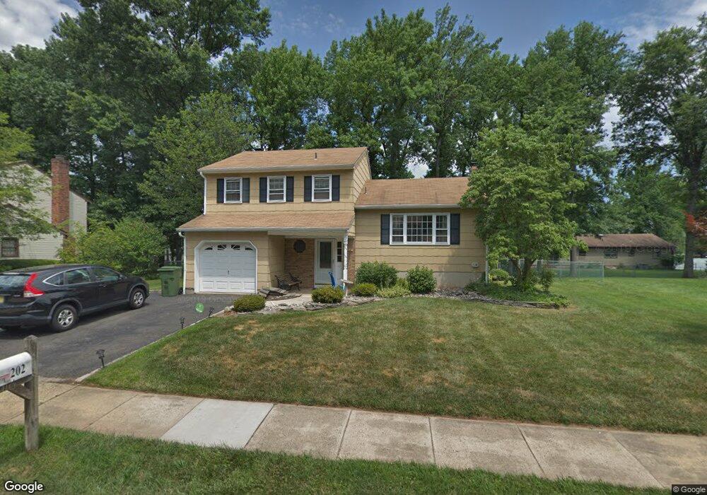
202 W Prescott Ave Edison, NJ 08820
Estimated Value: $714,000 - $839,000
3
Beds
2
Baths
1,638
Sq Ft
$475/Sq Ft
Est. Value
About This Home
This home is located at 202 W Prescott Ave, Edison, NJ 08820 and is currently estimated at $778,558, approximately $475 per square foot. 202 W Prescott Ave is a home located in Middlesex County with nearby schools including James Madison Primary School, James Madison Intermediate School, and John Adams Middle School.
Ownership History
Date
Name
Owned For
Owner Type
Purchase Details
Closed on
Feb 20, 2015
Sold by
Miedowicz Leon
Bought by
Ghai Gaurav and Guha Nupur
Current Estimated Value
Home Financials for this Owner
Home Financials are based on the most recent Mortgage that was taken out on this home.
Original Mortgage
$316,000
Outstanding Balance
$240,956
Interest Rate
3.64%
Mortgage Type
New Conventional
Estimated Equity
$537,602
Create a Home Valuation Report for This Property
The Home Valuation Report is an in-depth analysis detailing your home's value as well as a comparison with similar homes in the area
Home Values in the Area
Average Home Value in this Area
Purchase History
| Date | Buyer | Sale Price | Title Company |
|---|---|---|---|
| Ghai Gaurav | $395,000 | Multiple |
Source: Public Records
Mortgage History
| Date | Status | Borrower | Loan Amount |
|---|---|---|---|
| Open | Ghai Gaurav | $316,000 |
Source: Public Records
Tax History Compared to Growth
Tax History
| Year | Tax Paid | Tax Assessment Tax Assessment Total Assessment is a certain percentage of the fair market value that is determined by local assessors to be the total taxable value of land and additions on the property. | Land | Improvement |
|---|---|---|---|---|
| 2025 | $12,823 | $215,400 | $104,900 | $110,500 |
| 2024 | $12,754 | $215,400 | $104,900 | $110,500 |
| 2023 | $12,754 | $215,400 | $104,900 | $110,500 |
| 2022 | $12,326 | $208,100 | $104,900 | $103,200 |
| 2021 | $12,284 | $208,100 | $104,900 | $103,200 |
| 2020 | $12,172 | $208,100 | $104,900 | $103,200 |
| 2019 | $11,712 | $208,100 | $104,900 | $103,200 |
| 2018 | $11,429 | $208,100 | $104,900 | $103,200 |
| 2017 | $11,187 | $208,100 | $104,900 | $103,200 |
| 2016 | $10,979 | $208,100 | $104,900 | $103,200 |
| 2015 | $10,309 | $203,100 | $104,900 | $98,200 |
| 2014 | $9,755 | $203,100 | $104,900 | $98,200 |
Source: Public Records
Map
Nearby Homes
- 37 E Hegel Ave
- 71 Overbrook Dr
- 868 Inman Ave
- 262 W Hegel Ave
- 14 Bonnie Ln
- 11 Bernice St
- 984 Feather Bed Ln
- 67 Brookside Terrace
- 4 Periwinkle Place
- 48 Cypress Dr
- 24 Sandalwood Dr
- 52 Brookside Terrace
- 227 Hawthorne Dr
- 41 Clover Ave
- 131 Morningside Rd
- 6 Tulip Ct
- 31 Jordan Rd
- 118 Schwinn Dr
- 975 Inman Ave
- 279 Savoy Ave
- 198 W Prescott Ave
- 206 W Prescott Ave
- 201 W Sherman Ave
- 205 W Sherman Ave
- 197 W Sherman Ave
- 201 W Prescott Ave
- 197 W Prescott Ave
- 210 W Prescott Ave
- 205 W Prescott Ave
- 1011 Wood Ave
- 209 W Sherman Ave
- 191 W Sherman Ave
- 209 W Prescott Ave
- 999 Wood Ave
- 202 W Locust Ave
- 214 W Prescott Ave
- 198 W Locust Ave
- 204 W Sherman Ave
- 206 W Locust Ave
- 196 W Sherman Ave