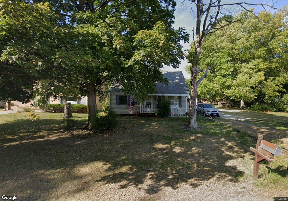
202 W Union St Mahomet, IL 61853
Estimated Value: $160,000 - $207,628
--
Bed
1
Bath
921
Sq Ft
$206/Sq Ft
Est. Value
About This Home
This home is located at 202 W Union St, Mahomet, IL 61853 and is currently estimated at $190,157, approximately $206 per square foot. 202 W Union St is a home located in Champaign County with nearby schools including Middletown Prairie Elementary, First School, and Mahomet Christian School.
Ownership History
Date
Name
Owned For
Owner Type
Purchase Details
Closed on
Dec 21, 2009
Sold by
Deutsche Bank National Trust Company
Bought by
Mahomet Property Group Llc
Current Estimated Value
Purchase Details
Closed on
Oct 14, 2009
Sold by
Brozenec Tim A
Bought by
Deutsche Bank National Trust Company
Purchase Details
Closed on
Oct 31, 2003
Sold by
Clapper Donald L and Clapper Judith J
Bought by
Brozenec Tim A and Brozenec Erin M
Home Financials for this Owner
Home Financials are based on the most recent Mortgage that was taken out on this home.
Original Mortgage
$82,500
Interest Rate
6.07%
Mortgage Type
Unknown
Create a Home Valuation Report for This Property
The Home Valuation Report is an in-depth analysis detailing your home's value as well as a comparison with similar homes in the area
Home Values in the Area
Average Home Value in this Area
Purchase History
| Date | Buyer | Sale Price | Title Company |
|---|---|---|---|
| Mahomet Property Group Llc | $78,000 | Allied | |
| Deutsche Bank National Trust Company | -- | None Available | |
| Brozenec Tim A | $82,500 | -- |
Source: Public Records
Mortgage History
| Date | Status | Borrower | Loan Amount |
|---|---|---|---|
| Previous Owner | Brozenec Tim A | $82,500 |
Source: Public Records
Tax History Compared to Growth
Tax History
| Year | Tax Paid | Tax Assessment Tax Assessment Total Assessment is a certain percentage of the fair market value that is determined by local assessors to be the total taxable value of land and additions on the property. | Land | Improvement |
|---|---|---|---|---|
| 2024 | $3,711 | $51,580 | $14,610 | $36,970 |
| 2023 | $3,711 | $46,890 | $13,280 | $33,610 |
| 2022 | $3,459 | $43,220 | $12,240 | $30,980 |
| 2021 | $3,291 | $40,850 | $11,570 | $29,280 |
| 2020 | $2,753 | $40,170 | $11,380 | $28,790 |
| 2019 | $2,680 | $39,540 | $11,200 | $28,340 |
| 2018 | $2,598 | $38,690 | $10,960 | $27,730 |
| 2017 | $2,482 | $36,850 | $10,440 | $26,410 |
| 2016 | $2,470 | $36,850 | $10,440 | $26,410 |
| 2015 | $2,427 | $36,850 | $10,440 | $26,410 |
| 2014 | $2,417 | $36,120 | $10,230 | $25,890 |
| 2013 | $2,297 | $34,670 | $9,820 | $24,850 |
Source: Public Records
Map
Nearby Homes
- 305 S West St
- 204 W Oak St
- 106 E Union St
- 403 E State St
- 401 N Tamula Dr
- 501 Richard Ct
- 502 Richard Ct
- 411 Weathering Dr
- 700 Eastwood Dr
- 605 N Craig Dr
- 1101 S Mcdougal Rd
- 200 Riverbend Blvd
- 1511 River Bluff Ct
- 1101 E Pin Oak Dr
- 1808 S Orchard Dr
- 1804 Horizon Ct
- Eldridge Plan at Whisper Meadow
- Ridgecrest 1865 Plan at Whisper Meadow
- Ridgeland Plan at Whisper Meadow
- Wellington Plan at Whisper Meadow
- 204 W Union St
- 106 W Union St
- 206 W Union St
- 201 W Union St
- 107 W Dunbar St
- 103 1/2 W Dunbar St
- 104 W Union St
- 203 W Dunbar St
- 304 S West St
- 205 W Dunbar St
- 105 W Dunbar St
- 302 S West St
- 103 W Dunbar St
- 107 W Union St
- 403 S Market St
- 207 W Union St
- 102 W Union St
- 300 S West St
- 303 S Division St
- 401 S Division St