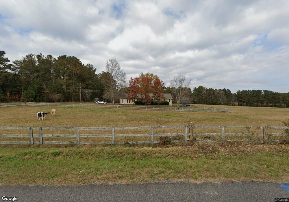
202 Wade Rd SW Taylorsville, GA 30178
Estimated Value: $364,243 - $453,000
3
Beds
2
Baths
1,640
Sq Ft
$245/Sq Ft
Est. Value
About This Home
This home is located at 202 Wade Rd SW, Taylorsville, GA 30178 and is currently estimated at $402,414, approximately $245 per square foot. 202 Wade Rd SW is a home with nearby schools including Taylorsville Elementary School, Woodland Middle School, and Woodland High School.
Ownership History
Date
Name
Owned For
Owner Type
Purchase Details
Closed on
Dec 14, 2020
Sold by
Poindexter Rhonda E
Bought by
Edmondson Ronald S
Current Estimated Value
Purchase Details
Closed on
Apr 15, 2015
Sold by
Mccleskey Sam R
Bought by
Pindexter Rhonda Kay
Purchase Details
Closed on
Mar 2, 2015
Sold by
Hutto Kenneth Wayne
Bought by
Mccleskey Sam R
Purchase Details
Closed on
Aug 30, 2013
Sold by
Mccleskey Sam R
Bought by
Hutto Kenneth Wayne
Create a Home Valuation Report for This Property
The Home Valuation Report is an in-depth analysis detailing your home's value as well as a comparison with similar homes in the area
Home Values in the Area
Average Home Value in this Area
Purchase History
| Date | Buyer | Sale Price | Title Company |
|---|---|---|---|
| Edmondson Ronald S | -- | -- | |
| Pindexter Rhonda Kay | $233,000 | -- | |
| Mccleskey Sam R | -- | -- | |
| Hutto Kenneth Wayne | $200,000 | -- |
Source: Public Records
Tax History Compared to Growth
Tax History
| Year | Tax Paid | Tax Assessment Tax Assessment Total Assessment is a certain percentage of the fair market value that is determined by local assessors to be the total taxable value of land and additions on the property. | Land | Improvement |
|---|---|---|---|---|
| 2024 | $2,659 | $109,424 | $27,268 | $82,156 |
| 2023 | $2,659 | $84,727 | $16,629 | $68,098 |
| 2022 | $2,129 | $83,852 | $16,464 | $67,388 |
| 2021 | $1,886 | $70,701 | $16,464 | $54,237 |
| 2020 | $1,805 | $70,701 | $16,464 | $54,237 |
| 2019 | $1,776 | $68,960 | $11,360 | $57,600 |
| 2018 | $1,782 | $68,960 | $11,360 | $57,600 |
| 2017 | $1,791 | $68,960 | $11,360 | $57,600 |
| 2016 | $1,804 | $68,960 | $11,360 | $57,600 |
| 2015 | $1,864 | $65,960 | $11,360 | $54,600 |
| 2014 | -- | $64,480 | $11,360 | $53,120 |
| 2013 | -- | $56,920 | $11,360 | $45,560 |
Source: Public Records
Map
Nearby Homes
- 169 Williams Rd
- 167 Iron Hill Rd
- 129 Miller Farm Rd
- 0 Taylorsville Macedonia Rd Unit 24327696
- 22 Ravenfield Rd
- 77 Popham Rd
- 226 Euharlee Five Forks Rd
- 0 Big Pond Road South W
- 00 John Kay Rd
- 0 Popham Rd Unit 7661846
- 0 Popham Rd Unit 10587111
- 0 Popham Rd Unit 22620358
- 37 Jackson Road South W
- 1921 Euharlee Rd
- 84 Popham Rd
- 16 Gatepost Ln
- 0 Taylorsville MacEdonia Miller Farm Rd Unit 10587057
- 621 Amberwood Place
- 0 Two Gun Bailey Rd Unit 7298610
- 24 Applewood Ln
- 201 Wade Rd SW
- 281 Williams Rd
- 240 Wade Rd SW
- 0 Wade Rd SW Unit 7477118
- 0 Wade Rd SW Unit 7115354
- 0 Wade Rd SW Unit 7089643
- 0 Wade Rd SW Unit 3240738
- 0 Wade Rd SW Unit 7476482
- 0 Wade Rd SW Unit 8460649
- 0 Wade Rd SW Unit 8337269
- 0 Wade Rd SW Unit 7034383
- 0 Wade Rd SW Unit 3243633
- 0 Wade Rd SW Unit 7447503
- 0 Wade Rd SW
- 0 Williams Rd
- 0 Williams Rd Unit 7489741
- 0 Williams Rd Unit 8626748
- 0 Williams Rd Unit 8558390
- 0 Williams Rd Unit 8174363
- 0 Williams Rd Unit 8568396