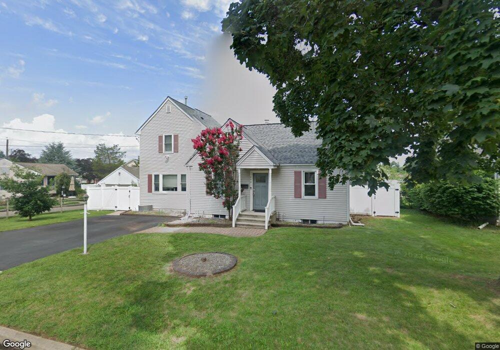
202 White Ave Manville, NJ 08835
Estimated Value: $510,000 - $603,000
--
Bed
--
Bath
1,975
Sq Ft
$277/Sq Ft
Est. Value
About This Home
This home is located at 202 White Ave, Manville, NJ 08835 and is currently estimated at $547,000, approximately $276 per square foot. 202 White Ave is a home located in Somerset County with nearby schools including Weston Elementary School, Roosevelt School, and Alexander Batcho Intermediate School (ABIS).
Ownership History
Date
Name
Owned For
Owner Type
Purchase Details
Closed on
Jun 13, 2006
Sold by
Mccreery Keith
Bought by
Korman Seth and Korman Debra
Current Estimated Value
Home Financials for this Owner
Home Financials are based on the most recent Mortgage that was taken out on this home.
Original Mortgage
$298,400
Outstanding Balance
$176,415
Interest Rate
6.67%
Estimated Equity
$370,585
Purchase Details
Closed on
Jun 2, 1995
Sold by
Gambardella Diane
Bought by
Mccreery Keith and Giovanniello Maria
Home Financials for this Owner
Home Financials are based on the most recent Mortgage that was taken out on this home.
Original Mortgage
$115,000
Interest Rate
8.21%
Create a Home Valuation Report for This Property
The Home Valuation Report is an in-depth analysis detailing your home's value as well as a comparison with similar homes in the area
Home Values in the Area
Average Home Value in this Area
Purchase History
| Date | Buyer | Sale Price | Title Company |
|---|---|---|---|
| Korman Seth | $373,000 | -- | |
| Mccreery Keith | $130,000 | -- |
Source: Public Records
Mortgage History
| Date | Status | Borrower | Loan Amount |
|---|---|---|---|
| Open | Korman Seth | $298,400 | |
| Previous Owner | Mccreery Keith | $115,000 |
Source: Public Records
Tax History Compared to Growth
Tax History
| Year | Tax Paid | Tax Assessment Tax Assessment Total Assessment is a certain percentage of the fair market value that is determined by local assessors to be the total taxable value of land and additions on the property. | Land | Improvement |
|---|---|---|---|---|
| 2025 | $9,411 | $445,400 | $249,500 | $195,900 |
| 2024 | $9,411 | $418,100 | $222,000 | $196,100 |
| 2023 | $9,424 | $392,000 | $207,000 | $185,000 |
| 2022 | $9,389 | $358,900 | $182,000 | $176,900 |
| 2021 | $9,000 | $310,000 | $152,000 | $158,000 |
| 2020 | $9,000 | $285,800 | $132,000 | $153,800 |
| 2019 | $8,919 | $273,000 | $132,000 | $141,000 |
| 2018 | $8,600 | $263,000 | $122,000 | $141,000 |
| 2017 | $8,376 | $260,600 | $117,000 | $143,600 |
| 2016 | $8,073 | $260,600 | $117,000 | $143,600 |
| 2015 | $8,111 | $335,600 | $184,000 | $151,600 |
| 2014 | $7,950 | $335,600 | $184,000 | $151,600 |
Source: Public Records
Map
Nearby Homes
- 1007 Bound Brook Ave
- 203 Jasinski Ave
- 212 White Ave
- 200 White Ave
- 211 White Ave
- 205 White Ave
- 921 Newark Ave
- 302 White Ave
- 913 Newark Ave
- 920 E Frech Ave
- 934 E Frech Ave
- 202 Jasinski Ave
- 925 Bound Brook Ave
- 1000 Bound Brook Ave
- 308 White Ave
- 208 W Frech Ave Unit 210
- 912 Newark Ave
- 305 White Ave
- 912 E Frech Ave
- 909 Newark Ave