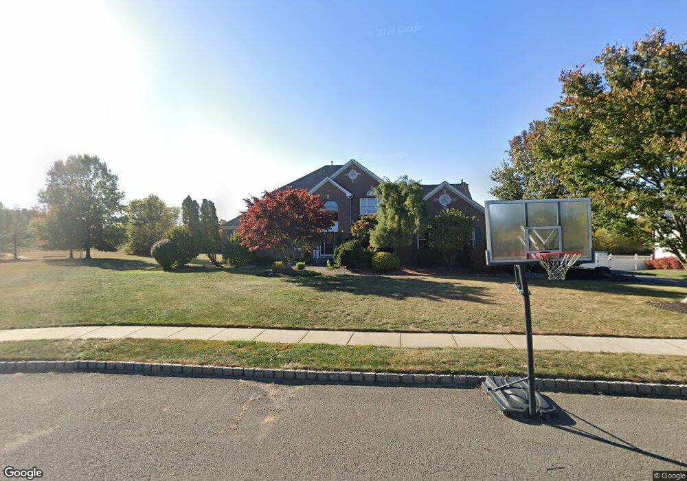
202 White Oak Ln Freehold, NJ 07728
Estimated Value: $1,324,000 - $1,395,837
4
Beds
3
Baths
3,415
Sq Ft
$393/Sq Ft
Est. Value
About This Home
This home is located at 202 White Oak Ln, Freehold, NJ 07728 and is currently estimated at $1,343,459, approximately $393 per square foot. 202 White Oak Ln is a home located in Monmouth County with nearby schools including Joseph J. Catena Elementary School, Dwight D. Eisenhower Middle School, and Freehold Township High School.
Ownership History
Date
Name
Owned For
Owner Type
Purchase Details
Closed on
Jul 13, 1998
Sold by
Matzel
Bought by
Katz Howard and Shea Jacqueline
Current Estimated Value
Home Financials for this Owner
Home Financials are based on the most recent Mortgage that was taken out on this home.
Original Mortgage
$352,000
Outstanding Balance
$71,534
Interest Rate
6.92%
Estimated Equity
$1,271,925
Create a Home Valuation Report for This Property
The Home Valuation Report is an in-depth analysis detailing your home's value as well as a comparison with similar homes in the area
Home Values in the Area
Average Home Value in this Area
Purchase History
| Date | Buyer | Sale Price | Title Company |
|---|---|---|---|
| Katz Howard | $439,863 | -- |
Source: Public Records
Mortgage History
| Date | Status | Borrower | Loan Amount |
|---|---|---|---|
| Open | Katz Howard | $352,000 |
Source: Public Records
Tax History Compared to Growth
Tax History
| Year | Tax Paid | Tax Assessment Tax Assessment Total Assessment is a certain percentage of the fair market value that is determined by local assessors to be the total taxable value of land and additions on the property. | Land | Improvement |
|---|---|---|---|---|
| 2025 | $22,945 | $1,300,800 | $481,200 | $819,600 |
| 2024 | $20,335 | $1,267,700 | $429,500 | $838,200 |
| 2023 | $20,335 | $1,096,200 | $332,200 | $764,000 |
| 2022 | $18,652 | $974,400 | $248,300 | $726,100 |
| 2021 | $18,652 | $865,100 | $219,800 | $645,300 |
| 2020 | $18,643 | $861,100 | $234,000 | $627,100 |
| 2019 | $18,575 | $856,400 | $229,300 | $627,100 |
| 2018 | $18,707 | $830,300 | $229,300 | $601,000 |
| 2017 | $17,609 | $770,300 | $215,000 | $555,300 |
| 2016 | $17,504 | $751,900 | $200,800 | $551,100 |
| 2015 | $17,252 | $724,300 | $200,800 | $523,500 |
| 2014 | $16,339 | $682,800 | $172,300 | $510,500 |
Source: Public Records
Map
Nearby Homes
- 10 Whittier Ct
- 6 Stowe Ct
- 10 Stowe Ct
- 9 Irving Ct
- 33 Weaverville Rd
- 12 Meadowbrook Ln
- 375 Peter Forman Dr
- 29 Chatham Ridge Dr
- 10 Harrison Dr
- 512 Harding Rd Unit 6
- 582 Colts Neck Rd
- 511 Burlington Rd
- 4 Tranquil Ct
- 210 Kentucky Way
- 83 Kentucky Way
- 20 Pacer Ln
- 6 Kensington Pass
- 36 Citation Dr
- 25 Citation Dr
- 16 Kensington Pass
- 206 White Oak Ln
- 198 White Oak Ln
- 201 White Oak Ln
- 194 White Oak Ln
- 197 White Oak Ln
- 186 Pin Oak Rd
- 210 Pin Oak Rd
- 220 Pin Oak Rd
- 182 Pin Oak Rd
- 187 Pin Oak Rd
- 222 Pin Oak Rd
- 197 Pin Oak Rd
- 178 Pin Oak Rd
- 177 Pin Oak Rd
- 9 Whittier Ct
- 224 Pin Oak Rd
- 8 Whittier Ct
- 12 Whittier Ct
- 11 Whittier Ct
- 169 Spotted Oak Dr