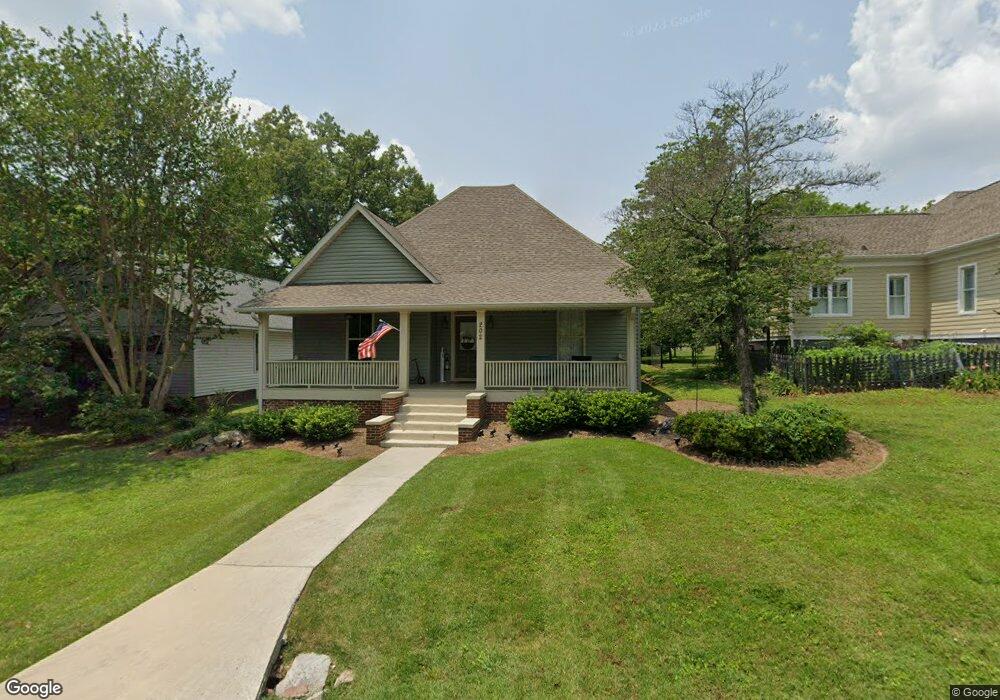
202 Wilder Ave Chickamauga, GA 30707
Estimated Value: $437,946 - $502,000
4
Beds
4
Baths
3,515
Sq Ft
$135/Sq Ft
Est. Value
About This Home
This home is located at 202 Wilder Ave, Chickamauga, GA 30707 and is currently estimated at $473,737, approximately $134 per square foot. 202 Wilder Ave is a home located in Walker County with nearby schools including Chickamauga Elementary School, Gordon Lee Middle School, and Gordon Lee High School.
Ownership History
Date
Name
Owned For
Owner Type
Purchase Details
Closed on
Jan 23, 2026
Sold by
Gibson Steven
Bought by
Gravley Nolita and Gravley Ricky B
Current Estimated Value
Home Financials for this Owner
Home Financials are based on the most recent Mortgage that was taken out on this home.
Original Mortgage
$285,000
Outstanding Balance
$283,929
Interest Rate
6.18%
Mortgage Type
Purchase Money Mortgage
Estimated Equity
$189,808
Purchase Details
Closed on
Oct 21, 2002
Sold by
Hensley Bronis B
Bought by
Gibson Steven and Wendy Gibson
Purchase Details
Closed on
May 3, 1979
Sold by
Gore Charles R and Gore Sadie M
Bought by
Hensley Bronis B
Purchase Details
Closed on
Dec 15, 1976
Sold by
Hester James R
Bought by
Gore Charles R and Gore Sadie M
Purchase Details
Closed on
Mar 18, 1975
Sold by
Robinson Bob
Bought by
Hester James R
Purchase Details
Closed on
Dec 1, 1974
Sold by
Lawrence L M
Bought by
Robinson Bob
Purchase Details
Closed on
Jan 3, 1972
Sold by
Tucker Myrtis Mae
Bought by
Stoker Harold and Stoker Parrish M
Purchase Details
Closed on
Jan 2, 1972
Sold by
Stoker Harold and Stoker Parrish M
Bought by
Lawrence L M
Purchase Details
Closed on
Jan 1, 1972
Bought by
Tucker Myrtis Mae
Create a Home Valuation Report for This Property
The Home Valuation Report is an in-depth analysis detailing your home's value as well as a comparison with similar homes in the area
Home Values in the Area
Average Home Value in this Area
Purchase History
| Date | Buyer | Sale Price | Title Company |
|---|---|---|---|
| Gravley Nolita | $295,000 | -- | |
| Gibson Steven | $63,000 | -- | |
| Hensley Bronis B | -- | -- | |
| Gore Charles R | -- | -- | |
| Hester James R | -- | -- | |
| Robinson Bob | -- | -- | |
| Stoker Harold | -- | -- | |
| Lawrence L M | -- | -- | |
| Tucker Myrtis Mae | -- | -- |
Source: Public Records
Mortgage History
| Date | Status | Borrower | Loan Amount |
|---|---|---|---|
| Open | Gravley Nolita | $285,000 |
Source: Public Records
Tax History
| Year | Tax Paid | Tax Assessment Tax Assessment Total Assessment is a certain percentage of the fair market value that is determined by local assessors to be the total taxable value of land and additions on the property. | Land | Improvement |
|---|---|---|---|---|
| 2025 | $3,839 | $167,726 | $10,000 | $157,726 |
| 2024 | $3,698 | $153,527 | $5,000 | $148,527 |
| 2023 | $3,627 | $145,911 | $5,000 | $140,911 |
| 2022 | $1,600 | $137,105 | $5,000 | $132,105 |
| 2021 | $1,040 | $67,183 | $5,000 | $62,183 |
| 2020 | $1,012 | $58,677 | $5,000 | $53,677 |
| 2019 | $1,013 | $58,677 | $5,000 | $53,677 |
| 2018 | $770 | $58,677 | $5,000 | $53,677 |
| 2017 | $1,209 | $58,677 | $5,000 | $53,677 |
| 2016 | $750 | $58,677 | $5,000 | $53,677 |
| 2015 | $1,087 | $84,962 | $3,000 | $81,962 |
| 2014 | $933 | $84,962 | $3,000 | $81,962 |
| 2013 | -- | $84,962 | $3,000 | $81,962 |
Source: Public Records
Map
Nearby Homes
- 74 Cove Rd
- 80 Cove Rd
- 111 Clebourne Ave
- 130 Krystal Dr
- 0 Cheatham Ave Unit 1529843
- 301 Clebourne Ave
- 8 W 8th St
- 311 Crescent Ave
- 308 Pinehurst Cir
- 138 Dana Ln
- 260 E Tennant Cir
- 0 W 12th St Unit 1526508
- 801 Thomas Ave
- 210 Wheeler Ave
- 409 Elder Ave
- 0 Rogers Rd Unit 1526382
- 201 E Tennant Cir
- 110 Christopher Dr
- 107 Hamel Dr
- 130 Oak Trail
Your Personal Tour Guide
Ask me questions while you tour the home.