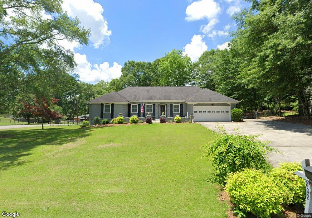
202 Wilson Dr Carrollton, GA 30117
Estimated Value: $275,567 - $334,000
3
Beds
2
Baths
1,596
Sq Ft
$194/Sq Ft
Est. Value
About This Home
This home is located at 202 Wilson Dr, Carrollton, GA 30117 and is currently estimated at $309,142, approximately $193 per square foot. 202 Wilson Dr is a home located in Carroll County with nearby schools including Carrollton Elementary School, Carrollton Upper Elementary School, and Carrollton Middle School.
Ownership History
Date
Name
Owned For
Owner Type
Purchase Details
Closed on
Jun 29, 2017
Sold by
Hester George Carey
Bought by
Williams Dan H and Williams Wilma T
Current Estimated Value
Purchase Details
Closed on
Apr 7, 1993
Sold by
Hester George C
Bought by
Hester George C and Charlotte Lrs
Purchase Details
Closed on
Jan 10, 1971
Sold by
H & S Developers
Bought by
Hester George C
Purchase Details
Closed on
Jan 5, 1971
Sold by
Wilson C L
Bought by
H & S Developers
Create a Home Valuation Report for This Property
The Home Valuation Report is an in-depth analysis detailing your home's value as well as a comparison with similar homes in the area
Home Values in the Area
Average Home Value in this Area
Purchase History
| Date | Buyer | Sale Price | Title Company |
|---|---|---|---|
| Williams Dan H | $147,000 | -- | |
| Hester George C | -- | -- | |
| Hester George C | -- | -- | |
| H & S Developers | -- | -- |
Source: Public Records
Tax History Compared to Growth
Tax History
| Year | Tax Paid | Tax Assessment Tax Assessment Total Assessment is a certain percentage of the fair market value that is determined by local assessors to be the total taxable value of land and additions on the property. | Land | Improvement |
|---|---|---|---|---|
| 2024 | $661 | $115,223 | $10,000 | $105,223 |
| 2023 | $645 | $105,743 | $10,000 | $95,743 |
| 2022 | $611 | $86,839 | $10,000 | $76,839 |
| 2021 | $562 | $75,969 | $10,000 | $65,969 |
| 2020 | $484 | $64,053 | $10,000 | $54,053 |
| 2019 | $476 | $59,557 | $10,000 | $49,557 |
| 2018 | $412 | $42,480 | $10,000 | $32,480 |
| 2017 | $353 | $42,480 | $10,000 | $32,480 |
| 2016 | $354 | $42,480 | $10,000 | $32,480 |
| 2015 | $315 | $33,128 | $6,000 | $27,128 |
| 2014 | $317 | $33,128 | $6,000 | $27,128 |
Source: Public Records
Map
Nearby Homes
- 121 Wilson Cir
- 816 Stewart St
- 111 Lakeview Dr
- 115 N Lake Dr
- 325 Almon Rd
- 123 Autumn Glen Dr
- 114 Green Point Way
- 123 Cedar Park Way
- 2580 Shady Grove Rd
- 231 N Lakeshore Dr
- 223 N Lakeshore Dr
- 131 Hunter Way
- 105 Providence Ct
- 221 Turtle Cove
- 777 College St
- 541 N White St
- 3 Burns Rd
- 2 Burns Rd
- 2930 Highway 113
- 119 Oxford Square
- 204 Wilson Dr
- 103 Wilson Cir
- 100 Wilson Cir
- 108 Lumpkin Dr
- 102 Wilson Cir
- 203 Wilson Dr
- 203 Wilson Dr
- 127 Wilson Cir
- 129 Wilson Cir
- 105 Wilson Cir
- 104 Lumpkin Dr
- 104 Wilson Cir
- 101 Kay Ln
- 0 Wilson Dr Unit 9010206
- 0 Wilson Dr Unit 9017602
- 295 Wilson Dr
- 0 Wilson Dr Unit 8844146
- 0 Wilson Dr
- 125 Wilson Cir
- 112 Lumpkin Dr