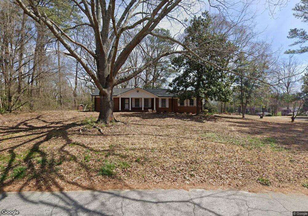
2020 Annette Ln Austell, GA 30106
Estimated Value: $258,000 - $316,000
3
Beds
2
Baths
1,452
Sq Ft
$194/Sq Ft
Est. Value
About This Home
This home is located at 2020 Annette Ln, Austell, GA 30106 and is currently estimated at $281,440, approximately $193 per square foot. 2020 Annette Ln is a home located in Cobb County with nearby schools including Deerwood Elementary School, Austell Elementary School, and Garrett Middle School.
Ownership History
Date
Name
Owned For
Owner Type
Purchase Details
Closed on
Aug 5, 2010
Sold by
Federal Natl Mtg Assn Fnma
Bought by
Hicks Sylvester and Hicks Jawaun
Current Estimated Value
Home Financials for this Owner
Home Financials are based on the most recent Mortgage that was taken out on this home.
Original Mortgage
$54,480
Outstanding Balance
$36,003
Interest Rate
4.61%
Mortgage Type
New Conventional
Estimated Equity
$245,437
Purchase Details
Closed on
Apr 6, 2010
Sold by
Bac Home Loans Servicing Lp
Bought by
Federal Natl Mtg Assn Fnma
Purchase Details
Closed on
Nov 28, 2005
Sold by
Sosebee Ralph E
Bought by
Argo Sylvia M
Home Financials for this Owner
Home Financials are based on the most recent Mortgage that was taken out on this home.
Original Mortgage
$29,900
Interest Rate
6.04%
Mortgage Type
New Conventional
Purchase Details
Closed on
Oct 12, 2004
Sold by
Ray Georgie I
Bought by
Sosebee Ralph E
Create a Home Valuation Report for This Property
The Home Valuation Report is an in-depth analysis detailing your home's value as well as a comparison with similar homes in the area
Home Values in the Area
Average Home Value in this Area
Purchase History
| Date | Buyer | Sale Price | Title Company |
|---|---|---|---|
| Hicks Sylvester | $68,100 | -- | |
| Federal Natl Mtg Assn Fnma | -- | -- | |
| Bac Home Loans Servicing Lp | $130,293 | -- | |
| Argo Sylvia M | $149,900 | -- | |
| Sosebee Ralph E | $125,000 | -- |
Source: Public Records
Mortgage History
| Date | Status | Borrower | Loan Amount |
|---|---|---|---|
| Open | Hicks Sylvester | $54,480 | |
| Previous Owner | Argo Sylvia M | $29,900 |
Source: Public Records
Tax History Compared to Growth
Tax History
| Year | Tax Paid | Tax Assessment Tax Assessment Total Assessment is a certain percentage of the fair market value that is determined by local assessors to be the total taxable value of land and additions on the property. | Land | Improvement |
|---|---|---|---|---|
| 2025 | $3,415 | $113,348 | $26,000 | $87,348 |
| 2024 | $3,207 | $106,376 | $24,000 | $82,376 |
| 2023 | $3,051 | $101,208 | $18,000 | $83,208 |
| 2022 | $1,876 | $61,796 | $10,000 | $51,796 |
| 2021 | $1,876 | $61,796 | $10,000 | $51,796 |
| 2020 | $1,517 | $49,980 | $10,000 | $39,980 |
| 2019 | $1,797 | $59,208 | $10,000 | $49,208 |
| 2018 | $1,285 | $42,344 | $7,200 | $35,144 |
| 2017 | $978 | $34,016 | $6,000 | $28,016 |
| 2016 | $895 | $31,116 | $5,600 | $25,516 |
| 2015 | $802 | $27,240 | $6,864 | $20,376 |
| 2014 | $809 | $27,240 | $0 | $0 |
Source: Public Records
Map
Nearby Homes
- 1971 Annette Ln
- 1943 Arnold Dr
- 1 Perkerson Mill Rd SW
- 1803 Gherry Dr
- 5164 Medford Ln
- 5154 Medford Ln
- 2136 Perkerson Mill Rd SW
- 1841 Mobley St
- Bayberry Plan at Sawmill Creek - Bungalow Series
- Wisteria Plan at Sawmill Creek - Bungalow Series
- Redbud Plan at Sawmill Creek - Bungalow Series
- 2179 Warren Dr
- Laurel Plan at Avenbrook
- Rosedale Plan at Avenbrook
- Fulmont at Avenbrook Plan at Avenbrook
- Addison Plan at Avenbrook
- Conley Plan at Avenbrook
- 0 Harris St Unit 7661273
- 5466 Davis Dr
- 1645 Fulmont Cir
- 2020 Annette Ln SW
- 1998 Annette Ln
- 0 Annette Ln SW Unit 7009435
- 2005 Arnold Dr
- 2049 Arnold Dr
- 2017 Arnold Dr
- 2043 Brannon Dr
- 1988 Annette Ln
- 1981 Arnold Dr
- 2040 Brannon Dr
- 1997 Annette Ln
- 2039 Brannon Dr
- 0 Brannon Dr Unit 8870039
- 0 Brannon Dr Unit 8676418
- 0 Brannon Dr Unit 8451087
- 0 Brannon Dr Unit 8386875
- 0 Brannon Dr Unit 8330290
- 0 Brannon Dr Unit 8619690
- 0 Brannon Dr Unit 8590775
- 0 Brannon Dr