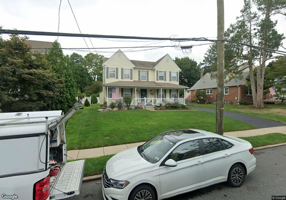
2020 Bellemead Ave Havertown, PA 19083
Estimated Value: $691,000 - $840,847
4
Beds
3
Baths
2,908
Sq Ft
$267/Sq Ft
Est. Value
About This Home
This home is located at 2020 Bellemead Ave, Havertown, PA 19083 and is currently estimated at $777,462, approximately $267 per square foot. 2020 Bellemead Ave is a home located in Delaware County with nearby schools including Lynnewood El School, Haverford Middle School, and Haverford Senior High School.
Ownership History
Date
Name
Owned For
Owner Type
Purchase Details
Closed on
Oct 31, 2002
Sold by
Sposato Rayer Builders Inc
Bought by
Rondolone Vincent P and Rondolone Siobhan M
Current Estimated Value
Home Financials for this Owner
Home Financials are based on the most recent Mortgage that was taken out on this home.
Original Mortgage
$206,400
Outstanding Balance
$86,579
Interest Rate
6.04%
Estimated Equity
$690,883
Create a Home Valuation Report for This Property
The Home Valuation Report is an in-depth analysis detailing your home's value as well as a comparison with similar homes in the area
Home Values in the Area
Average Home Value in this Area
Purchase History
| Date | Buyer | Sale Price | Title Company |
|---|---|---|---|
| Rondolone Vincent P | $258,000 | Commonwealth Land Title Ins |
Source: Public Records
Mortgage History
| Date | Status | Borrower | Loan Amount |
|---|---|---|---|
| Open | Rondolone Vincent P | $206,400 |
Source: Public Records
Tax History Compared to Growth
Tax History
| Year | Tax Paid | Tax Assessment Tax Assessment Total Assessment is a certain percentage of the fair market value that is determined by local assessors to be the total taxable value of land and additions on the property. | Land | Improvement |
|---|---|---|---|---|
| 2025 | $12,460 | $484,580 | $104,990 | $379,590 |
| 2024 | $12,460 | $484,580 | $104,990 | $379,590 |
| 2023 | $12,106 | $484,580 | $104,990 | $379,590 |
| 2022 | $11,823 | $484,580 | $104,990 | $379,590 |
| 2021 | $19,261 | $484,580 | $104,990 | $379,590 |
| 2020 | $11,349 | $244,180 | $53,160 | $191,020 |
| 2019 | $11,140 | $244,180 | $53,160 | $191,020 |
| 2018 | $10,949 | $244,180 | $0 | $0 |
| 2017 | $10,717 | $244,180 | $0 | $0 |
| 2016 | $1,340 | $244,180 | $0 | $0 |
| 2015 | $1,340 | $244,180 | $0 | $0 |
| 2014 | $1,367 | $244,180 | $0 | $0 |
Source: Public Records
Map
Nearby Homes
- 2300 Oakmont Ave
- 26 E Turnbull Ave
- 32 E Benedict Ave
- 2424 Delchester Ave
- 41 W Hillcrest Ave
- 101 Rockland Rd
- 627 N Eagle Rd
- 143 Campbell Ave
- 1216 Darby Rd
- 664 Washington Ave
- 100 Brookline Blvd
- 2423 Hollis Rd
- 2616 Prescott Rd
- 164 Woodbine Rd
- 1447 Lawrence Rd
- 145 Sycamore Rd
- 1321 Annabella Ave
- 100 E Manoa Rd
- 110 Sycamore Rd
- 911 Darby Rd
- 2010 Bellemead Ave
- 2016 Bellemead Ave
- Lot 076 Bellemead Ave
- 345-000 W Turnbull Ave
- 2001 Laurel Rd
- 2024 Bellemead Ave
- 2004 Bellemead Ave
- 2005 Laurel Rd
- 40 W Turnbull Ave
- 2009 Laurel Rd
- 2028 Bellemead Ave
- 49 W Turnbull Ave
- 2005 Bellemead Ave
- 47 W Turnbull Ave
- 45 W Turnbull Ave
- 43 W Turnbull Ave
- 2013 Laurel Rd
- 36 W Turnbull Ave
- 41 W Turnbull Ave
- 2017 Laurel Rd