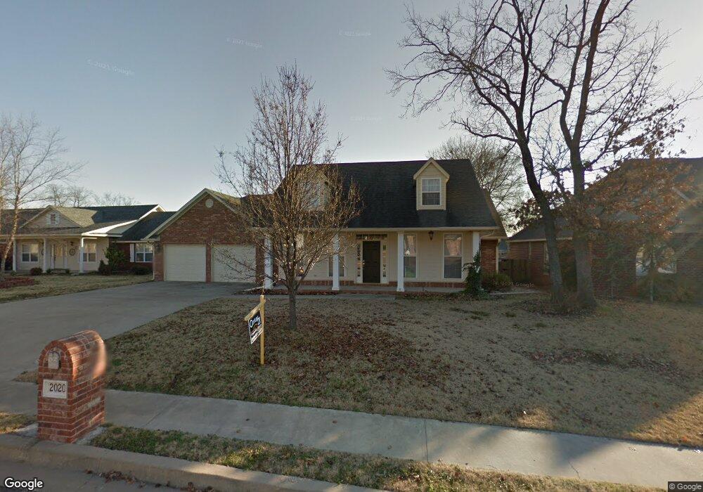
2020 Birch Ln Tahlequah, OK 74464
Estimated Value: $283,836 - $333,000
3
Beds
2
Baths
2,385
Sq Ft
$131/Sq Ft
Est. Value
About This Home
This home is located at 2020 Birch Ln, Tahlequah, OK 74464 and is currently estimated at $311,959, approximately $130 per square foot. 2020 Birch Ln is a home located in Cherokee County with nearby schools including Heritage Elementary School, Tahlequah Middle School, and Tahlequah High School.
Ownership History
Date
Name
Owned For
Owner Type
Purchase Details
Closed on
Aug 21, 2014
Sold by
Payne Matthew Neil and Beavers Jody Lynn
Bought by
Girdner Stacy
Current Estimated Value
Purchase Details
Closed on
Sep 12, 2008
Sold by
Lunn Michael H and Lunn Lora L
Bought by
Payne Matthew Neil and Beavers Jooy Lynn
Home Financials for this Owner
Home Financials are based on the most recent Mortgage that was taken out on this home.
Original Mortgage
$168,453
Interest Rate
6.6%
Mortgage Type
FHA
Purchase Details
Closed on
Nov 19, 2003
Sold by
Brad and Beatrice Tullis
Bought by
Michael and Lora Lunn
Purchase Details
Closed on
Jun 2, 2003
Sold by
Southridge Development Co
Bought by
Brad and Beatrice Tullis
Create a Home Valuation Report for This Property
The Home Valuation Report is an in-depth analysis detailing your home's value as well as a comparison with similar homes in the area
Home Values in the Area
Average Home Value in this Area
Purchase History
| Date | Buyer | Sale Price | Title Company |
|---|---|---|---|
| Girdner Stacy | $125,000 | None Available | |
| Payne Matthew Neil | $171,500 | Tahlequah Abstract Closing S | |
| Michael | $141,000 | -- | |
| Brad | $14,000 | -- |
Source: Public Records
Mortgage History
| Date | Status | Borrower | Loan Amount |
|---|---|---|---|
| Previous Owner | Payne Matthew Neil | $168,453 |
Source: Public Records
Tax History Compared to Growth
Tax History
| Year | Tax Paid | Tax Assessment Tax Assessment Total Assessment is a certain percentage of the fair market value that is determined by local assessors to be the total taxable value of land and additions on the property. | Land | Improvement |
|---|---|---|---|---|
| 2025 | $1,601 | $18,439 | $1,803 | $16,636 |
| 2024 | $1,601 | $17,901 | $1,750 | $16,151 |
| 2023 | $1,601 | $17,380 | $1,540 | $15,840 |
| 2022 | $1,520 | $17,380 | $1,540 | $15,840 |
| 2021 | $1,525 | $17,380 | $1,540 | $15,840 |
| 2020 | $1,553 | $17,380 | $1,540 | $15,840 |
| 2019 | $1,539 | $17,380 | $1,540 | $15,840 |
| 2018 | $1,576 | $17,577 | $1,540 | $16,037 |
| 2017 | $1,573 | $17,577 | $1,540 | $16,037 |
| 2016 | $1,583 | $17,577 | $1,540 | $16,037 |
| 2015 | $1,556 | $17,577 | $1,540 | $16,037 |
| 2014 | $1,776 | $18,865 | $1,540 | $17,325 |
Source: Public Records
Map
Nearby Homes
- 2045 Aspen Dr
- 573 Woodlands Dr
- 656 Woodlands Dr
- 635 Woodlands Dr
- 692 Woodlands Dr
- 655 Woodlands Dr
- 668 Woodlands Dr
- 704 Woodlands Dr
- 633 Kingston
- 19925 S 503 Rd
- 19971 S 503 Rd
- 19747 S 503 Rd
- 19781 S 503 Rd
- 19920 S 503 Rd
- 19887 S 503 Rd
- 19815 S 503 Rd
- 19970 S 503 Rd
- 565 Woodlands Dr
- 550 Woodlands Dr
- 574 Woodlands Dr