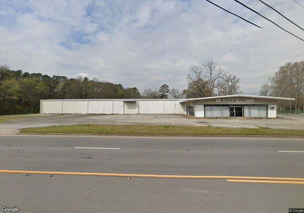
2020 Buchanan Hwy Cedartown, GA 30125
Estimated Value: $185,711
--
Bed
--
Bath
12,250
Sq Ft
$15/Sq Ft
Est. Value
About This Home
This home is located at 2020 Buchanan Hwy, Cedartown, GA 30125 and is currently estimated at $185,711, approximately $15 per square foot. 2020 Buchanan Hwy is a home located in Polk County with nearby schools including Cedar Christian School.
Ownership History
Date
Name
Owned For
Owner Type
Purchase Details
Closed on
Apr 9, 2021
Sold by
Martin Vesta C
Bought by
Segura Raul
Current Estimated Value
Purchase Details
Closed on
Oct 12, 2016
Sold by
Raul
Bought by
Martin Vesta C
Purchase Details
Closed on
May 1, 2012
Sold by
Giles Freddie W
Bought by
The First National Bank Of Pol
Purchase Details
Closed on
Jun 16, 2005
Sold by
Puckett Eula W
Bought by
Giles Freddie W
Home Financials for this Owner
Home Financials are based on the most recent Mortgage that was taken out on this home.
Original Mortgage
$157,104
Interest Rate
5.66%
Mortgage Type
Commercial
Create a Home Valuation Report for This Property
The Home Valuation Report is an in-depth analysis detailing your home's value as well as a comparison with similar homes in the area
Home Values in the Area
Average Home Value in this Area
Purchase History
| Date | Buyer | Sale Price | Title Company |
|---|---|---|---|
| Segura Raul | $120,000 | -- | |
| Martin Vesta C | $120,000 | -- | |
| The First National Bank Of Pol | $139,963 | -- | |
| Giles Freddie W | $100,000 | -- | |
| Puckett Eula W | -- | -- |
Source: Public Records
Mortgage History
| Date | Status | Borrower | Loan Amount |
|---|---|---|---|
| Previous Owner | Giles Freddie W | $157,104 |
Source: Public Records
Tax History Compared to Growth
Tax History
| Year | Tax Paid | Tax Assessment Tax Assessment Total Assessment is a certain percentage of the fair market value that is determined by local assessors to be the total taxable value of land and additions on the property. | Land | Improvement |
|---|---|---|---|---|
| 2024 | $1,285 | $61,468 | $11,900 | $49,568 |
| 2023 | $1,273 | $53,657 | $6,644 | $47,013 |
| 2022 | $1,139 | $52,422 | $6,486 | $45,936 |
| 2021 | $1,132 | $47,092 | $6,204 | $40,888 |
| 2020 | $1,134 | $47,092 | $6,204 | $40,888 |
| 2019 | $1,265 | $47,092 | $6,204 | $40,888 |
| 2018 | $1,298 | $47,092 | $6,204 | $40,888 |
| 2017 | $1,281 | $47,092 | $6,204 | $40,888 |
Source: Public Records
Map
Nearby Homes
- 1987 Buchanan Hwy
- 00 Buchanan Hwy
- 35 Old Mill Rd
- 240 Benedict Loop
- 142 Acres On Judkin Mill Rd
- 255 Mildred Dr
- 95 Wieuca Way
- 000 Wieuca Way
- 0 Wieuca Way Unit 10614129
- 480 Cason Rd
- 766 Antioch Rd
- 0 Old Esom Hill Loop Unit 10611077
- 0 Old Esom Hill Loop Unit 7654342
- 203 Cason Rd
- 9236 Tallapoosa Hwy
- 117 Cason Rd
- 1789 Johnson Lake Rd
- 1003 Fairview Ave
- 149 Irwin St
- 0 Judkin Mill Rd Unit LotWP001 19369404
- 2023 Buchanan Hwy
- 2041 Buchanan Hwy
- 81 Benedict Loop
- 2031 Buchanan Hwy
- 70 Benedict Loop
- 23 Morton Springs Rd
- 30 Morton Springs Rd
- 125 Benedict Loop
- 2069 Buchanan Hwy
- 0 Benedict Loop Unit 8050180
- 39 Morton Springs Rd
- 50 Benedict Loop
- 30 Benedict Loop
- 46 Morton Springs Rd
- 2081 Buchanan Hwy
- 1967 Buchanan Hwy
- 51 Morton Springs Rd
- 37 Saw Mill Rd
- 40 Peek Ln
- 64 Peek Ln