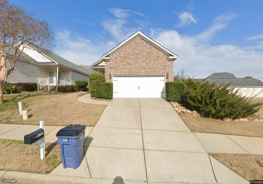
2020 Dundee Way Grovetown, GA 30813
Estimated Value: $236,000 - $253,000
3
Beds
2
Baths
1,496
Sq Ft
$163/Sq Ft
Est. Value
About This Home
This home is located at 2020 Dundee Way, Grovetown, GA 30813 and is currently estimated at $244,363, approximately $163 per square foot. 2020 Dundee Way is a home located in Columbia County with nearby schools including Baker Place Elementary School, Rockbridge Elementary School, and Gilmer Middle School.
Ownership History
Date
Name
Owned For
Owner Type
Purchase Details
Closed on
Oct 27, 2009
Sold by
Percival Richard
Bought by
Roger Sharon M
Current Estimated Value
Home Financials for this Owner
Home Financials are based on the most recent Mortgage that was taken out on this home.
Original Mortgage
$89,600
Outstanding Balance
$58,058
Interest Rate
4.93%
Mortgage Type
New Conventional
Estimated Equity
$186,305
Purchase Details
Closed on
Oct 7, 2009
Sold by
Regions Bank
Bought by
Percival Richard
Home Financials for this Owner
Home Financials are based on the most recent Mortgage that was taken out on this home.
Original Mortgage
$89,600
Outstanding Balance
$58,058
Interest Rate
4.93%
Mortgage Type
New Conventional
Estimated Equity
$186,305
Purchase Details
Closed on
Nov 9, 2007
Sold by
High Meadows Group Llc
Bought by
Southern Bldrs & Land Developers Inc
Home Financials for this Owner
Home Financials are based on the most recent Mortgage that was taken out on this home.
Original Mortgage
$120,000
Interest Rate
6.32%
Mortgage Type
New Conventional
Create a Home Valuation Report for This Property
The Home Valuation Report is an in-depth analysis detailing your home's value as well as a comparison with similar homes in the area
Home Values in the Area
Average Home Value in this Area
Purchase History
| Date | Buyer | Sale Price | Title Company |
|---|---|---|---|
| Roger Sharon M | $112,000 | -- | |
| Percival Richard | $81,400 | -- | |
| Southern Bldrs & Land Developers Inc | $120,000 | -- |
Source: Public Records
Mortgage History
| Date | Status | Borrower | Loan Amount |
|---|---|---|---|
| Open | Roger Sharon M | $89,600 | |
| Previous Owner | Southern Bldrs & Land Developers Inc | $120,000 |
Source: Public Records
Tax History Compared to Growth
Tax History
| Year | Tax Paid | Tax Assessment Tax Assessment Total Assessment is a certain percentage of the fair market value that is determined by local assessors to be the total taxable value of land and additions on the property. | Land | Improvement |
|---|---|---|---|---|
| 2025 | $2,333 | $97,324 | $19,304 | $78,020 |
| 2024 | $2,409 | $96,034 | $20,804 | $75,230 |
| 2023 | $2,409 | $91,877 | $19,504 | $72,373 |
| 2022 | $2,156 | $82,653 | $17,304 | $65,349 |
| 2021 | $1,956 | $71,723 | $16,104 | $55,619 |
| 2020 | $1,892 | $67,970 | $14,404 | $53,566 |
| 2019 | $1,819 | $65,329 | $14,604 | $50,725 |
| 2018 | $1,723 | $61,639 | $14,104 | $47,535 |
| 2017 | $1,691 | $60,298 | $13,104 | $47,194 |
| 2016 | $1,575 | $58,244 | $12,280 | $45,964 |
| 2015 | $1,481 | $54,639 | $11,980 | $42,659 |
| 2014 | $1,405 | $51,198 | $11,080 | $40,118 |
Source: Public Records
Map
Nearby Homes
- 613 Dunrobin Ln
- 2051 Dundee Way
- 1803 Dunrobin Ct
- 304 High Meadows Place
- 214 Kickham Ln
- 520 Sweet Meadow Dr
- 3010 Kilknockie Dr
- 3027 Kilknockie Dr
- 932 Niagra Falls
- Montauk 2 Plan at Misty Meadows
- Haverford Plan at Misty Meadows
- Covington 7 Plan at Misty Meadows
- Kelly 9 Plan at Misty Meadows
- Riverton 3 Plan at Misty Meadows
- Oxford Plan at Misty Meadows
- Lyndhurst Plan at Misty Meadows
- Riverton 4 Plan at Misty Meadows
- Stoneridge Plan at Misty Meadows
- Oxford 2 Plan at Misty Meadows
- Gilford Plan at Misty Meadows
- 2022 Dundee Way
- 2010 Dundee Way
- 610 Dunrobin Ln
- 604 Dunrobin Ln
- 2008 Dundee Way
- 612 Dunrobin Ln
- 2021 Dundee Way
- 2023 Dundee Way
- 2019 Dundee Way
- 2006 Dundee Way
- 2025 Dundee Way
- 614 Dunrobin Ln
- 2027 Dundee Way
- 2015 Dundee Way
- 607 Dunrobin Ln
- 605 Dunrobin Ln
- 2013 Dundee Way
- 627 Dunrobin Ln
- 2004 Dundee Way
- 2029 Dundee Way