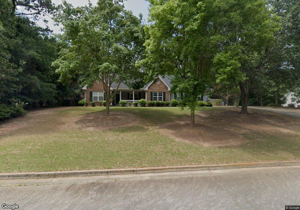
2020 Emily Dr Social Circle, GA 30025
Estimated Value: $322,406 - $421,000
--
Bed
--
Bath
1,780
Sq Ft
$199/Sq Ft
Est. Value
About This Home
This home is located at 2020 Emily Dr, Social Circle, GA 30025 and is currently estimated at $353,352, approximately $198 per square foot. 2020 Emily Dr is a home located in Walton County with nearby schools including Social Circle Primary School, Social Circle Elementary School, and Social Circle Middle School.
Ownership History
Date
Name
Owned For
Owner Type
Purchase Details
Closed on
Dec 30, 2021
Sold by
Fesperman Bobby L
Bought by
Fesperman Sarah B
Current Estimated Value
Purchase Details
Closed on
Sep 7, 1999
Sold by
Kitchens Kenneth W
Bought by
Fesperman Bobby L
Home Financials for this Owner
Home Financials are based on the most recent Mortgage that was taken out on this home.
Original Mortgage
$89,500
Interest Rate
7.73%
Mortgage Type
New Conventional
Purchase Details
Closed on
Feb 20, 1998
Sold by
T & J Holmes Inc
Bought by
Kitchens Kenneth W
Home Financials for this Owner
Home Financials are based on the most recent Mortgage that was taken out on this home.
Original Mortgage
$18,401
Interest Rate
6.86%
Mortgage Type
New Conventional
Create a Home Valuation Report for This Property
The Home Valuation Report is an in-depth analysis detailing your home's value as well as a comparison with similar homes in the area
Home Values in the Area
Average Home Value in this Area
Purchase History
| Date | Buyer | Sale Price | Title Company |
|---|---|---|---|
| Fesperman Sarah B | -- | -- | |
| Fesperman Bobby L | $139,500 | -- | |
| Kitchens Kenneth W | $18,200 | -- |
Source: Public Records
Mortgage History
| Date | Status | Borrower | Loan Amount |
|---|---|---|---|
| Previous Owner | Fesperman Bobby L | $89,500 | |
| Previous Owner | Kitchens Kenneth W | $18,401 |
Source: Public Records
Tax History Compared to Growth
Tax History
| Year | Tax Paid | Tax Assessment Tax Assessment Total Assessment is a certain percentage of the fair market value that is determined by local assessors to be the total taxable value of land and additions on the property. | Land | Improvement |
|---|---|---|---|---|
| 2024 | $1,438 | $116,996 | $24,000 | $92,996 |
| 2023 | $1,350 | $105,916 | $22,000 | $83,916 |
| 2022 | $514 | $97,316 | $22,000 | $75,316 |
| 2021 | $514 | $81,436 | $16,000 | $65,436 |
| 2020 | $527 | $75,116 | $12,000 | $63,116 |
| 2019 | $538 | $70,156 | $12,000 | $58,156 |
| 2018 | $538 | $70,156 | $12,000 | $58,156 |
| 2017 | $2,932 | $70,156 | $12,000 | $58,156 |
| 2016 | $559 | $61,648 | $12,000 | $49,648 |
| 2015 | $552 | $53,488 | $10,000 | $43,488 |
| 2014 | $558 | $51,420 | $10,000 | $41,420 |
Source: Public Records
Map
Nearby Homes
- 853 Crossroads Ct
- 843 Crossroads Ct
- 821 Crossroads Ct
- 815 Crossroads Ct
- 443 Windsong Ln
- 381 Crossroads Dr
- 939 Park Place St
- 931 Park Place St
- 960 Park Place St
- 1244 Morrow Dr
- 741 Jackson Ct
- 670 Park Place Way
- 695 Park Place Way
- 357 W Hightower Trail
- 310 Crossroads Dr
- 690 Park Place Way
- 226 Rogue Rd
- (GA)The Ava | Front Entry Plan at Weslyn Park
- (GA)The Everett | Front Entry Plan at Weslyn Park
- (GA) The Brooks | Front Entry Plan at Weslyn Park
- 2006 Emily Dr
- 2036 Emily Dr
- 1017 Justin Cir
- 2023 Emily Dr
- 1005 Justin Cir Unit 24
- 1005 Justin Cir
- 1023 Justin Cir
- 2007 Emily Dr
- 2060 Emily Dr
- 1030 Justin Cir
- 203 Corby Ln
- 213 Corby Ln
- 2066 Emily Dr
- 195 Corby Ln
- 1024 Justin Cir
- 227 Corby Ln
- 1018 Justin Cir
- 185 Corby Ln
- 2055 Emily Dr Unit 15
- 2055 Emily Dr