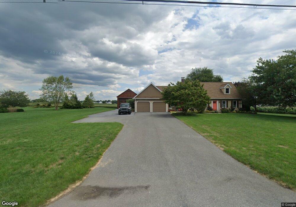
2020 Forry Rd Lancaster, PA 17601
Estimated Value: $426,000 - $581,000
4
Beds
2
Baths
2,249
Sq Ft
$228/Sq Ft
Est. Value
About This Home
This home is located at 2020 Forry Rd, Lancaster, PA 17601 and is currently estimated at $512,993, approximately $228 per square foot. 2020 Forry Rd is a home located in Lancaster County with nearby schools including Fritz Elementary School, Gerald G. Huesken Middle School, and Conestoga Valley High School.
Ownership History
Date
Name
Owned For
Owner Type
Purchase Details
Closed on
Jul 19, 2011
Sold by
Shenk Mahlon H and Shenk Almeda J
Bought by
Rehm Scott N and Rehm Sharon L
Current Estimated Value
Home Financials for this Owner
Home Financials are based on the most recent Mortgage that was taken out on this home.
Original Mortgage
$180,000
Outstanding Balance
$69,955
Interest Rate
4.49%
Mortgage Type
New Conventional
Estimated Equity
$443,038
Create a Home Valuation Report for This Property
The Home Valuation Report is an in-depth analysis detailing your home's value as well as a comparison with similar homes in the area
Home Values in the Area
Average Home Value in this Area
Purchase History
| Date | Buyer | Sale Price | Title Company |
|---|---|---|---|
| Rehm Scott N | $305,000 | None Available |
Source: Public Records
Mortgage History
| Date | Status | Borrower | Loan Amount |
|---|---|---|---|
| Open | Rehm Scott N | $180,000 |
Source: Public Records
Tax History
| Year | Tax Paid | Tax Assessment Tax Assessment Total Assessment is a certain percentage of the fair market value that is determined by local assessors to be the total taxable value of land and additions on the property. | Land | Improvement |
|---|---|---|---|---|
| 2025 | $6,270 | $309,700 | $77,500 | $232,200 |
| 2024 | $6,270 | $309,700 | $77,500 | $232,200 |
| 2023 | $6,125 | $309,700 | $77,500 | $232,200 |
| 2022 | $5,973 | $309,700 | $77,500 | $232,200 |
| 2021 | $5,762 | $309,700 | $77,500 | $232,200 |
| 2020 | $5,762 | $309,700 | $77,500 | $232,200 |
| 2019 | $5,638 | $309,700 | $77,500 | $232,200 |
| 2018 | $8,104 | $309,700 | $77,500 | $232,200 |
| 2017 | $4,579 | $211,500 | $53,200 | $158,300 |
| 2016 | $4,524 | $211,500 | $53,200 | $158,300 |
| 2015 | $1,156 | $211,500 | $53,200 | $158,300 |
| 2014 | $2,559 | $179,000 | $53,200 | $125,800 |
Source: Public Records
Map
Nearby Homes
- 466 Eastwood Ln
- 443 Eastwood Ln
- 403 Eastwood Ln
- 742 Nancy Ln
- 723 Sherry Ln
- 726 Nancy Ln
- 824 Carrie Ct
- 2047 Jarvis Rd
- 622 Enfield Dr
- 2234 Coach Light Ln
- 2024 Meadow Ridge Dr Unit HAVEN MODEL
- 2024 Meadow Ridge Dr
- 2024 Meadow Ridge Dr Unit HAWTHORNE MODEL
- 2212 Brentford St
- 2299 Sue Ann Drive (Lot #1)
- 2297
- 26 Midway Farms Ln
- 509 Oak Grove Dr
- 195 Eshelman Rd
- 83 Highland Dr
- 2030 Forry Rd
- 2040 Forry Rd
- 488 Willow Rd
- 492 Willow Rd
- 484 Willow Rd
- 462 Willow Rd
- 447 Willow Rd
- 458 Willow Rd
- 454 Willow Rd
- 450 Willow Rd
- 444 Willow Rd
- 450 Ben Franklin Blvd
- 555 Willow Rd
- 560 Willow Rd
- 568 Willow Rd
- 570 Willow Rd
- 573 Willow Rd
- 396 Willow Rd
- 1866 Colonial Village Ln
- 1866 Colonial Village Ln Unit 106
Your Personal Tour Guide
Ask me questions while you tour the home.