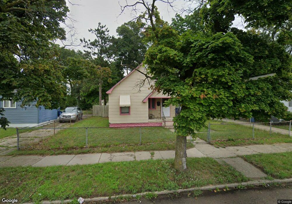
2020 Hoyt St Muskegon, MI 49444
Estimated Value: $82,000 - $111,000
3
Beds
1
Bath
896
Sq Ft
$101/Sq Ft
Est. Value
About This Home
This home is located at 2020 Hoyt St, Muskegon, MI 49444 and is currently estimated at $90,798, approximately $101 per square foot. 2020 Hoyt St is a home located in Muskegon County with nearby schools including Edgewood Elementary Academy, Dr. Martin Luther King Academy, and Muskegon Heights Academy.
Ownership History
Date
Name
Owned For
Owner Type
Purchase Details
Closed on
Mar 17, 2025
Sold by
Sandifer Trina
Bought by
Tys Family Living Trust and Sandifer
Current Estimated Value
Purchase Details
Closed on
Aug 31, 2022
Sold by
Muskegon County Treasurer
Bought by
City Of Muskegon Heights
Purchase Details
Closed on
Dec 12, 2014
Sold by
Moore City Properties Llc
Bought by
Bradley Vickie
Purchase Details
Closed on
Feb 22, 2013
Sold by
Moore Investment Properties Inc
Bought by
Moore City Properties Llc
Create a Home Valuation Report for This Property
The Home Valuation Report is an in-depth analysis detailing your home's value as well as a comparison with similar homes in the area
Home Values in the Area
Average Home Value in this Area
Purchase History
| Date | Buyer | Sale Price | Title Company |
|---|---|---|---|
| Tys Family Living Trust | -- | None Listed On Document | |
| Tys Family Living Trust | -- | None Listed On Document | |
| City Of Muskegon Heights | -- | -- | |
| Bradley Vickie | -- | None Available | |
| Moore City Properties Llc | -- | Rei |
Source: Public Records
Tax History Compared to Growth
Tax History
| Year | Tax Paid | Tax Assessment Tax Assessment Total Assessment is a certain percentage of the fair market value that is determined by local assessors to be the total taxable value of land and additions on the property. | Land | Improvement |
|---|---|---|---|---|
| 2025 | $941 | $24,300 | $0 | $0 |
| 2024 | $698 | $19,900 | $0 | $0 |
| 2023 | $761 | $14,500 | $0 | $0 |
| 2022 | $638 | $13,600 | $0 | $0 |
| 2021 | $521 | $11,900 | $0 | $0 |
| 2020 | $677 | $11,700 | $0 | $0 |
| 2019 | $665 | $11,400 | $0 | $0 |
| 2018 | $649 | $10,300 | $0 | $0 |
| 2017 | $602 | $10,100 | $0 | $0 |
| 2016 | $405 | $10,300 | $0 | $0 |
| 2015 | -- | $10,600 | $0 | $0 |
| 2014 | -- | $11,900 | $0 | $0 |
| 2013 | -- | $11,600 | $0 | $0 |
Source: Public Records
Map
Nearby Homes
- 2024 Hoyt St
- 2016 Hoyt St
- 2028 Hoyt St
- 2012 Hoyt St
- 2025 Reynolds St
- 2013 Reynolds St
- 2029 Reynolds St
- 2021 Reynolds St
- 2017 Reynolds St
- 2033 Reynolds St
- 2040 Hoyt St
- 2037 Reynolds St
- 2037 Hoyt St
- 2041 Reynolds St
- 2020 Reynolds St
- 2044 Hoyt St
- 2041 Hoyt St
- 226 E Delano Ave
- 2024 Reynolds St
- 2045 Hoyt St