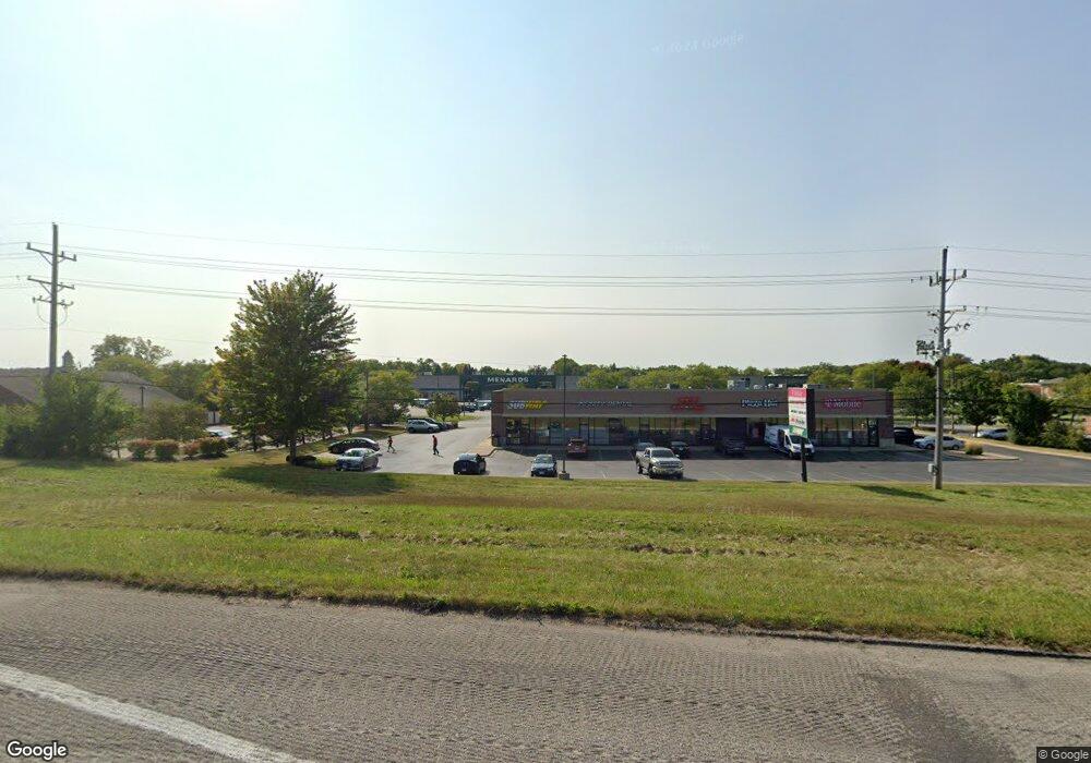
2020 N Us Highway 12 Spring Grove, IL 60081
--
Bed
--
Bath
22,135
Sq Ft
1.29
Acres
About This Home
This home is located at 2020 N Us Highway 12, Spring Grove, IL 60081. 2020 N Us Highway 12 is a home located in McHenry County with nearby schools including Spring Grove Elementary School, Nippersink Middle School, and Richmond-Burton High School.
Ownership History
Date
Name
Owned For
Owner Type
Purchase Details
Closed on
Aug 7, 2007
Sold by
Cunat Portfolio Sgr Llc
Bought by
Sg1 Properties Llc
Home Financials for this Owner
Home Financials are based on the most recent Mortgage that was taken out on this home.
Original Mortgage
$2,160,000
Interest Rate
6.5%
Mortgage Type
Commercial
Purchase Details
Closed on
Dec 28, 1999
Sold by
Home State Bank/National Assn
Bought by
Cunat Portfolio Sgr Llc
Home Financials for this Owner
Home Financials are based on the most recent Mortgage that was taken out on this home.
Original Mortgage
$1,950,000
Interest Rate
8.16%
Mortgage Type
Commercial
Create a Home Valuation Report for This Property
The Home Valuation Report is an in-depth analysis detailing your home's value as well as a comparison with similar homes in the area
Home Values in the Area
Average Home Value in this Area
Purchase History
| Date | Buyer | Sale Price | Title Company |
|---|---|---|---|
| Sg1 Properties Llc | $3,285,000 | None Available | |
| Cunat Portfolio Sgr Llc | -- | Chicago Title |
Source: Public Records
Mortgage History
| Date | Status | Borrower | Loan Amount |
|---|---|---|---|
| Closed | Sg1 Properties Llc | $2,160,000 | |
| Previous Owner | Cunat Portfolio Sgr Llc | $1,950,000 |
Source: Public Records
Tax History Compared to Growth
Tax History
| Year | Tax Paid | Tax Assessment Tax Assessment Total Assessment is a certain percentage of the fair market value that is determined by local assessors to be the total taxable value of land and additions on the property. | Land | Improvement |
|---|---|---|---|---|
| 2024 | $17,555 | $233,738 | $47,705 | $186,033 |
| 2023 | $17,521 | $217,999 | $44,493 | $173,506 |
| 2022 | $20,581 | $241,697 | $39,139 | $202,558 |
| 2021 | $21,263 | $227,844 | $36,896 | $190,948 |
| 2020 | $22,106 | $217,803 | $35,270 | $182,533 |
| 2019 | $26,161 | $289,390 | $36,614 | $252,776 |
| 2018 | $35,512 | $350,586 | $35,482 | $315,104 |
| 2017 | $37,031 | $329,220 | $33,320 | $295,900 |
| 2016 | $33,359 | $314,411 | $31,821 | $282,590 |
| 2013 | -- | $302,339 | $8,647 | $293,692 |
Source: Public Records
Map
Nearby Homes
- LOT 9 Mayo Ct
- 1992 Red Oak Ln
- 1876 Red Oak Ln
- 2003 Red Oak Ln
- Lot 36 Red Oak Ln
- LOT 40 Red Oak Ln
- 7393 English Oak Ln
- 7392 English Oak Ln
- 1979 Red Oak Ln
- 7389 English Oak Ln
- 7388 English Oak Ln
- 1975 Red Oak Ln
- 7381 English Oak Ln
- 7377 English Oak Ln
- 1971 Red Oak Ln
- 1852 Red Oak Ln
- 7373 English Oak Ln
- 1848 Red Oak Ln
- 7369 English Oak Ln
- 2214 Main Street Rd
- 2020 N Us Highway 12 Unit A
- 2020 N Us Highway 12
- 2020 N Us Highway 12 Unit A
- 7609 Asbury Ct
- 2020 Rt 12 Unit A
- 2020 U S 12
- 7613 Asbury Ct
- 7605 Blivin St
- 7619 Asbury Ct
- 2150 N Us Highway 12
- 7902 Blivin St
- 7621 Asbury Ct
- 1918 Rte 12
- 1918 N Us Highway12
- 1918 U S 12
- 2112 Westward Dr
- 2207 N Us Highway 12 Unit G
- 2207 N Us Highway 12 Unit BGHIJ
- 2207 N Us Highway 12 Unit F
- 2207 N Us Highway 12 Unit B