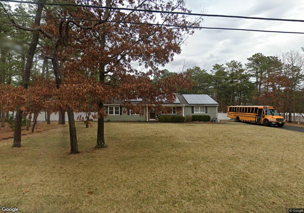
2020 Perth Amboy Ave Whiting, NJ 08759
Estimated Value: $430,330 - $512,000
5
Beds
2
Baths
1,580
Sq Ft
$296/Sq Ft
Est. Value
About This Home
This home is located at 2020 Perth Amboy Ave, Whiting, NJ 08759 and is currently estimated at $467,333, approximately $295 per square foot. 2020 Perth Amboy Ave is a home located in Ocean County with nearby schools including Manchester Township High School.
Ownership History
Date
Name
Owned For
Owner Type
Purchase Details
Closed on
May 11, 2005
Sold by
Heranney William and Coleman Jean M
Bought by
Bieth Robert and Bieth Diane
Current Estimated Value
Home Financials for this Owner
Home Financials are based on the most recent Mortgage that was taken out on this home.
Original Mortgage
$56,800
Interest Rate
5.2%
Mortgage Type
Stand Alone Second
Create a Home Valuation Report for This Property
The Home Valuation Report is an in-depth analysis detailing your home's value as well as a comparison with similar homes in the area
Home Values in the Area
Average Home Value in this Area
Purchase History
| Date | Buyer | Sale Price | Title Company |
|---|---|---|---|
| Bieth Robert | $284,000 | -- | |
| Heranney William | -- | -- |
Source: Public Records
Mortgage History
| Date | Status | Borrower | Loan Amount |
|---|---|---|---|
| Previous Owner | Heranney William | $56,800 | |
| Previous Owner | Bieth Robert | $227,200 |
Source: Public Records
Tax History
| Year | Tax Paid | Tax Assessment Tax Assessment Total Assessment is a certain percentage of the fair market value that is determined by local assessors to be the total taxable value of land and additions on the property. | Land | Improvement |
|---|---|---|---|---|
| 2025 | $6,252 | $429,700 | $195,000 | $234,700 |
| 2024 | $5,608 | $240,700 | $85,000 | $155,700 |
| 2023 | $5,332 | $240,700 | $85,000 | $155,700 |
| 2022 | $5,332 | $240,700 | $85,000 | $155,700 |
| 2021 | $5,216 | $240,700 | $85,000 | $155,700 |
| 2020 | $5,079 | $240,700 | $85,000 | $155,700 |
| 2019 | $5,882 | $229,300 | $85,000 | $144,300 |
| 2018 | $5,859 | $229,300 | $85,000 | $144,300 |
| 2017 | $5,882 | $229,300 | $85,000 | $144,300 |
| 2016 | $5,810 | $229,300 | $85,000 | $144,300 |
| 2015 | $5,534 | $222,500 | $85,000 | $137,500 |
| 2014 | $5,420 | $222,500 | $85,000 | $137,500 |
Source: Public Records
Map
Nearby Homes
- 551 Monroe Ave
- 46 Norwalk Ave
- 10 Hartford Rd
- 29 Brentwood St Unit 73
- 31 Chelsea Dr
- 13 S Chestnut Ave Unit 70
- 7 Eaton Ln Unit 73
- 13 Orchard Dr Unit 73
- 8 Hummingbird Ln
- 55 Chelsea Dr Unit 70
- 1820 Perth Amboy Ave
- 19 Attleboro Ln Unit 73
- 19 Attleboro Ln
- 69 Chelsea Dr
- 1130 Monroe Ave
- 3 Apple Ln
- 51 S Chestnut Ave Unit 72
- 14 Berry Hill Rd Unit 72
- 29 Keene St Unit 70
- 56 S Chestnut Ave
- 651 Bloomfield Ave
- 2021 New Brunswick Ave
- 2040 Perth Amboy Ave
- 2021 Perth Amboy Ave
- 601 Bloomfield Ave
- 600 Monroe Ave
- 2041 Perth Amboy Ave
- 701 Bloomfield Ave
- 651 Monroe Ave
- 600 Bloomfield Ave
- 2020 New Brunswick Ave
- 2020 Elizabeth Ave
- 601 Monroe Ave
- 551 Bloomfield Ave
- 1981 Perth Amboy Ave
- 550 Monroe Ave
- 750 Monroe Ave
- 751 Bloomfield Ave
- 701 Monroe Ave
- 1960 Perth Amboy Ave
Your Personal Tour Guide
Ask me questions while you tour the home.