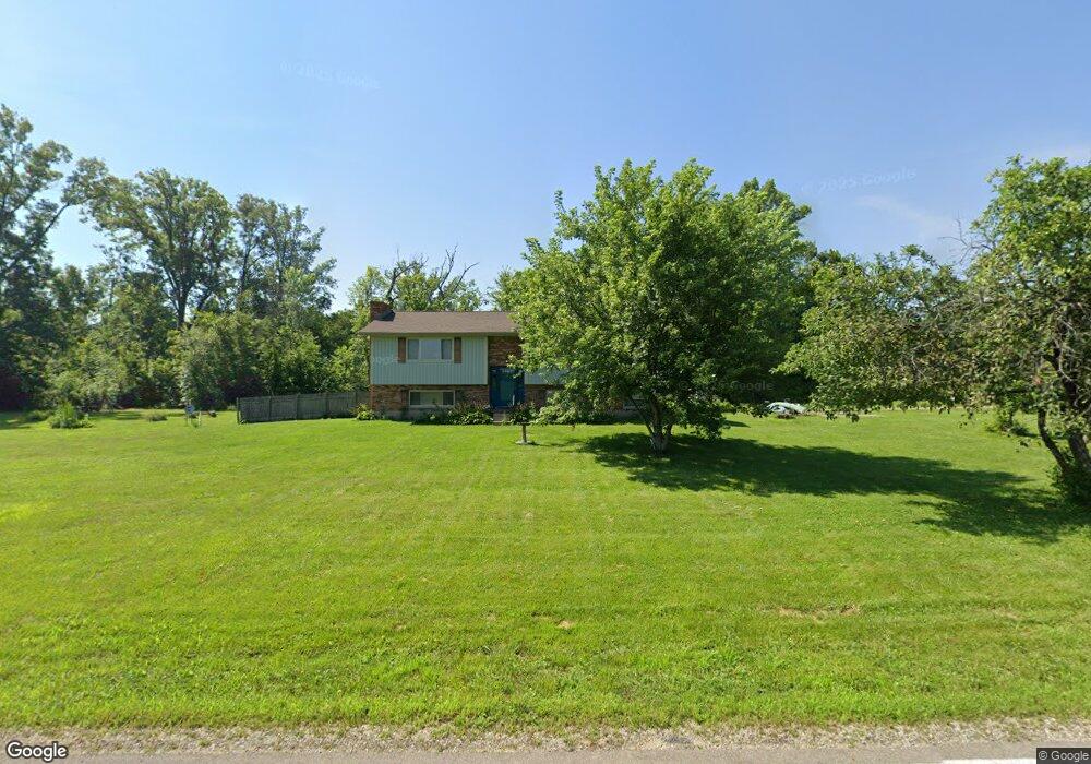
2020 Rhoades Rd Farmersville, OH 45325
Estimated Value: $245,000 - $299,000
3
Beds
2
Baths
1,440
Sq Ft
$191/Sq Ft
Est. Value
About This Home
This home is located at 2020 Rhoades Rd, Farmersville, OH 45325 and is currently estimated at $275,122, approximately $191 per square foot. 2020 Rhoades Rd is a home located in Montgomery County with nearby schools including Valley View Intermediate School, Valley View Primary School, and Valley View Junior High School.
Ownership History
Date
Name
Owned For
Owner Type
Purchase Details
Closed on
Jun 14, 2021
Sold by
Lee Charles W and Parker Lee Gail
Bought by
Parker Travis W and Parker Brian R
Current Estimated Value
Purchase Details
Closed on
Apr 8, 2008
Sold by
Parker Lee Gail M and Lee Charles W
Bought by
Lee Charles W and Parker Lee Gail M
Home Financials for this Owner
Home Financials are based on the most recent Mortgage that was taken out on this home.
Original Mortgage
$153,000
Interest Rate
6.17%
Mortgage Type
Purchase Money Mortgage
Create a Home Valuation Report for This Property
The Home Valuation Report is an in-depth analysis detailing your home's value as well as a comparison with similar homes in the area
Home Values in the Area
Average Home Value in this Area
Purchase History
| Date | Buyer | Sale Price | Title Company |
|---|---|---|---|
| Parker Travis W | -- | None Available | |
| Lee Charles W | -- | Attorney |
Source: Public Records
Mortgage History
| Date | Status | Borrower | Loan Amount |
|---|---|---|---|
| Previous Owner | Lee Charles W | $153,000 |
Source: Public Records
Tax History Compared to Growth
Tax History
| Year | Tax Paid | Tax Assessment Tax Assessment Total Assessment is a certain percentage of the fair market value that is determined by local assessors to be the total taxable value of land and additions on the property. | Land | Improvement |
|---|---|---|---|---|
| 2024 | $3,153 | $68,730 | $14,040 | $54,690 |
| 2023 | $3,153 | $68,730 | $14,040 | $54,690 |
| 2022 | $3,407 | $52,620 | $10,720 | $41,900 |
| 2021 | $3,452 | $52,620 | $10,720 | $41,900 |
| 2020 | $3,445 | $52,620 | $10,720 | $41,900 |
| 2019 | $2,971 | $46,720 | $11,170 | $35,550 |
| 2018 | $2,976 | $46,720 | $11,170 | $35,550 |
| 2017 | $2,787 | $46,720 | $11,170 | $35,550 |
| 2016 | $2,670 | $44,840 | $8,930 | $35,910 |
| 2015 | $2,621 | $44,840 | $8,930 | $35,910 |
| 2014 | $2,621 | $44,840 | $8,930 | $35,910 |
| 2012 | -- | $37,840 | $6,090 | $31,750 |
Source: Public Records
Map
Nearby Homes
- 1833 Guntle Rd
- 10849 Mile Rd
- 2950 S Clayton Rd
- 630 Holderman Place
- 660 Cranwood Cir
- 712 Homeway Dr
- 432 Scarborough Ct
- 221 Mills Place
- 136 Bronwood St
- 231 S Church St
- 213 S Church St
- 0 Dayton Eaton Pike Unit 1834498
- 2135 Dayton Eaton Pike
- 116 W Main St
- 109 E Main St
- 101 E Weaver St
- 115 N Clayton Rd
- 106 W Main St
- 1204 Sizemore Ct
- 306 N Clayton Rd
- 10600 Havermale Rd
- 10634 Havermale Rd
- 10700 Havermale Rd
- 2061 Rhoades Rd
- 10730 Havermale Rd
- 2080 Rhoades Rd
- 2101 Rhoades Rd
- 10760 Havermale Rd
- 10755 Havermale Rd
- 10790 Havermale Rd
- 2171 Rhoades Rd
- 10811 Havermale Rd
- 10820 Havermale Rd
- 2217 Rhoades Rd
- 10477 Havermale Rd
- 2228 Rhoades Rd
- 2253 Rhoades Rd
- 10891 Havermale Rd
- 2268 Rhoades Rd
- 2309 Rhoades Rd