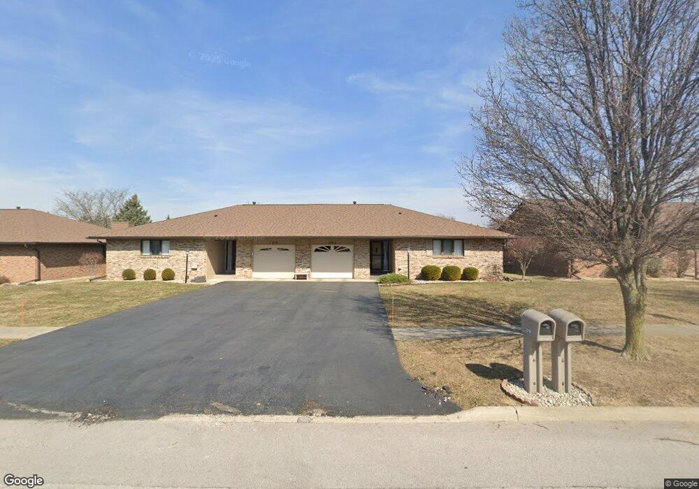
2020 Silverstone Dr Findlay, OH 45840
Estimated Value: $173,000 - $195,000
2
Beds
2
Baths
1,246
Sq Ft
$149/Sq Ft
Est. Value
About This Home
This home is located at 2020 Silverstone Dr, Findlay, OH 45840 and is currently estimated at $185,256, approximately $148 per square foot. 2020 Silverstone Dr is a home located in Hancock County with nearby schools including Wilson Vance Elementary School, Whittier Elementary School, and Glenwood Middle School.
Ownership History
Date
Name
Owned For
Owner Type
Purchase Details
Closed on
Jul 19, 2021
Sold by
Neal Charles F and Neal Vivian R
Bought by
Neal Michael
Current Estimated Value
Home Financials for this Owner
Home Financials are based on the most recent Mortgage that was taken out on this home.
Original Mortgage
$99,000
Outstanding Balance
$89,827
Interest Rate
2.9%
Mortgage Type
New Conventional
Estimated Equity
$95,429
Purchase Details
Closed on
Jun 7, 2016
Sold by
Dove Bonnie J and Beall Judy A
Bought by
Neal Charles F and Neal Vivian R
Purchase Details
Closed on
Jun 17, 1988
Bought by
Dove Willis F and Dove Bonnie J
Purchase Details
Closed on
Feb 19, 1988
Bought by
Reeder Dorothy
Purchase Details
Closed on
Nov 25, 1987
Bought by
Petti Construction Co
Create a Home Valuation Report for This Property
The Home Valuation Report is an in-depth analysis detailing your home's value as well as a comparison with similar homes in the area
Home Values in the Area
Average Home Value in this Area
Purchase History
| Date | Buyer | Sale Price | Title Company |
|---|---|---|---|
| Neal Michael | $132,000 | None Available | |
| Neal Michael | -- | None Listed On Document | |
| Neal Charles F | $110,000 | Flag City Title | |
| Dove Willis F | $72,700 | -- | |
| Reeder Dorothy | $71,500 | -- | |
| Petti Construction Co | -- | -- |
Source: Public Records
Mortgage History
| Date | Status | Borrower | Loan Amount |
|---|---|---|---|
| Open | Neal Michael | $99,000 | |
| Closed | Neal Michael | $99,000 |
Source: Public Records
Tax History
| Year | Tax Paid | Tax Assessment Tax Assessment Total Assessment is a certain percentage of the fair market value that is determined by local assessors to be the total taxable value of land and additions on the property. | Land | Improvement |
|---|---|---|---|---|
| 2024 | $1,702 | $47,910 | $2,800 | $45,110 |
| 2023 | $1,705 | $47,910 | $2,800 | $45,110 |
| 2022 | $1,699 | $47,910 | $2,800 | $45,110 |
| 2021 | $1,716 | $42,160 | $2,100 | $40,060 |
| 2020 | $1,360 | $42,160 | $2,100 | $40,060 |
| 2019 | $1,334 | $42,160 | $2,100 | $40,060 |
| 2018 | $1,103 | $34,140 | $2,100 | $32,040 |
| 2017 | $1,104 | $34,140 | $2,100 | $32,040 |
| 2016 | $1,097 | $34,140 | $2,100 | $32,040 |
| 2015 | $1,183 | $35,810 | $2,100 | $33,710 |
| 2014 | $1,183 | $35,810 | $2,100 | $33,710 |
| 2012 | $1,194 | $35,810 | $2,100 | $33,710 |
Source: Public Records
Map
Nearby Homes
- 1813 Manor Hill Rd Unit 10
- 1801 Manor Hill Rd Unit U7
- 1448 Eastshore Dr
- 2143 Bluestone Dr
- 0 Bright Rd Unit 6117142
- 0 Bright Rd Unit 6117138
- 0 Bright Rd Unit 6117143
- 0 Bright Rd Unit 6117148
- 1203 Chateau Ct
- 0 Romick Pkwy Unit 6131435
- 0 Romick Pkwy Unit 6123797
- 0 Keith Pkwy Unit 6123798
- 1926 Queenswood Dr
- 827 Abbey Ln
- 801 Fox Run Rd
- 1828 Queenswood Dr
- 845 Fox Run Rd
- 821 Fox Run Rd Unit 6
- 1724 Queenswood Dr Unit 10 (2-C)
- 1474 Southwood Ave
- 2016 Silverstone Dr Unit 5
- 2028 Silverstone Dr
- 2012 Silverstone Dr Unit 4
- 2008 Silverstone Dr
- 1908 Stonehill Dr
- 1825 Hillstone Dr Unit U37
- 2036 Silverstone Dr Unit 10
- 1820 Pebblestone Dr
- 1820 Hillstone Dr
- 27 Windstone Dr Unit 27
- 17 Windstone Dr Unit U17
- 28 Windstone Dr
- 2032 Silverstone Dr
- 2032 Silverstone Dr Unit U-9
- 1821 Hillstone Dr
- 1816 Pebblestone Dr
- 1816 Pebblestone Dr Unit 9
- 2004 Silverstone Dr Unit 2
- 2040 Silverstone Dr
- 29 Windstone Dr
Your Personal Tour Guide
Ask me questions while you tour the home.