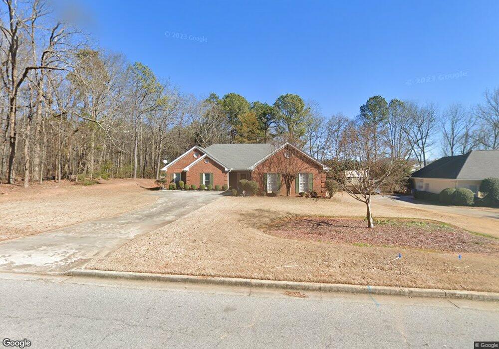
2020 Weatherstone Cir SE Unit 1 Conyers, GA 30094
Estimated Value: $331,620 - $392,000
3
Beds
2
Baths
2,352
Sq Ft
$155/Sq Ft
Est. Value
About This Home
This home is located at 2020 Weatherstone Cir SE Unit 1, Conyers, GA 30094 and is currently estimated at $364,655, approximately $155 per square foot. 2020 Weatherstone Cir SE Unit 1 is a home located in Rockdale County with nearby schools including Flat Shoals Elementary School, Edwards Middle School, and Rockdale County High School.
Ownership History
Date
Name
Owned For
Owner Type
Purchase Details
Closed on
Oct 31, 2002
Sold by
Kim Lawrence G
Bought by
Gaines Beverly W
Current Estimated Value
Home Financials for this Owner
Home Financials are based on the most recent Mortgage that was taken out on this home.
Original Mortgage
$140,400
Outstanding Balance
$58,418
Interest Rate
5.93%
Mortgage Type
New Conventional
Estimated Equity
$306,237
Purchase Details
Closed on
Nov 13, 1997
Sold by
Massey Terry N
Bought by
Kim Lawrence G and Kim Susan D
Home Financials for this Owner
Home Financials are based on the most recent Mortgage that was taken out on this home.
Original Mortgage
$112,000
Interest Rate
7.35%
Mortgage Type
New Conventional
Create a Home Valuation Report for This Property
The Home Valuation Report is an in-depth analysis detailing your home's value as well as a comparison with similar homes in the area
Home Values in the Area
Average Home Value in this Area
Purchase History
| Date | Buyer | Sale Price | Title Company |
|---|---|---|---|
| Gaines Beverly W | $175,500 | -- | |
| Kim Lawrence G | $140,000 | -- |
Source: Public Records
Mortgage History
| Date | Status | Borrower | Loan Amount |
|---|---|---|---|
| Open | Gaines Beverly W | $140,400 | |
| Previous Owner | Kim Lawrence G | $112,000 |
Source: Public Records
Tax History Compared to Growth
Tax History
| Year | Tax Paid | Tax Assessment Tax Assessment Total Assessment is a certain percentage of the fair market value that is determined by local assessors to be the total taxable value of land and additions on the property. | Land | Improvement |
|---|---|---|---|---|
| 2024 | $2,689 | $137,520 | $30,920 | $106,600 |
| 2023 | $2,165 | $122,800 | $30,800 | $92,000 |
| 2022 | $1,954 | $102,320 | $24,960 | $77,360 |
| 2021 | $1,631 | $85,880 | $20,800 | $65,080 |
| 2020 | $1,341 | $75,480 | $17,760 | $57,720 |
| 2019 | $1,171 | $68,520 | $10,800 | $57,720 |
| 2018 | $885 | $59,080 | $10,800 | $48,280 |
| 2017 | $714 | $53,320 | $10,800 | $42,520 |
| 2016 | $622 | $53,320 | $10,800 | $42,520 |
| 2015 | $434 | $46,840 | $9,320 | $37,520 |
| 2014 | $195 | $41,440 | $8,000 | $33,440 |
| 2013 | -- | $64,640 | $13,600 | $51,040 |
Source: Public Records
Map
Nearby Homes
- Astrid Plan at Alder Park
- Harrison Plan at Alder Park
- Baker Plan at Alder Park
- Oliver Plan at Alder Park
- 2197 Boxwood Cir
- 660 Kirkus Dr SE
- 1870 Parker Rd SE
- 1242 Saxony Dr SE
- 1408 Aramore Dr SE
- 1402 Aramore Dr SE
- Boston Plan at Millers Pointe
- Atlanta Plan at Millers Pointe
- Columbus Plan at Millers Pointe
- 0 Georgia 20 Unit 10439576
- 1000 Silver Summit Dr SE
- 1701 Silver Summit Dr SE
- 1502 Silver Summit Dr SE
- 1503 Silver Summit Dr SE Unit 1503
- 1019 Henna Ct SE
- 2464 Lennox Rd SE
- 2030 Weatherstone Cir SE Unit 1
- 2010 Weatherstone Cir SE
- 2040 Weatherstone Cir SE
- 2021 Weatherstone Cir SE
- 2050 Weatherstone Cir SE Unit 1
- 2060 Weatherstone Cir SE
- 1001 Boxwood Cir Unit 64
- 2014 Boxwood Cir
- 2070 Weatherstone Cir SE
- 1009 Starmoss Ln
- 1002 Starmoss Ln
- 1005 Starmoss Ln
- 2145 Miller Chapel Rd SE
- 2441 Boxwood Cir
- 3810 Boxwood Cir
- 2080 Weatherstone Cir SE
- 2041 Weatherstone Cir SE
- 2051 Weatherstone Cir SE Unit 1 / 4
- 2051 Weatherstone Cir SE
- 2090 Weatherstone Cir SE