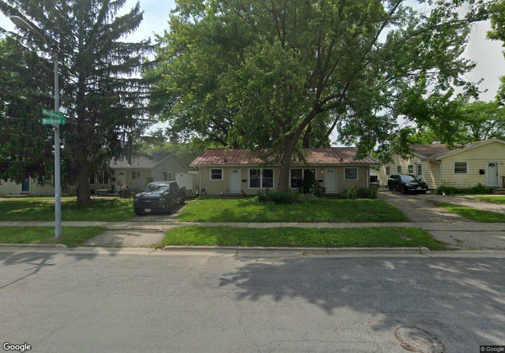
2020 Westbrook Ln Madison, WI 53711
Prairie Hills NeighborhoodEstimated Value: $399,000 - $546,000
4
Beds
2
Baths
1,632
Sq Ft
$275/Sq Ft
Est. Value
About This Home
This home is located at 2020 Westbrook Ln, Madison, WI 53711 and is currently estimated at $448,077, approximately $274 per square foot. 2020 Westbrook Ln is a home located in Dane County with nearby schools including Huegel Elementary School, Toki Middle School, and Vel Phillips Memorial High School.
Ownership History
Date
Name
Owned For
Owner Type
Purchase Details
Closed on
May 30, 2013
Sold by
Jmj Properties Llc
Bought by
Brandt Jeffrey T
Current Estimated Value
Home Financials for this Owner
Home Financials are based on the most recent Mortgage that was taken out on this home.
Original Mortgage
$90,000
Outstanding Balance
$63,849
Interest Rate
3.43%
Mortgage Type
New Conventional
Estimated Equity
$384,228
Purchase Details
Closed on
Jul 14, 2007
Sold by
Annin Michael E
Bought by
Jmj Properties Llc
Purchase Details
Closed on
May 30, 2007
Sold by
Jmj Properties Llc
Bought by
Annin Michael E
Create a Home Valuation Report for This Property
The Home Valuation Report is an in-depth analysis detailing your home's value as well as a comparison with similar homes in the area
Home Values in the Area
Average Home Value in this Area
Purchase History
| Date | Buyer | Sale Price | Title Company |
|---|---|---|---|
| Brandt Jeffrey T | $120,000 | None Available | |
| Jmj Properties Llc | -- | None Available | |
| Annin Michael E | -- | None Available |
Source: Public Records
Mortgage History
| Date | Status | Borrower | Loan Amount |
|---|---|---|---|
| Open | Brandt Jeffrey T | $90,000 |
Source: Public Records
Tax History Compared to Growth
Tax History
| Year | Tax Paid | Tax Assessment Tax Assessment Total Assessment is a certain percentage of the fair market value that is determined by local assessors to be the total taxable value of land and additions on the property. | Land | Improvement |
|---|---|---|---|---|
| 2024 | $12,558 | $359,400 | $105,300 | $254,100 |
| 2023 | $5,883 | $326,700 | $95,700 | $231,000 |
| 2021 | $5,369 | $253,700 | $74,300 | $179,400 |
| 2020 | $5,199 | $234,900 | $68,800 | $166,100 |
| 2019 | $5,017 | $225,900 | $68,800 | $157,100 |
| 2018 | $4,271 | $193,100 | $68,800 | $124,300 |
| 2017 | $3,675 | $160,900 | $59,800 | $101,100 |
| 2016 | $3,427 | $146,300 | $59,800 | $86,500 |
| 2015 | $3,263 | $134,400 | $59,800 | $74,600 |
| 2014 | $3,178 | $134,400 | $59,800 | $74,600 |
| 2013 | $4,295 | $134,300 | $59,800 | $74,500 |
Source: Public Records
Map
Nearby Homes
- 6217 Pioneer Rd
- 2310 Ravenswood Rd
- 6017 Mayhill Dr
- 13 Jacobs Ct
- 6749 Raymond Rd
- 18 S Wickham Ct
- 1506 Lynndale Rd
- 6305-6307 Hammersley Rd
- 2109 Canterbury Rd
- 2622 Mckenna Blvd
- 5701 Bartlett Ln
- 5734 Meadowood Dr
- 5914 Stanton Ln
- 9 Newport Cir
- 6817 Stratford Dr
- 5726 Hempstead Rd
- 7106 Pagham Dr
- 2945 Maple Run Dr
- 6210 Davenport Dr
- 2118 Gilbert Rd
- 2014 Westbrook Ln
- 2016 Westbrook Ln
- 2024 Westbrook Ln
- 2028 Westbrook Ln
- 2026 Westbrook Ln
- 4 Westbrook Cir
- 3 Westbrook Cir
- 2012 Westbrook Ln
- 1 Westbrook Cir
- 2032 Westbrook Ln
- 2008 Westbrook Ln
- 2011 Westbrook Ln
- 2030 Westbrook Ln
- 2027 Westbrook Ln
- 2009 Westbrook Ln
- 2007 Westbrook Ln
- 2029 Westbrook Ln
- 2031 Westbrook Ln
- 6301 Raymond Rd
- 6305 Raymond Rd