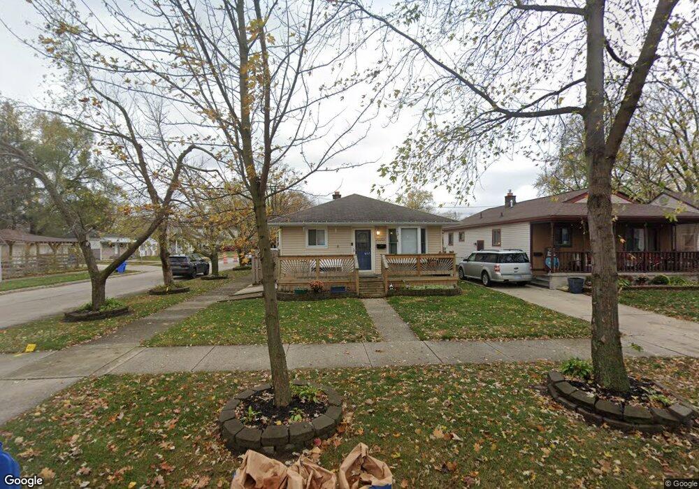
20201 Powers Ave Dearborn Heights, MI 48125
Estimated Value: $130,000 - $150,000
3
Beds
1
Bath
936
Sq Ft
$149/Sq Ft
Est. Value
About This Home
This home is located at 20201 Powers Ave, Dearborn Heights, MI 48125 and is currently estimated at $139,480, approximately $149 per square foot. 20201 Powers Ave is a home located in Wayne County with nearby schools including Polk Elementary School, Bedford School, and Pardee School.
Ownership History
Date
Name
Owned For
Owner Type
Purchase Details
Closed on
Nov 16, 2011
Sold by
Lemaire Rebecca and Napier Gary
Bought by
Lemaire Rebecca
Current Estimated Value
Purchase Details
Closed on
May 29, 2007
Sold by
National City Bank Of Midwest
Bought by
Lemaire Rebecca
Purchase Details
Closed on
Jan 5, 2006
Sold by
Fairchild Christopher J and Fairchild Michelle
Bought by
National City Bank Of Midwest
Purchase Details
Closed on
Aug 20, 2003
Sold by
Rathfon Christopher and Rathfon Ileana
Bought by
Fairchild Christopher
Purchase Details
Closed on
Nov 30, 1998
Sold by
Leese E
Bought by
Rathfon Christopher
Create a Home Valuation Report for This Property
The Home Valuation Report is an in-depth analysis detailing your home's value as well as a comparison with similar homes in the area
Home Values in the Area
Average Home Value in this Area
Purchase History
| Date | Buyer | Sale Price | Title Company |
|---|---|---|---|
| Lemaire Rebecca | -- | Michigan Title Insurance Age | |
| Lemaire Rebecca | $63,000 | Fidelity Natl Title Group | |
| National City Bank Of Midwest | $74,298 | None Available | |
| Fairchild Christopher | $114,890 | Stewart Title | |
| Rathfon Christopher | $79,000 | -- |
Source: Public Records
Tax History Compared to Growth
Tax History
| Year | Tax Paid | Tax Assessment Tax Assessment Total Assessment is a certain percentage of the fair market value that is determined by local assessors to be the total taxable value of land and additions on the property. | Land | Improvement |
|---|---|---|---|---|
| 2025 | $1,087 | $63,600 | $0 | $0 |
| 2024 | $1,087 | $57,200 | $0 | $0 |
| 2023 | $1,027 | $50,500 | $0 | $0 |
| 2022 | $1,425 | $43,300 | $0 | $0 |
| 2021 | $1,426 | $37,200 | $0 | $0 |
| 2019 | $1,327 | $30,800 | $0 | $0 |
| 2018 | $892 | $25,700 | $0 | $0 |
| 2017 | $802 | $24,900 | $0 | $0 |
| 2016 | $1,263 | $24,300 | $0 | $0 |
| 2015 | $2,260 | $22,600 | $0 | $0 |
| 2013 | $2,320 | $24,200 | $0 | $0 |
| 2010 | -- | $31,500 | $0 | $0 |
Source: Public Records
Map
Nearby Homes
- 5455 Mayfair St
- 4924 Ziegler St
- 20425 Powers Ave
- 5642 Weddel St
- 4705 Jackson St
- 5709 Weddell St
- 4679 Mayfair St
- 4641 Weddell St
- 20001 Annapolis St
- 4630 Pelham St
- 5648 Hipp St
- 5660 Hipp St
- 4476 Weddel St
- 4934 Edgewood St
- 19035 Annapolis St
- 5381 Merrick St
- 5315 Edgewood St
- 4656 Edgewood St
- 5621 Merrick St
- 4460 Detroit St
- 20209 Powers Ave
- 20217 Powers Ave
- 5336 Jackson St
- 20071 Powers Ave
- 5348 Jackson St
- 20202 Powers Ave
- 20212 Powers Ave
- 20063 Powers Ave
- 5356 Jackson St
- 5331 Weddell St
- 20230 Powers Ave
- 20241 Powers Ave
- 5333 Jackson St
- 5345 Weddell St
- 20055 Powers Ave
- 20070 Powers Ave
- 5341 Jackson St
- 20238 Powers Ave
- 5364 Jackson St
- 20062 Powers Ave