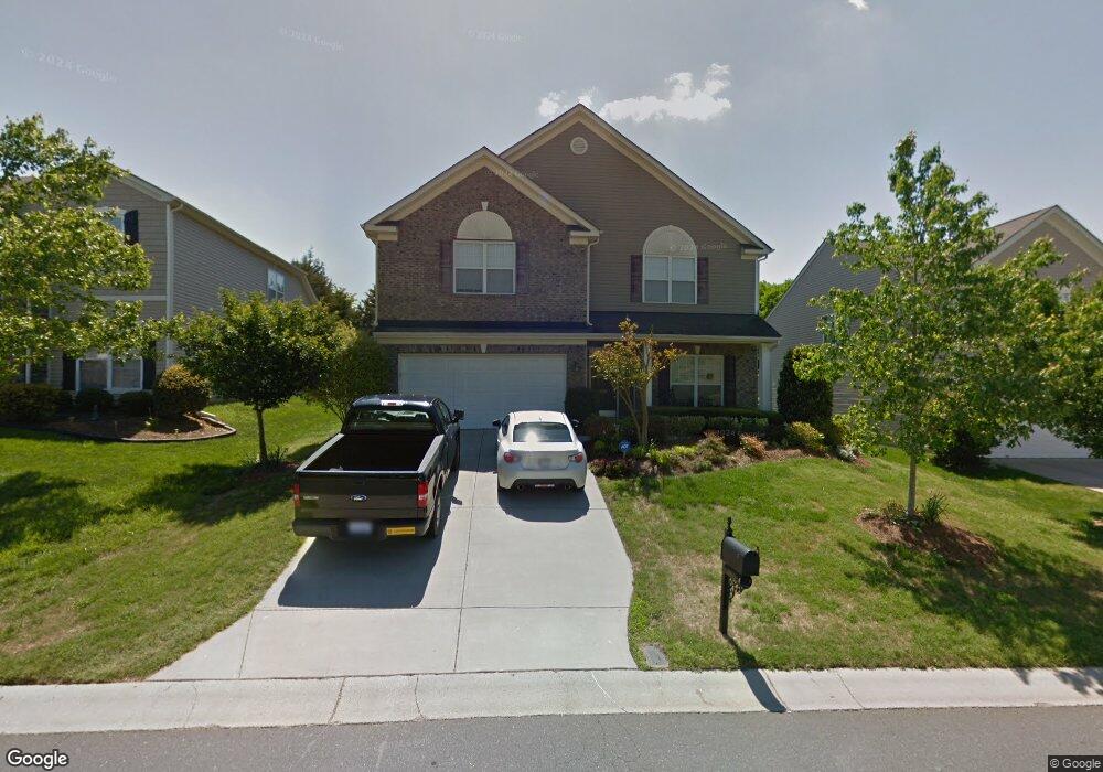
2021 Bridleside Dr Indian Trail, NC 28079
Estimated Value: $461,000 - $517,000
4
Beds
2
Baths
2,822
Sq Ft
$170/Sq Ft
Est. Value
About This Home
This home is located at 2021 Bridleside Dr, Indian Trail, NC 28079 and is currently estimated at $479,036, approximately $169 per square foot. 2021 Bridleside Dr is a home located in Union County with nearby schools including Shiloh Valley Primary School, Shiloh Valley Elementary School, and Sun Valley Middle School.
Ownership History
Date
Name
Owned For
Owner Type
Purchase Details
Closed on
Jul 2, 2020
Sold by
Molchan Greg and Molchan Amy
Bought by
Wolfe Wyatt Oliver
Current Estimated Value
Home Financials for this Owner
Home Financials are based on the most recent Mortgage that was taken out on this home.
Original Mortgage
$247,000
Outstanding Balance
$219,430
Interest Rate
3.2%
Mortgage Type
New Conventional
Estimated Equity
$259,606
Purchase Details
Closed on
Mar 29, 2006
Sold by
The Ryland Group Inc
Bought by
Molchan Greg and Molchan Amy
Home Financials for this Owner
Home Financials are based on the most recent Mortgage that was taken out on this home.
Original Mortgage
$211,170
Interest Rate
6.25%
Mortgage Type
Fannie Mae Freddie Mac
Purchase Details
Closed on
Dec 8, 2005
Sold by
Pace/Dowd Properties Ltd
Bought by
The Ryland Group Inc
Create a Home Valuation Report for This Property
The Home Valuation Report is an in-depth analysis detailing your home's value as well as a comparison with similar homes in the area
Home Values in the Area
Average Home Value in this Area
Purchase History
| Date | Buyer | Sale Price | Title Company |
|---|---|---|---|
| Wolfe Wyatt Oliver | $260,000 | None Available | |
| Molchan Greg | $235,000 | None Available | |
| The Ryland Group Inc | $37,500 | -- |
Source: Public Records
Mortgage History
| Date | Status | Borrower | Loan Amount |
|---|---|---|---|
| Open | Wolfe Wyatt Oliver | $247,000 | |
| Previous Owner | Molchan Greg | $211,170 |
Source: Public Records
Tax History Compared to Growth
Tax History
| Year | Tax Paid | Tax Assessment Tax Assessment Total Assessment is a certain percentage of the fair market value that is determined by local assessors to be the total taxable value of land and additions on the property. | Land | Improvement |
|---|---|---|---|---|
| 2024 | $2,599 | $304,300 | $57,000 | $247,300 |
| 2023 | $2,564 | $304,300 | $57,000 | $247,300 |
| 2022 | $2,510 | $304,300 | $57,000 | $247,300 |
| 2021 | $2,507 | $304,300 | $57,000 | $247,300 |
| 2020 | $1,734 | $221,200 | $34,000 | $187,200 |
| 2019 | $2,179 | $221,200 | $34,000 | $187,200 |
| 2018 | $0 | $221,200 | $34,000 | $187,200 |
| 2017 | $2,290 | $221,200 | $34,000 | $187,200 |
| 2016 | $1,782 | $221,200 | $34,000 | $187,200 |
| 2015 | $1,804 | $221,200 | $34,000 | $187,200 |
| 2014 | $1,527 | $219,840 | $37,500 | $182,340 |
Source: Public Records
Map
Nearby Homes
- 1002 Canopy Dr
- 4016 Holly Villa Cir
- 4030 Holly Villa Cir
- 1025 Canopy Dr
- 1022 Canopy Dr
- 1010 Craven St
- 7417 Sparkleberry Dr
- 5506 Rogers Rd
- 3009 Canopy Dr
- 5805 Lindley Crescent Dr
- 2010 Hollyhedge Ln
- 4017 Garden Oak Dr
- 5008 Rosewater Ln
- 5535 Whispering Wind Ln
- 2035 Hollyhedge Ln
- 5000 Dresden Ct
- 2113 Foster Ct
- 5412 Fulton Ridge Dr
- 7523 Pinnacle Ct
- 1006 Apogee Dr
- 2025 Bridleside Dr
- 2019 Bridleside Dr
- 2027 Bridleside Dr
- 2027 Bridleside Dr Unit 12
- 1022 Whippoorwill Ln
- 1020 Whippoorwill Ln
- 1026 Whippoorwill Ln
- 2029 Bridleside Dr
- 2015 Bridleside Dr
- 1018 Whippoorwill Ln
- 1028 Whippoorwill Ln
- 2022 Bridleside Dr
- 2020 Bridleside Dr
- 2026 Bridleside Dr
- 2018 Bridleside Dr
- 1016 Whippoorwill Ln
- 1030 Whippoorwill Ln
- 2011 Bridleside Dr
- 2028 Bridleside Dr
- 2031 Bridleside Dr