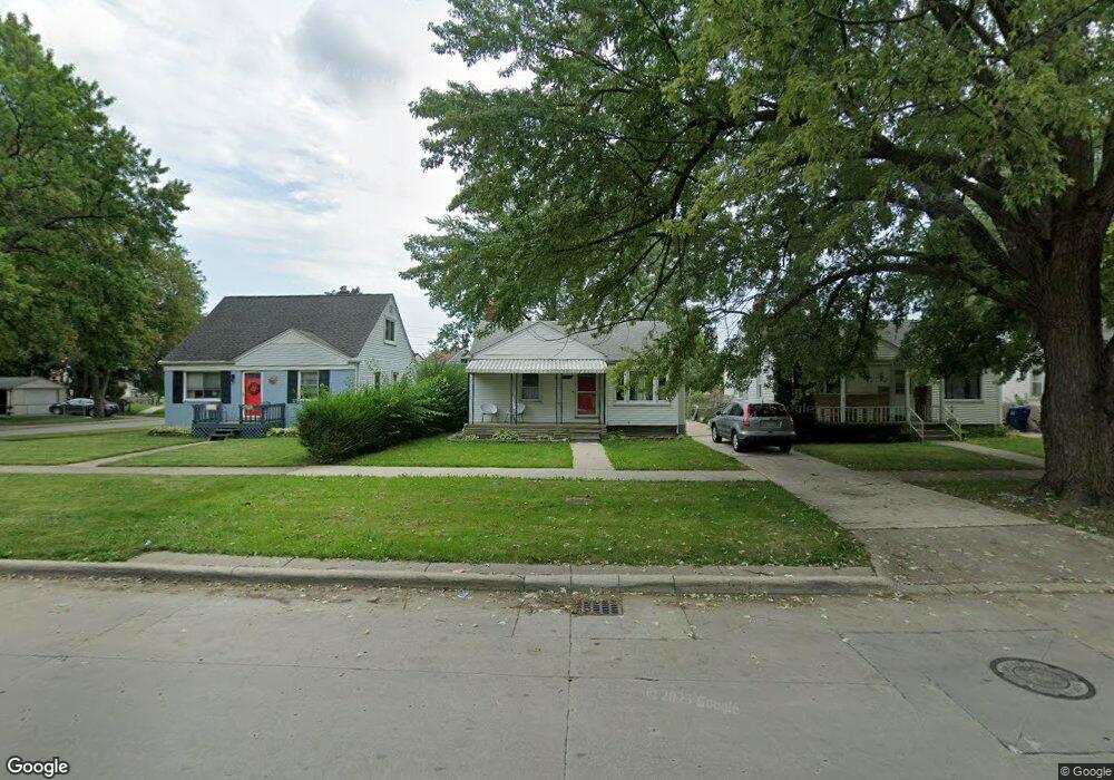
2021 Champaign Rd Unit Bldg-Unit Lincoln Park, MI 48146
Estimated Value: $122,000 - $136,088
--
Bed
1
Bath
719
Sq Ft
$178/Sq Ft
Est. Value
About This Home
This home is located at 2021 Champaign Rd Unit Bldg-Unit, Lincoln Park, MI 48146 and is currently estimated at $128,272, approximately $178 per square foot. 2021 Champaign Rd Unit Bldg-Unit is a home located in Wayne County with nearby schools including Max Paun School, Lincoln Park Middle School, and Lincoln Park High School.
Ownership History
Date
Name
Owned For
Owner Type
Purchase Details
Closed on
Nov 16, 2018
Sold by
Fernandez Linda
Bought by
Thiara Fernandez Linda and Thiara Melo
Current Estimated Value
Purchase Details
Closed on
May 30, 2018
Sold by
Boyd Michael R
Bought by
Fernandez Linda
Purchase Details
Closed on
Jul 17, 1998
Sold by
Mann Joseph L and Mann Sandra S
Bought by
Boyd Michael R
Purchase Details
Closed on
Apr 23, 1997
Sold by
Scott C and Scott Susan Davis
Bought by
Joseph L Manners
Create a Home Valuation Report for This Property
The Home Valuation Report is an in-depth analysis detailing your home's value as well as a comparison with similar homes in the area
Home Values in the Area
Average Home Value in this Area
Purchase History
| Date | Buyer | Sale Price | Title Company |
|---|---|---|---|
| Thiara Fernandez Linda | -- | Michigan Title Ins Agency In | |
| Fernandez Linda | $40,000 | Michigan Title Ins Agency In | |
| Boyd Michael R | $65,000 | -- | |
| Joseph L Manners | $61,500 | -- |
Source: Public Records
Tax History Compared to Growth
Tax History
| Year | Tax Paid | Tax Assessment Tax Assessment Total Assessment is a certain percentage of the fair market value that is determined by local assessors to be the total taxable value of land and additions on the property. | Land | Improvement |
|---|---|---|---|---|
| 2025 | $1,371 | $55,700 | $0 | $0 |
| 2024 | $1,371 | $50,600 | $0 | $0 |
| 2023 | $1,846 | $45,400 | $0 | $0 |
| 2022 | $2,054 | $40,900 | $0 | $0 |
| 2021 | $2,238 | $34,300 | $0 | $0 |
| 2020 | $1,986 | $30,500 | $0 | $0 |
| 2019 | $1,665 | $26,800 | $0 | $0 |
| 2018 | $1,280 | $24,300 | $0 | $0 |
| 2017 | $663 | $21,700 | $0 | $0 |
| 2016 | $1,535 | $21,800 | $0 | $0 |
| 2015 | $2,110 | $21,100 | $0 | $0 |
| 2013 | $2,200 | $22,900 | $0 | $0 |
| 2012 | $1,348 | $23,600 | $6,200 | $17,400 |
Source: Public Records
Map
Nearby Homes
- 2660 Bailey Ave
- 2091 Markese Ave
- 2910 Bailey Ave
- 2366 Progress Ave
- LOT 398 Dix Hwy
- 2316 Detroit Ave
- 2099 Mill St
- 2209 Progress Ave
- 2279 Detroit Ave
- 2163 Cleveland Ave
- 2159 Detroit Ave
- 14837 Angelique Ave
- 2315 Hartwick Hwy
- 1805 Rose Ave
- 1741 Cleveland Ave
- 7208 Rosedale Blvd
- 2154 White Ave
- 2162 White Ave
- 14705 Wick Rd
- 2932 Green St
- 2021 Champaign Rd
- 2027 Champaign Rd
- 2015 Champaign Rd
- 2031 Champaign Rd
- 2049 Champaign Rd
- 2279 Hoover Ave
- 1995 Champaign Rd
- 2271 Hoover Ave
- 2018 Champaign Rd
- 2022 Champaign Rd
- 2014 Champaign Rd
- 2026 Champaign Rd
- 1991 Champaign Rd
- 2267 Hoover Ave
- 2010 Champaign Rd
- 2053 Champaign Rd
- 2006 Champaign Rd
- 2266 Hoover Ave
- 2060 Champaign Rd
- 1987 Champaign Rd