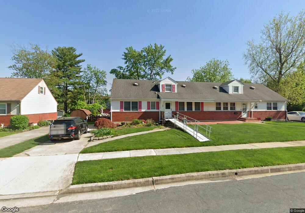
2021 Derrickson Rd Windsor Mill, MD 21244
Estimated Value: $294,932 - $393,000
Studio
2
Baths
1,680
Sq Ft
$196/Sq Ft
Est. Value
About This Home
This home is located at 2021 Derrickson Rd, Windsor Mill, MD 21244 and is currently estimated at $328,733, approximately $195 per square foot. 2021 Derrickson Rd is a home located in Baltimore County with nearby schools including Dogwood Elementary School, Windsor Mill Middle School, and Woodlawn High School.
Ownership History
Date
Name
Owned For
Owner Type
Purchase Details
Closed on
Feb 11, 2005
Sold by
Lockhart Ronnie S
Bought by
Lockhart Renee M
Current Estimated Value
Home Financials for this Owner
Home Financials are based on the most recent Mortgage that was taken out on this home.
Original Mortgage
$164,000
Outstanding Balance
$83,468
Interest Rate
5.77%
Mortgage Type
New Conventional
Estimated Equity
$245,265
Purchase Details
Closed on
Oct 29, 1992
Sold by
Jones Melvin E
Bought by
Lockhart Ronnie S
Purchase Details
Closed on
Jun 23, 1986
Sold by
Young Frank
Bought by
Jones Melvin E
Create a Home Valuation Report for This Property
The Home Valuation Report is an in-depth analysis detailing your home's value as well as a comparison with similar homes in the area
Home Values in the Area
Average Home Value in this Area
Purchase History
| Date | Buyer | Sale Price | Title Company |
|---|---|---|---|
| Lockhart Renee M | -- | -- | |
| Lockhart Ronnie S | $118,000 | -- | |
| Jones Melvin E | $75,000 | -- |
Source: Public Records
Mortgage History
| Date | Status | Borrower | Loan Amount |
|---|---|---|---|
| Open | Lockhart Renee M | $164,000 |
Source: Public Records
Tax History
| Year | Tax Paid | Tax Assessment Tax Assessment Total Assessment is a certain percentage of the fair market value that is determined by local assessors to be the total taxable value of land and additions on the property. | Land | Improvement |
|---|---|---|---|---|
| 2025 | $3,369 | $235,633 | -- | -- |
| 2024 | $3,369 | $216,200 | $63,000 | $153,200 |
| 2023 | $1,627 | $206,667 | $0 | $0 |
| 2022 | $3,178 | $197,133 | $0 | $0 |
| 2021 | $2,997 | $187,600 | $63,000 | $124,600 |
| 2020 | $2,997 | $182,333 | $0 | $0 |
| 2019 | $2,848 | $177,067 | $0 | $0 |
| 2018 | $2,934 | $171,800 | $39,100 | $132,700 |
| 2017 | $2,675 | $166,433 | $0 | $0 |
| 2016 | $3,062 | $161,067 | $0 | $0 |
| 2015 | $3,062 | $155,700 | $0 | $0 |
| 2014 | $3,062 | $155,700 | $0 | $0 |
Source: Public Records
Map
Nearby Homes
- 7104 Iverson Ct
- 2025 Greengage Rd
- 2106 N Rolling Rd
- 49 Rocky Brook Ct
- 7 Kimberlys Ct
- 10 Kettle Ct
- 7544 Maury Rd
- 7536 Maury Rd
- 21 Tallow Ct
- 14 Sharrow Ct
- 2305 Kevsway Ct
- 8 Middleview Ct
- 2004 Wildlife Dr
- 2000 Wildlife Dr
- 6945 Rockfield Rd
- 7205 Bogley Rd Unit 202
- 7205 Bogley Rd Unit 303
- 2116 Amber Way
- 2019 Amber Way
- 1828 Oxbow Rd
- 2023 Derrickson Rd
- 2019 Derrickson Rd
- 2025 Derrickson Rd
- 2004 Greengage Rd
- 2017 Derrickson Rd
- 2002 Greengage Rd
- 2006 Greengage Rd
- 7205 Chamberlain Rd
- 2016 Derrickson Rd
- 2014 Derrickson Rd
- 2015 Derrickson Rd
- 2000 Greengage Rd
- 7207 Chamberlain Rd
- 2013 Derrickson Rd
- 2008 Greengage Rd
- 2012 Derrickson Rd
- 7202 Chamberlain Rd
- 7204 Chamberlain Rd
- 7209 Chamberlain Rd
- 2011 Derrickson Rd
Your Personal Tour Guide
Ask me questions while you tour the home.