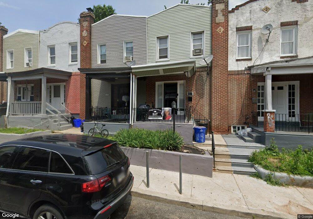
2021 E Rittenhouse St Philadelphia, PA 19138
West Oak Lane NeighborhoodEstimated Value: $128,863 - $194,000
3
Beds
1
Bath
840
Sq Ft
$182/Sq Ft
Est. Value
About This Home
This home is located at 2021 E Rittenhouse St, Philadelphia, PA 19138 and is currently estimated at $153,216, approximately $182 per square foot. 2021 E Rittenhouse St is a home located in Philadelphia County with nearby schools including William Rowen School, Gen. Louis Wagner Middle School, and Martin Luther King High School.
Ownership History
Date
Name
Owned For
Owner Type
Purchase Details
Closed on
Jul 1, 2010
Sold by
Aldi Land Developers Inc
Bought by
Rhaney Anthony
Current Estimated Value
Purchase Details
Closed on
Jun 15, 2009
Sold by
Rhaney Anthony
Bought by
Aldi Land Developers Inc
Purchase Details
Closed on
Sep 30, 2000
Sold by
Aldi Land Developers Inc
Bought by
Rhaney Anthony
Home Financials for this Owner
Home Financials are based on the most recent Mortgage that was taken out on this home.
Original Mortgage
$25,000
Interest Rate
7.78%
Mortgage Type
Seller Take Back
Create a Home Valuation Report for This Property
The Home Valuation Report is an in-depth analysis detailing your home's value as well as a comparison with similar homes in the area
Home Values in the Area
Average Home Value in this Area
Purchase History
| Date | Buyer | Sale Price | Title Company |
|---|---|---|---|
| Rhaney Anthony | $50,000 | None Available | |
| Aldi Land Developers Inc | $6,000 | None Available | |
| Rhaney Anthony | $25,000 | -- |
Source: Public Records
Mortgage History
| Date | Status | Borrower | Loan Amount |
|---|---|---|---|
| Previous Owner | Rhaney Anthony | $25,000 |
Source: Public Records
Tax History Compared to Growth
Tax History
| Year | Tax Paid | Tax Assessment Tax Assessment Total Assessment is a certain percentage of the fair market value that is determined by local assessors to be the total taxable value of land and additions on the property. | Land | Improvement |
|---|---|---|---|---|
| 2026 | $1,349 | $119,700 | $23,940 | $95,760 |
| 2025 | $1,349 | $119,700 | $23,940 | $95,760 |
| 2024 | $1,349 | $119,700 | $23,940 | $95,760 |
| 2023 | $1,349 | $96,400 | $19,280 | $77,120 |
| 2022 | $1,027 | $96,400 | $19,280 | $77,120 |
| 2021 | $1,027 | $0 | $0 | $0 |
| 2020 | $1,027 | $0 | $0 | $0 |
| 2019 | $1,074 | $0 | $0 | $0 |
| 2018 | $1,097 | $0 | $0 | $0 |
| 2017 | $1,097 | $0 | $0 | $0 |
| 2016 | $1,097 | $0 | $0 | $0 |
| 2015 | $973 | $0 | $0 | $0 |
| 2014 | -- | $72,600 | $4,782 | $67,818 |
| 2012 | -- | $10,240 | $1,784 | $8,456 |
Source: Public Records
Map
Nearby Homes
- 6732 Ogontz Ave
- 6869 Forrest Ave
- 6838 Ogontz Ave
- 6905 Forrest Ave
- 2056 Eastburn Ave
- 6908 Ogontz Ave
- 6731 N Woodstock St
- 6733 N Woodstock St
- 1934 69th Ave
- 6944 Cedar Park Ave
- 1816 67th Ave
- 6625 Ogontz Ave
- 1729 68th Ave
- 1733 67th Ave
- 1731 67th Ave
- 2070 E Haines St
- 6629 N Gratz St
- 1720 68th Ave
- 6603 Ogontz Ave
- 6600 N Opal St
- 2019 E Rittenhouse St
- 2023 E Rittenhouse St
- 2017 E Rittenhouse St
- 2025 E Rittenhouse St
- 2015 E Rittenhouse St
- 2027 E Rittenhouse St
- 2013 E Rittenhouse St
- 2029 E Rittenhouse St
- 2018 E Haines St
- 2020 E Haines St
- 2011 E Rittenhouse St
- 2031 E Rittenhouse St
- 2018 E Rittenhouse St
- 2033 E Rittenhouse St
- 2016 E Rittenhouse St
- 2009 E Rittenhouse St
- 2020 E Rittenhouse St
- 2022 E Rittenhouse St
- 2012 E Rittenhouse St
- 2014 E Rittenhouse St