2021 Holleman Cir N Mobile, AL 36618
Autumndale NeighborhoodEstimated Value: $64,481 - $114,000
3
Beds
1
Bath
950
Sq Ft
$97/Sq Ft
Est. Value
About This Home
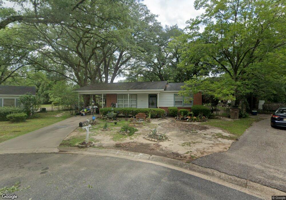
This home is located at 2021 Holleman Cir N, Mobile, AL 36618 and is currently estimated at $92,370, approximately $97 per square foot. 2021 Holleman Cir N is a home located in Mobile County with nearby schools including Forest Hill Elementary School, CL Scarborough Middle School, and Mattie T Blount High School.
Ownership History
Date
Name
Owned For
Owner Type
Purchase Details
Closed on
Mar 26, 2010
Sold by
Jellenc V David
Bought by
Thomas Naomi A
Current Estimated Value
Home Financials for this Owner
Home Financials are based on the most recent Mortgage that was taken out on this home.
Original Mortgage
$56,949
Outstanding Balance
$38,420
Interest Rate
5.5%
Mortgage Type
FHA
Estimated Equity
$53,950
Purchase Details
Closed on
Sep 10, 2009
Sold by
Jellenc Marion J
Bought by
Jellenc V David
Create a Home Valuation Report for This Property
The Home Valuation Report is an in-depth analysis detailing your home's value as well as a comparison with similar homes in the area
Home Values in the Area
Average Home Value in this Area
Purchase History
| Date | Buyer | Sale Price | Title Company |
|---|---|---|---|
| Thomas Naomi A | $58,000 | None Available | |
| Jellenc V David | -- | None Available |
Source: Public Records
Mortgage History
| Date | Status | Borrower | Loan Amount |
|---|---|---|---|
| Open | Thomas Naomi A | $56,949 |
Source: Public Records
Tax History
| Year | Tax Paid | Tax Assessment Tax Assessment Total Assessment is a certain percentage of the fair market value that is determined by local assessors to be the total taxable value of land and additions on the property. | Land | Improvement |
|---|---|---|---|---|
| 2025 | $252 | $4,860 | $1,000 | $3,860 |
| 2024 | $252 | $4,600 | $1,000 | $3,600 |
| 2023 | $235 | $4,420 | $1,000 | $3,420 |
| 2022 | $202 | $4,240 | $1,000 | $3,240 |
| 2021 | $182 | $3,920 | $800 | $3,120 |
| 2020 | $174 | $3,770 | $600 | $3,170 |
| 2019 | $164 | $3,590 | $600 | $2,990 |
| 2018 | $164 | $3,600 | $0 | $0 |
| 2017 | $154 | $3,420 | $0 | $0 |
| 2016 | $242 | $4,860 | $0 | $0 |
| 2013 | $337 | $4,740 | $0 | $0 |
Source: Public Records
Map
Nearby Homes
- 2113 Cornell Dr
- 4060 Dickson Ln
- 2205 Beau Terra Dr W
- 2004 Beau Terra Dr W
- 2210 Wolf Ridge Rd
- 0 Junius Ln
- 1758 La Pine Dr
- 1757 Le Grande Dr
- 871 Kuffskie Ln
- 4409 Eastview Dr
- 1561 Phillips Ln
- 1701 Phillips Ln
- 6632 Monarch Cir
- 3531 Anton St
- 21 Brucewood Dr W
- 3514 Anton St
- 6 Brucewood Dr W
- 1811 Butler St
- 4453 Myers Rd
- 2621 Berkley Ave
- 2019 Holleman Cir N
- 2120 Baker Rd
- 2023 Holleman Cir N
- 2116 Baker Rd
- 2124 Baker Rd
- 2112 Baker Rd
- 2025 Holleman Cir N
- 2128 Baker Rd
- 2017 Holleman Cir N
- 2108 Baker Rd
- 2132 Baker Rd
- 2013 Holleman Dr
- 2027 Holleman Cir N
- 3859 Pickett Dr
- 3855 Pickett Dr
- 2004 Holleman Cir S
- 2121 Baker Rd
- 2117 Baker Rd
- 2105 Holleman Dr
- 2125 Baker Rd
Your Personal Tour Guide
Ask me questions while you tour the home.